Francis Scott Key Bridge Collapse

Early morning on March 26, 2024 the Baltimore Francis Scott Key Bridge collapsed after it was struck by a 984-foot cargo ship. This image was Tasked and collected within hours of the event.
2021 Marshall Colorado Wildfire

This Spotlight image was captured during the Marshall Fire in Colorado in December 2021. The image shows the western side of Lousiville and the northern edge of Superior, centered over the Louisville Rec Center. On the east side of the image, you can see downtown Louisville. Capella’s Louisville office is visible in the lower left […]
Kīlauea Caldera, Hawaii Volcanoes National Park
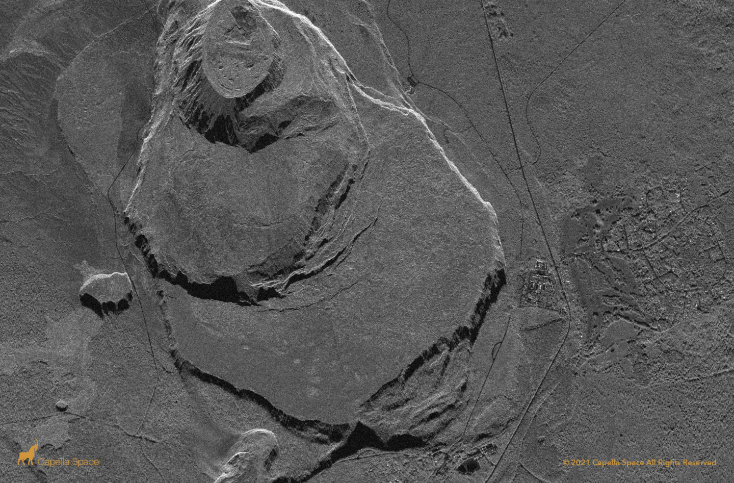
The Kilauea Caldera is located in Hawaii Volcanoes National Park on the Big Island, Hawaii. When analysts are monitoring a volcano, it’s very important for them to understand what’s happening at the top of the crater during an eruption. Smoke usually obscures the crater from optical satellites, but SAR can see through smoke and ash. […]
Imperial County, California
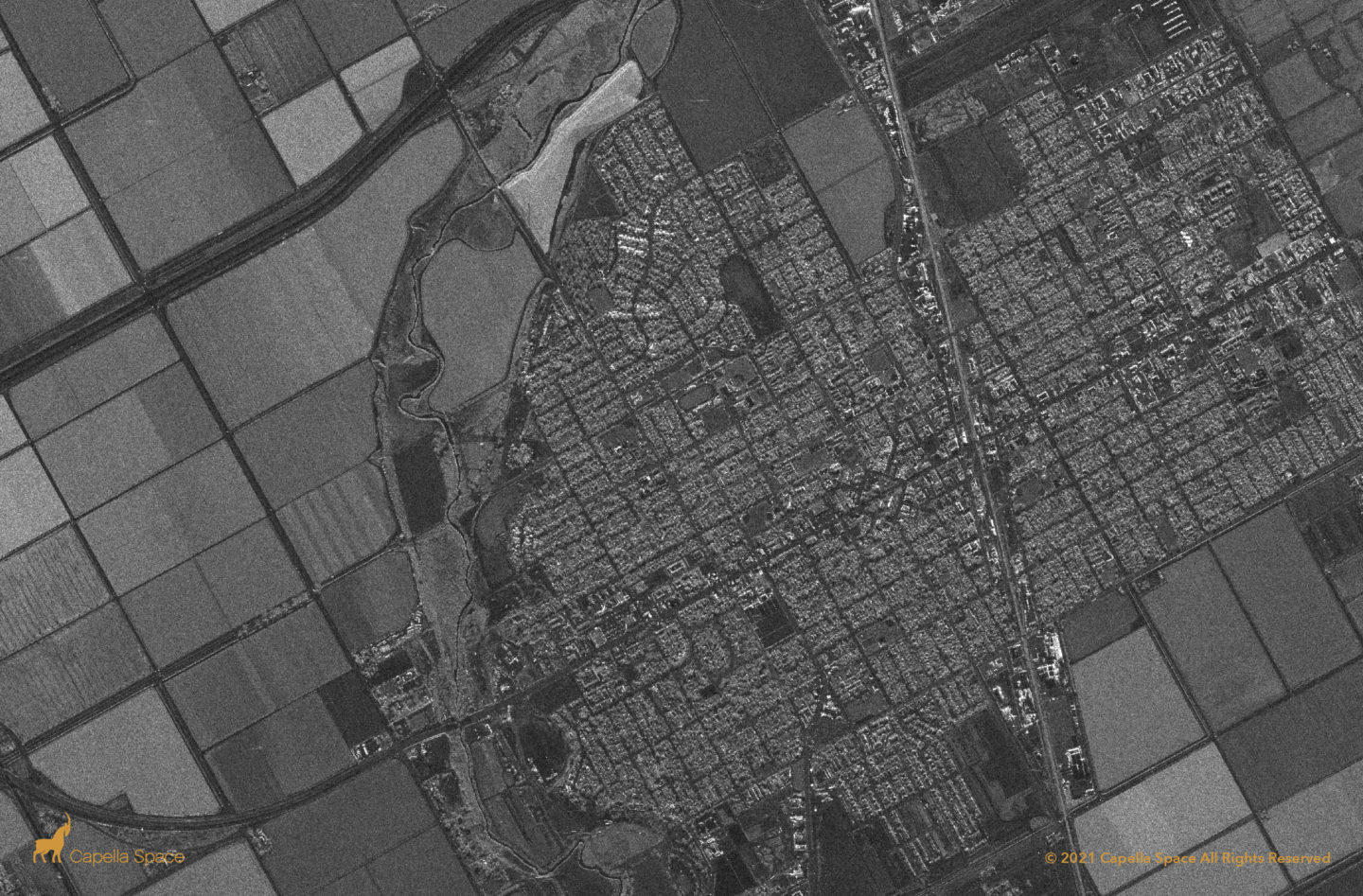
Brawley is a city in Imperial County in California, an agricultural region close to the US-Mexico border which has a climate conducive for yearlong agricultural activity. The local economy includes significant livestock and feed production. In SAR imagery, darker colored agricultural fields usually indicate the field is inundated or waterlogged.
San Joaquin Valley
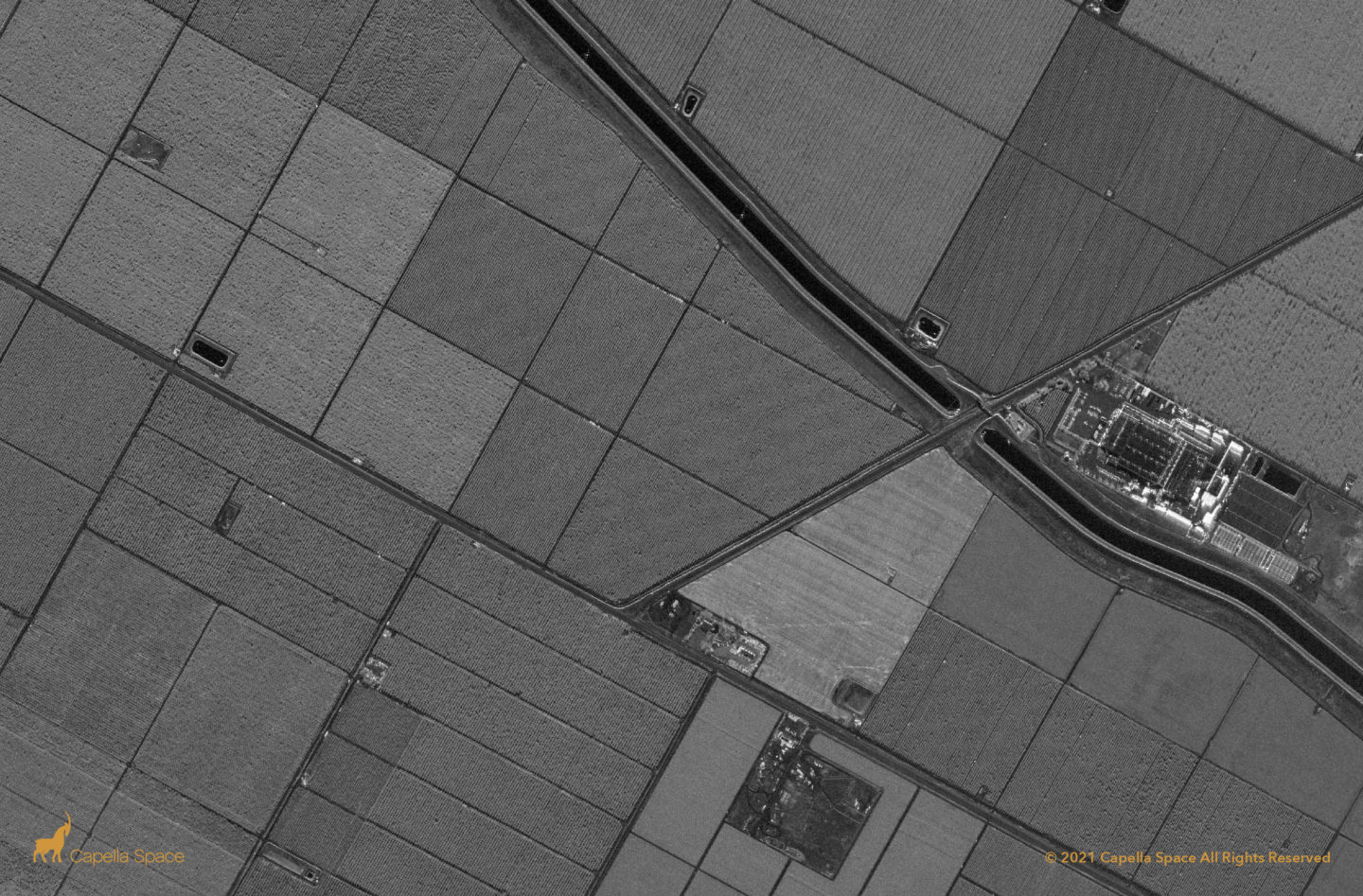
In this Spotlight image of the San Joaquin Valley, you can clearly see an irrigation canal and a number of fields in very high resolution. SAR analysts can use SAR imagery to view agricultural lands used to produce grapes, milk, almonds and walnuts — the most lucrative agricultural commodities from California’s San Joaquin Valley.
U.S.A. – Mexico Border
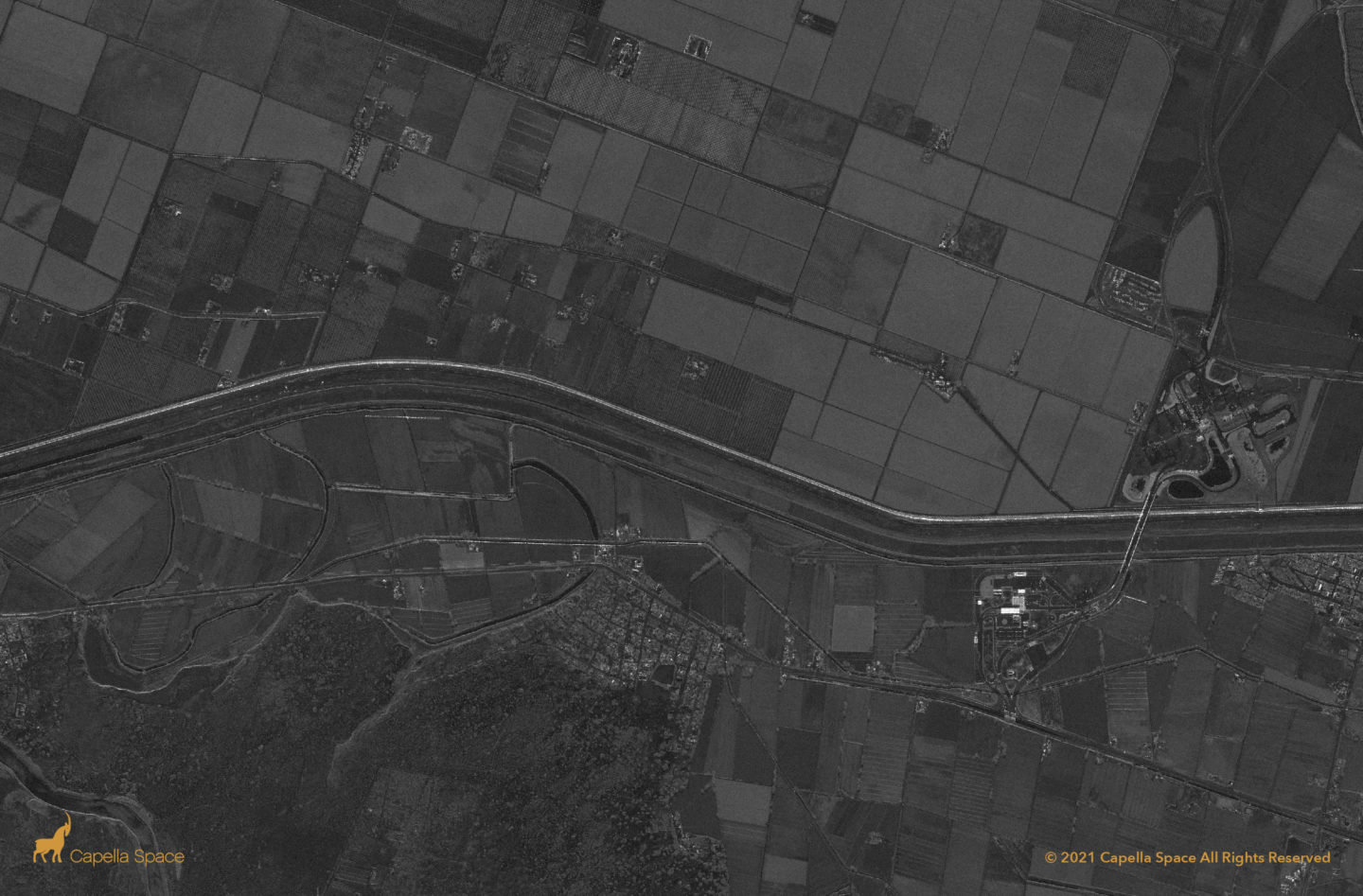
The US-Mexico border contains several ports of entry for commercial purposes. This location, southeast of El Paso and Ciudad Juarez has many features to analyze in SAR, including the Puento Tornillo Guadalupe bridge, the Rio Grande River, and traffic related to border crossings and customs in both Texas and Chihuahua.
Cushing Oil Storage Terminal
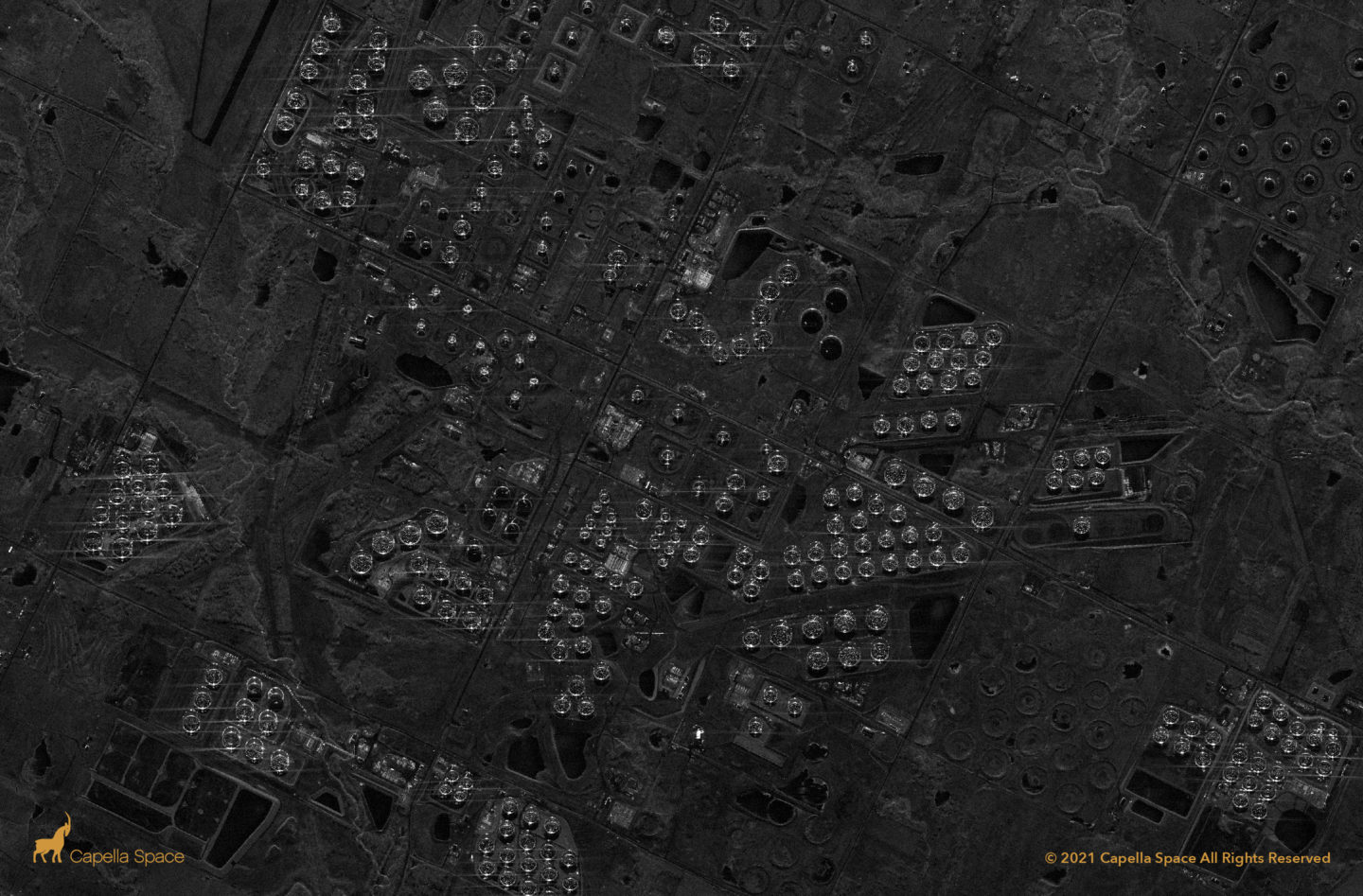
Cushing, Oklahoma is a major trading hub for crude oil and is known as the Pipeline Crossroads of the World. The city’s crude oil tanks, many of which are reflected strongly here in Capella’s SAR image, have approximately 91 million barrels of storage capacity.
Dallas Executive Airport
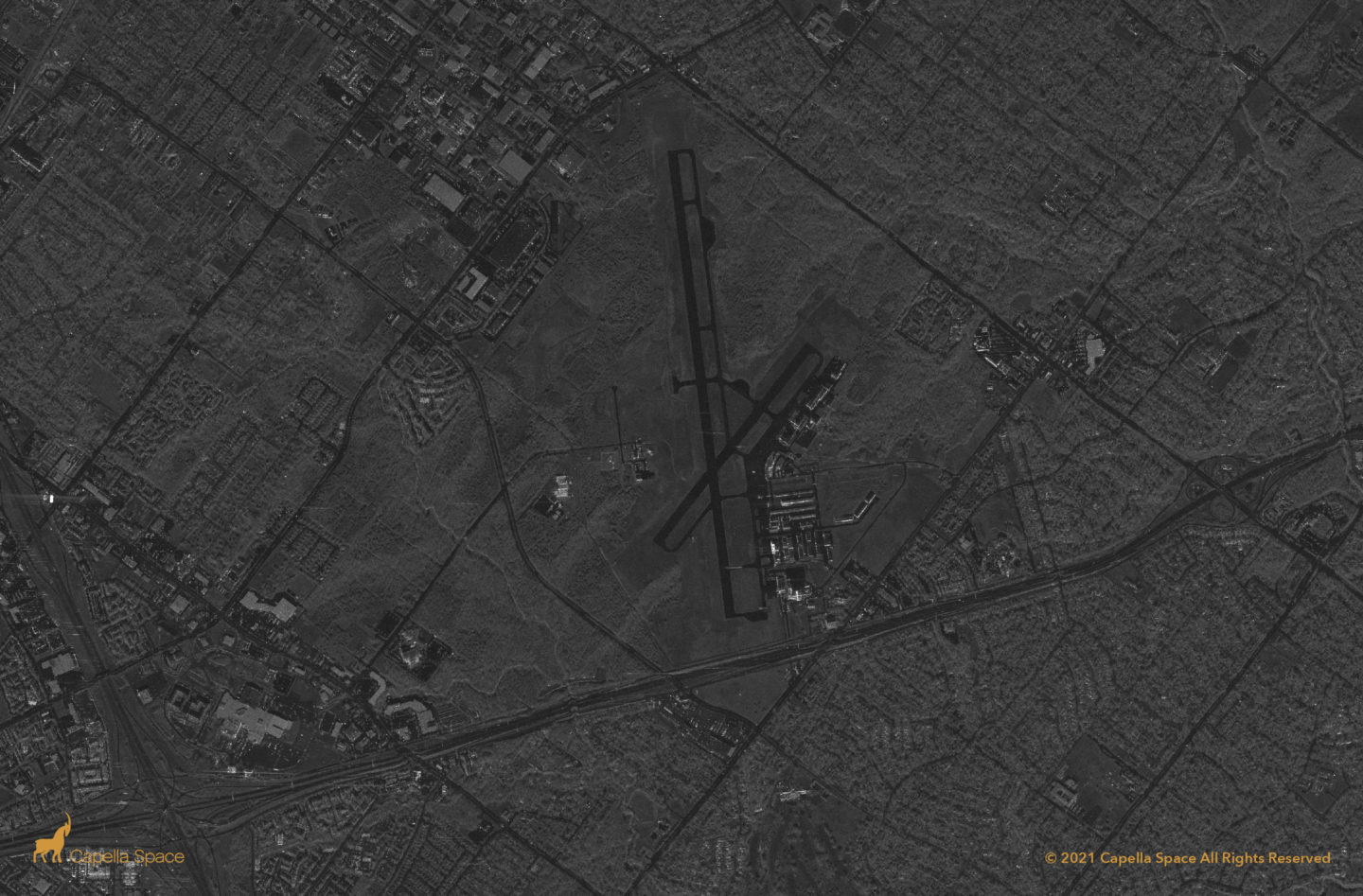
Formerly Redbird Airport, the Dallas Executive Airport serves general aviation and relief support for Dallas Love Field. SAR analysts can identify civilian aircraft as well as police helicopters at the airports two runways.
