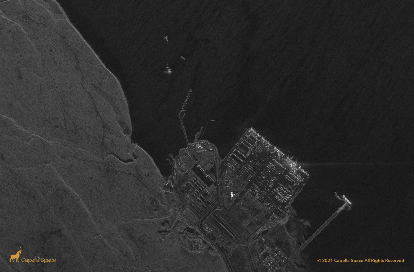
Arabian Pier, Duba, Saudi Arabia

A First Light image from Capella’s C-9 satellite. The Arabian Pier is a public boardwalk with a flowy, cascade design highlighting a unique architectural feat visible from space.
Iskenderun Limakport, Turkey

Here we see a 50 cm image of Iskenderun Limakport, Turkey, an active port for Russian coal imports.
Sikka Port, India

India’s western port city of Sikka is a hub for oil and petroleum imports.
Bay of Gibraltar

Capella has added a data stack of 19 new spotlight images of the Bay of Gibraltar to its Open Dataset. This latest open data release previews the utility of port monitoring, maritime domain awareness, and supply chain management. In this example, Capella’s high quality SAR imagery makes it possible to track vessels with great detail and clarity.
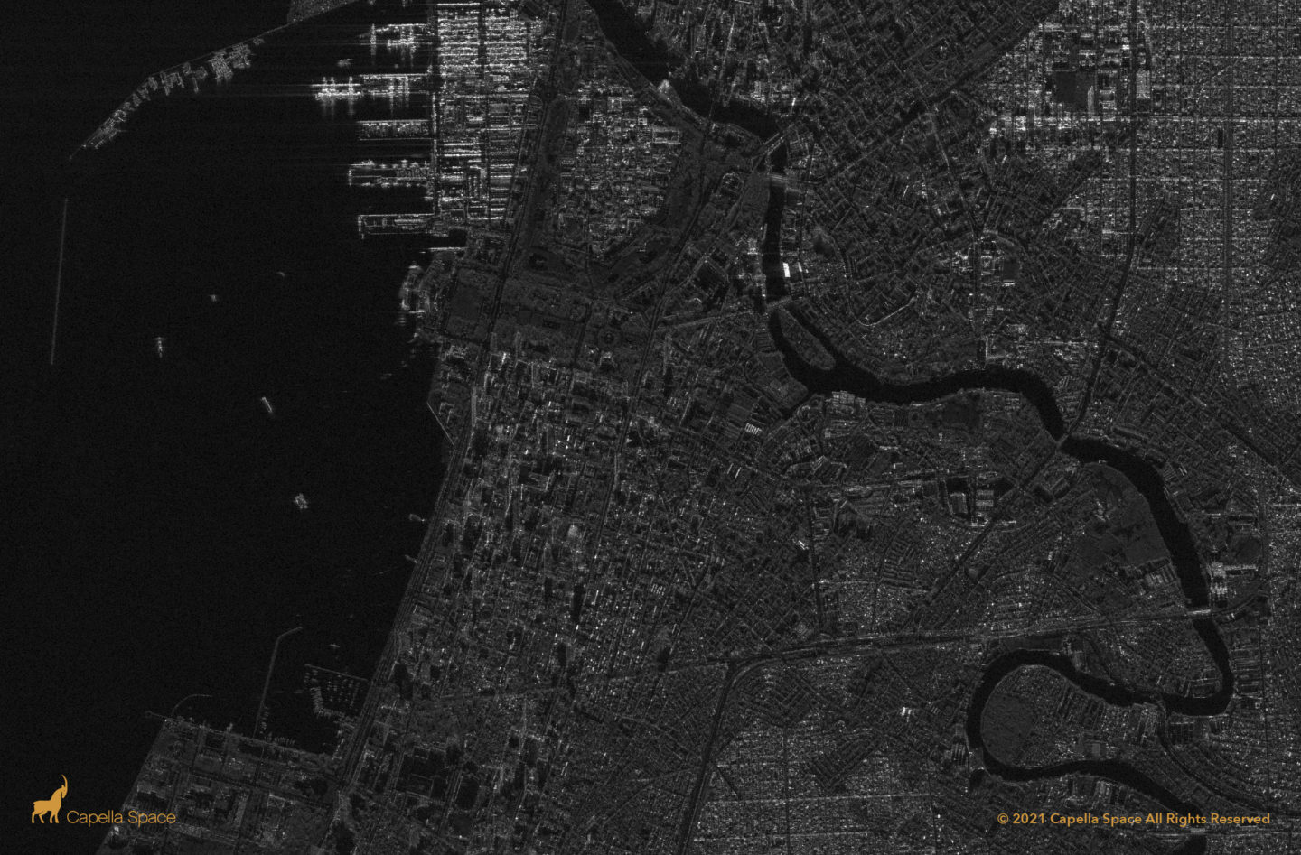
Shanghai Container Terminal Port & Changxing Island

The Shanghai Container Terminal Port is in a region that is typically very cloudy, making it difficult to capture imagery through electro-optical (EO) satellites. In Capella’s Stripmap image, in contrast, you can see the port and Changxing Island clearly and gather rich information about the port in real time. This is a significant advantage because […]
Port de Casablanca

Imports and exports make up a large portion of Morocco’s GDP. In this Stripmap image of the Port of Casablanca, you can clearly see ships as they are being loaded in the berths, containers, and rail activity. SAR can be a useful tool to monitor for potential congestion in and out of ports as goods […]
Panama Canal
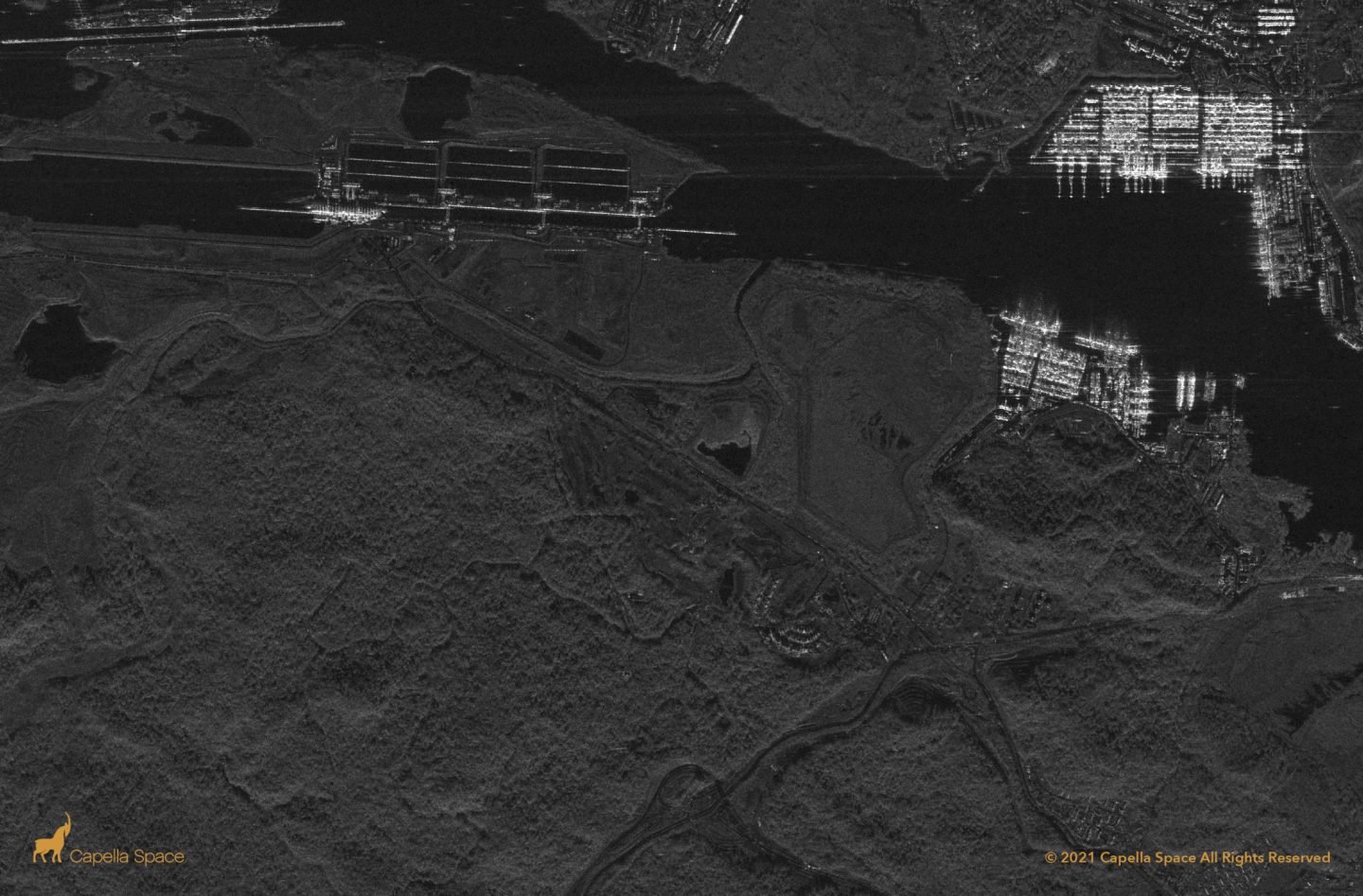
This image shows the southern entrance of the Panama Canal. You can see the Gatun Locks, which control traffic in and out of the canal, and a boat being guided through. Capella’s custom elongated scene provides a wider swath for additional visibility needed for certain applications. In this use case, Capella’s Stripmap imagery mode is […]
Manila Port Area
The Port of Manila is the largest port in the Philippines. In this image, the port and the cities of Manila and Quezon are clearly visible, along with containers, ship activity, ships in the harbor, ships at anchorage, and other sections of the city. Capella’s Stripmap, Spotlight and Sliding Spotlight images can help analysts monitor […]
Doraleh Multi-Purpose Port (DMP)
The Port of Doraleh is an extension of the Port of Djibouti, located 5 km west of Djibouti City. SAR data enables deep analyses of the terminals for handling oil, bulk cargo, and containers as well as the adjacent Chinese naval base.
