Pantanal Tropical Wetlands

The Pantanal is the world’s largest tropical wetland area, spanning across three different countries: Brazil, Bolivia and Paraguay. The Pantanal Wetlands suffered from devastating wildfires in 2019 and 2020, likely started by humans clearing land for agricultural purposes. The fires have been difficult to control and track due to a lack of access to the […]
Amazon Deforestation, Province of Chiquitos
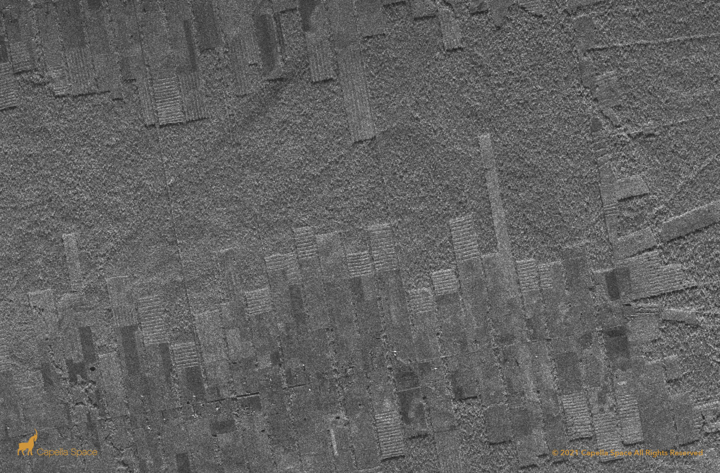
Capella’s wide swath Stripmap imagery reveals strip cut deforestation of Amazonian virgin forest. In it’s place, SAR data reveals what appears to be planted vegetation in newly formed agricultural land. When analyzing SAR data, naturally occurring forests appear in rougher patterns. The strip cut areas look artificial, showing straight lines of re-planted trees that don’t […]
Amazon Deforestation, Luna Camba
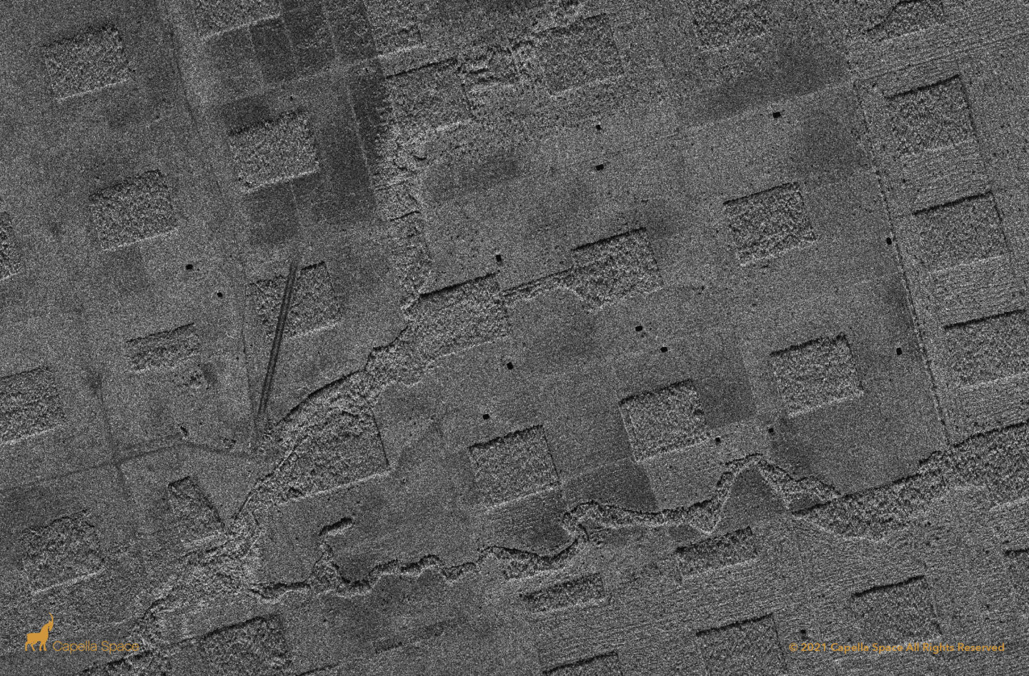
In this image, you can see deforestation in the Amazon Rainforest. Deforestation in the Amazon Rainforest is difficult to monitor at scale due to the size and opacity of the region, which often is obscured by cloud cover. Capella’s 24/7, all-weather Stripmap imagery mode uses a wider swath to detect high-resolution changes such as land […]
Urucu-Manaus Pipeline
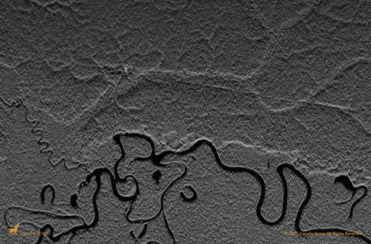
Deforestation is difficult to monitor in the tropics due to persistent cloud coverage in equatorial regions, however Capella’s all-weather SAR imagery provides transparency into new infrastructure and agricultural developments that threaten natural habitats. This SAR image clearly visualizes an access road leading from the Rio Urucu to a natural gas pipeline running parallel to the […]
