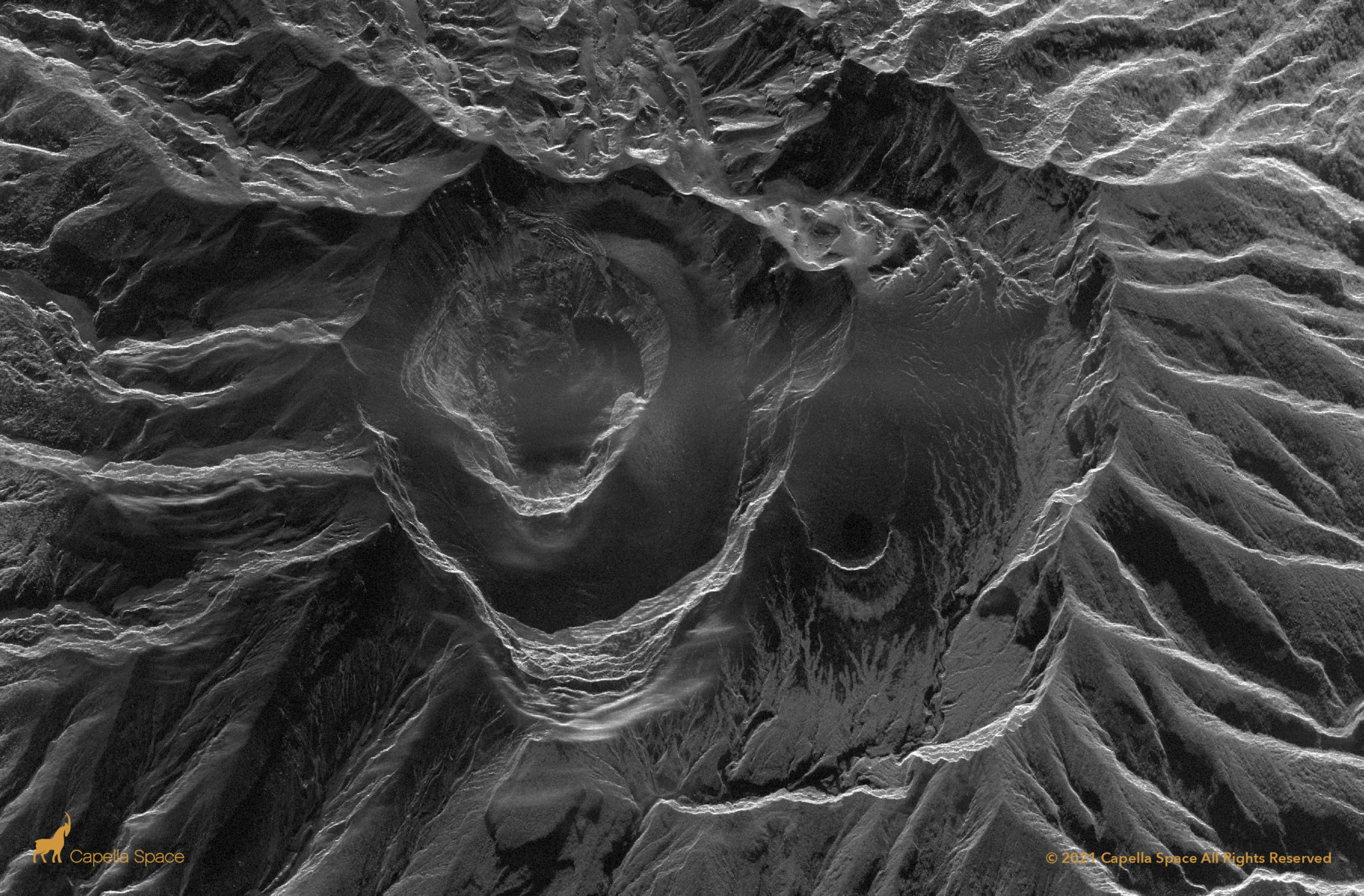
This image of La Soufrière captures an active volcanic eruption, using microwave remote sensing to detect the lava dome’s collapse through miles of volcanic smoke. SAR satellites can see through smoke and volcanic ash for 24/7 disaster response data.
