Back to Resources
Blog
Images from New Capella Space Satellites Showcase Highest Quality SAR Commercially Available
Capella Space
Blog
April 3, 2023
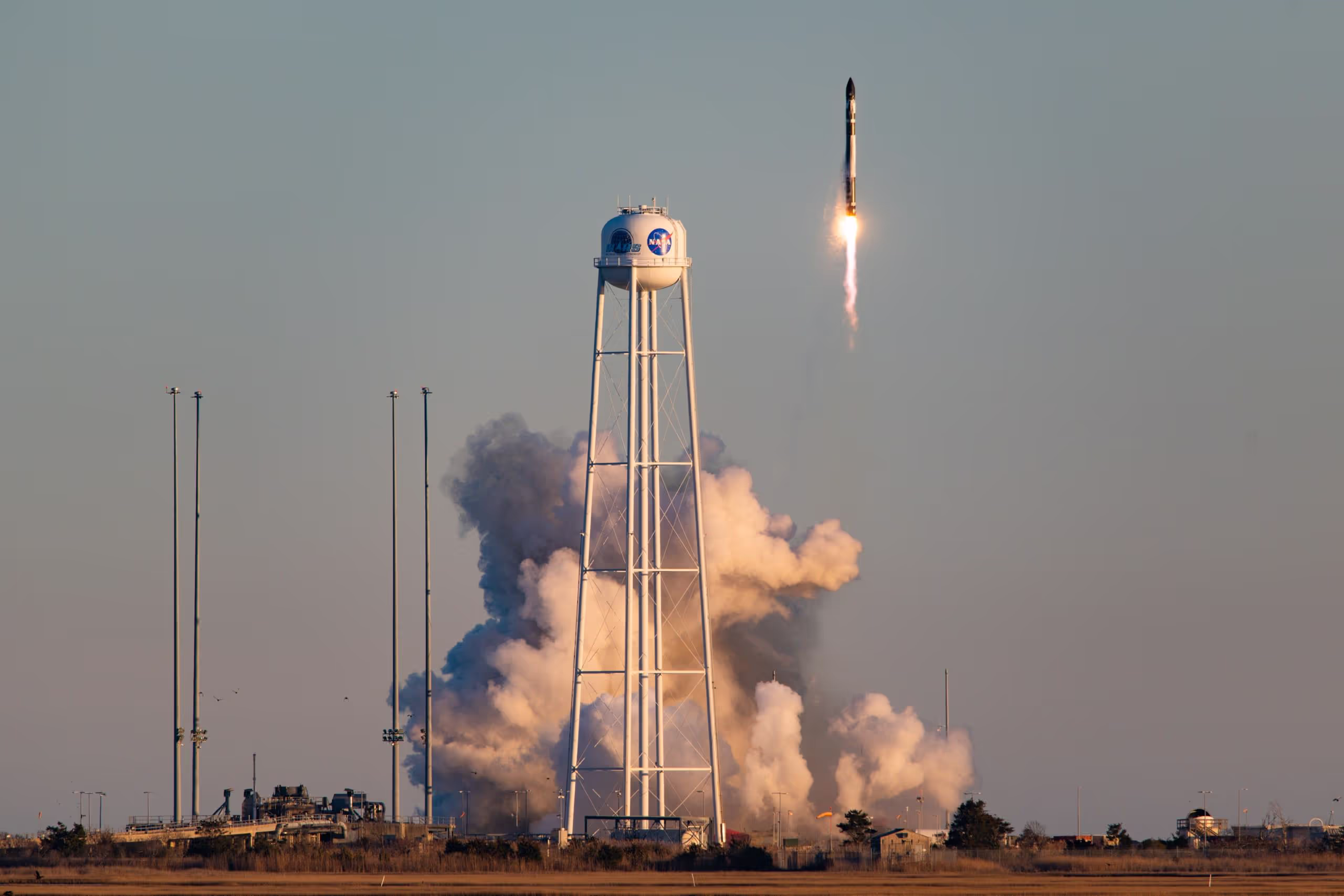
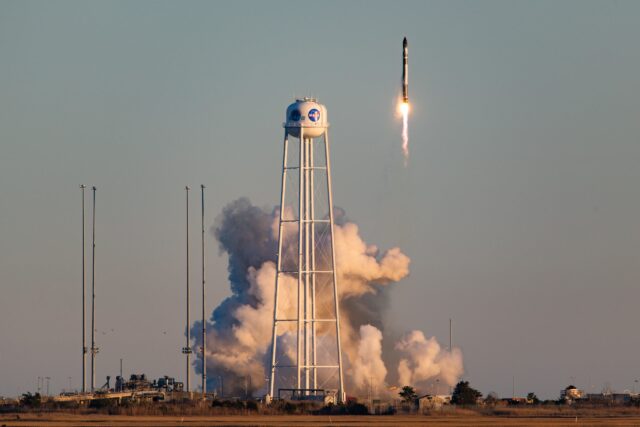
Last month Capella Space hit two major milestones: we celebrated our seventh anniversary as a company, and we successfully launched two more of our industry-leading Synthetic Aperture Radar (SAR) satellites. The “Stronger Together” mission took place with Rocket Lab on March 16, 2023, at NASA’s Wallops Flight Facility in Virginia. We deployed two 100-kg class payloads to low-Earth orbit from an Electron rocket, expanding our constellation of best-in-class SAR satellites that deliver the highest quality SAR images commercially available.
Commissioning Two Satellites
It took only four days, 23 hours and 10 minutes to commission both satellites. This fast timeline was the result of our fantastic team effort, along with our automated and well-tested procedures. I’m proud of our team for moving so quickly without adding any new risk. Our successful process is enabled by a proven, cloud-first data infrastructure and robust ground systems that streamline communications with the satellites.
Our commissioning flow, from initial health checkouts through structural deployments and payload checkouts, went smoothly on the first satellite. We then turned around and repeated the same success on the second one immediately afterwards. Each subsystem was confirmed to be in perfect working order, and the combined result is this beautiful first light imagery that I’m excited to share.

Highest Quality Commercial SAR Images in Any Weather
Capella’s SAR technology penetrates all weather conditions and lighting conditions– including rain, snow, wind, fog, smoke and darkness. SAR is like having a flash on your camera -- it lets you take images in conditions that wouldn’t be possible without it.
No other commercial SAR provider can consistently deliver high-quality imagery, thanks to our advanced deployable reflector, state-of-the-art radar, and custom processing and delivery pipeline. Put together, these innovations provide an unparalleled view of the planet for our customers.
New Images
And now – the images! From ships at ports, to natural wonders, to impressive human-made structures, these new images from across the globe highlight Capella’s unique Earth observation capabilities.

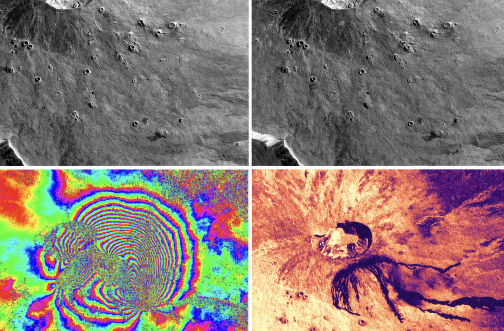
The horse outline in this image is made of solar panels, a design that reflects the region’s horse-racing and horse-breeding traditions. This Guinness Book of World Record holder for “largest image of solar panels” boasts 196,320 solar panels across 345 acres.
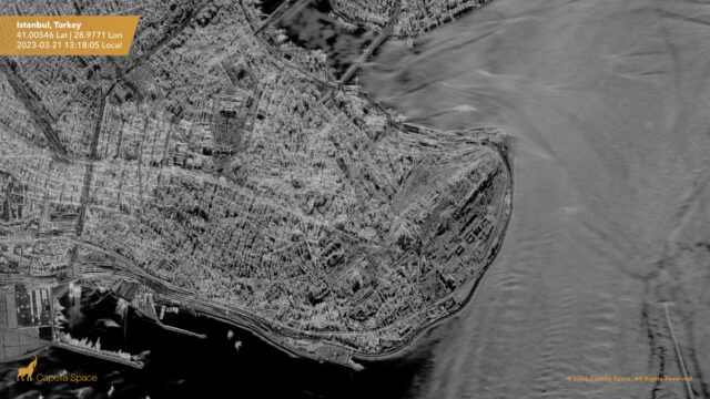
The Sultanahmet Camii, or “The Blue Mosque,” completed in 1617, is visible in the middle of the image. There is a wind shadow on the lower side of the land that causes the water to appear darker than other areas in the scene. What’s most interesting here is the difference in reflectivity between the moving water in the channel and the still water in the harbor area. Changes in reflectivity can be measured and used for not only water, but things like differentiating crops. Other features on the water are caused by boat wakes and wave-current interaction, and the moving boats appear blurred because the ships were moving when the image was taken.

The Arabian Pier is a public boardwalk with a flowy, cascade design visible from space. This pier is a great example of how something in space looks totally different than what you see and experience on Earth. This vantage point from low-Earth orbit provides an elegant image highlighting a unique architectural feat you can’t fully appreciate on the ground.

Located in California’s Sierra Nevada mountains, Mount Whitney has an elevation of 14,505 feet (4,421 m) and is the namesake of Capella’s second-generation satellites. Here in this image, layover and multi-look capturing enable us to see more of the natural features of the mountain. Our satellite generations (classes) are named after well-known natural areas in the United States and these two satellites are the last of our Whitney class of satellites. Our next generation Acadia satellites will begin launching later this year with technical enhancements and new features.
The World’s Best Quality SAR
Capella Space technology delivers the world’s highest quality SAR imagery commercially available, focusing on high-resolution, low noise, orbital diversity, and highest imaging frequency, helping our customers solve some of the world’s toughest problems. As pioneers and trailblazers in the commercial SAR market, we were the first U.S. company with a constellation of SAR satellites. This has enabled us to offer the largest archive of commercial SAR data, along with the world’s best quality SAR with the fastest order-to-delivery speeds for our customers.
Reach out to our team to learn more about Capella's SAR imagery products.
Curious Which Of Our Analytics Partners
Can Support Your Mission?
Contact our team to explore the possibilities. Our experts can help
you determine the optimal solutions for your unique needs.

Keywords

Stay Informed. Stay Ready.
Get briefings on new capabilities, technology improvements, and upcoming events.


.avif)
