Researchers turn to Synthetic Aperture Radar (SAR) satellite imagery to monitor Pacific walruses as ice melt increases in the Arctic
The following is a guest post from the U.S. Geological Survey’s Walrus Research Program. USGS scientists are using Capella’s high resolution SAR imagery to study walruses’ use of terrestrial haulouts, which is increasing as global warming melts their sea ice habitats. Learn more about walruses, the challenges they face, and the challenges of studying them at the Alaska Science Center.
Upwards of 200,000 Pacific walrus – females, dependent young, and some adult males – summer north of the Bering Strait, feeding on clams and large marine worms that grow in the sediments of the shallow continental shelf, which extends between Alaska and the Russian Far East.
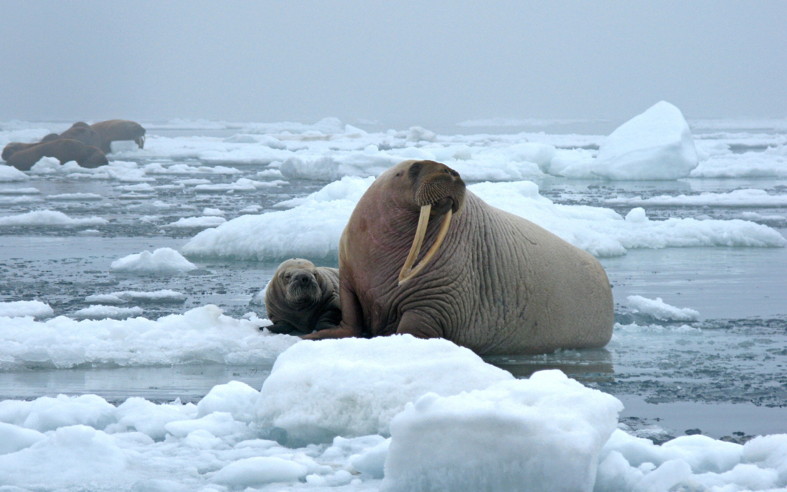
Historically walrus spent their summers resting in small groups almost exclusively on floating sea ice near these rich sediment beds. However, recently their summer sea ice resting platforms have been disappearing due to unprecedented warming in the Arctic.
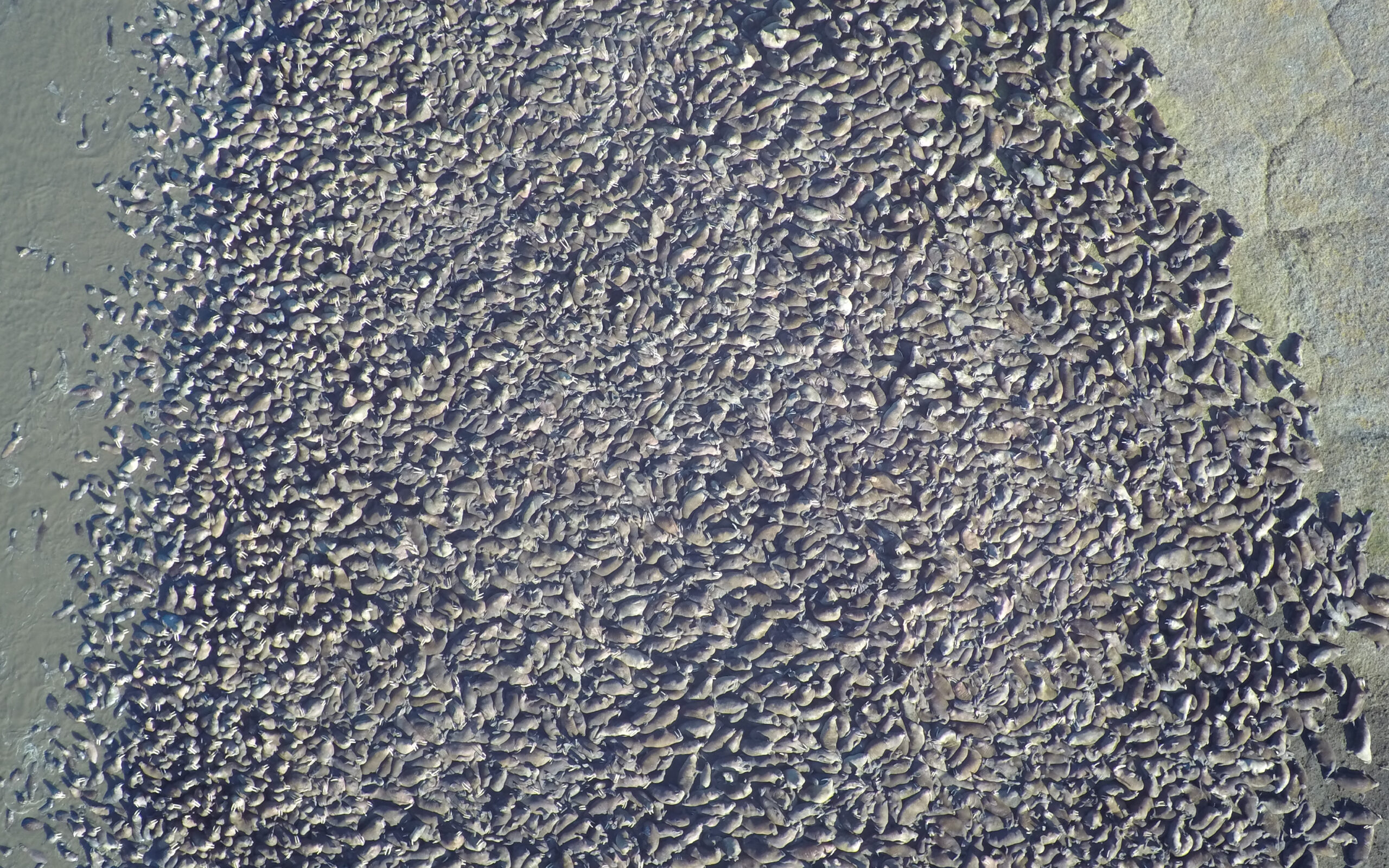
The Arctic is warming four times faster than the global average, and summer sea ice extent is rapidly diminishing. For instance, since 2007, summer sea ice has completely disappeared from most of the Chukchi Sea’s continental shelf, leaving walruses there with no place to rest between foraging bouts. Without sea ice, walruses must go to land to rest in large numbers.
What happens when walruses are forced to rest on shore
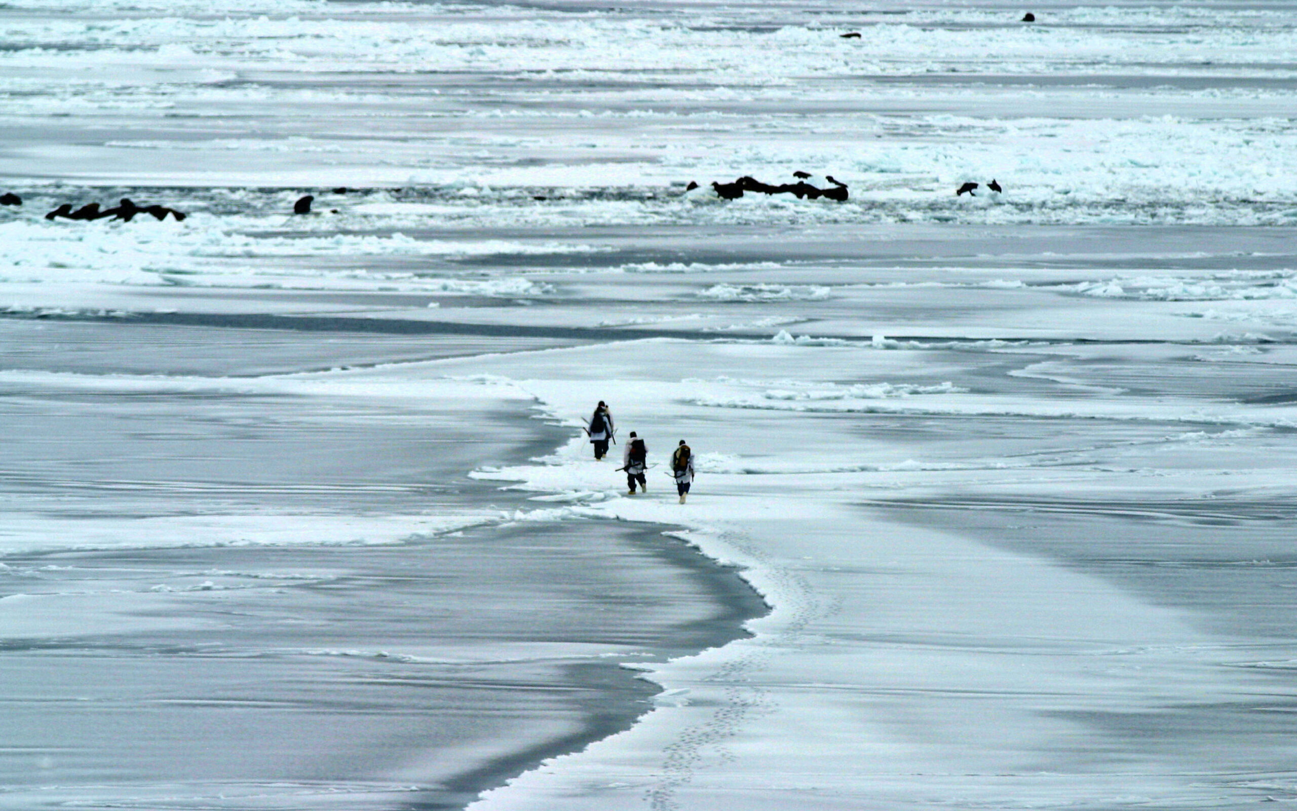
There are several implications of diminishing sea ice to consider. Resting onshore forces walruses to burn more calories to acquire food and exposes them to the risks of trampling deaths if they are disturbed. Low-flying aircraft are known to cause stampedes, and there are also risks of vessel spills along the rapidly growing international Arctic shipping routes. These risks raise concerns for the walrus population long-term because more sea ice is expected to melt in the coming decades.
Addressing these concerns is not only important for determining the current and future status of the walrus population, but also for the five linguistically distinct Pacific Arctic Indigenous cultures that rely on walruses for their cultures and sustenance.
Why use Synthetic Aperture radar to monitor walrus haulouts?
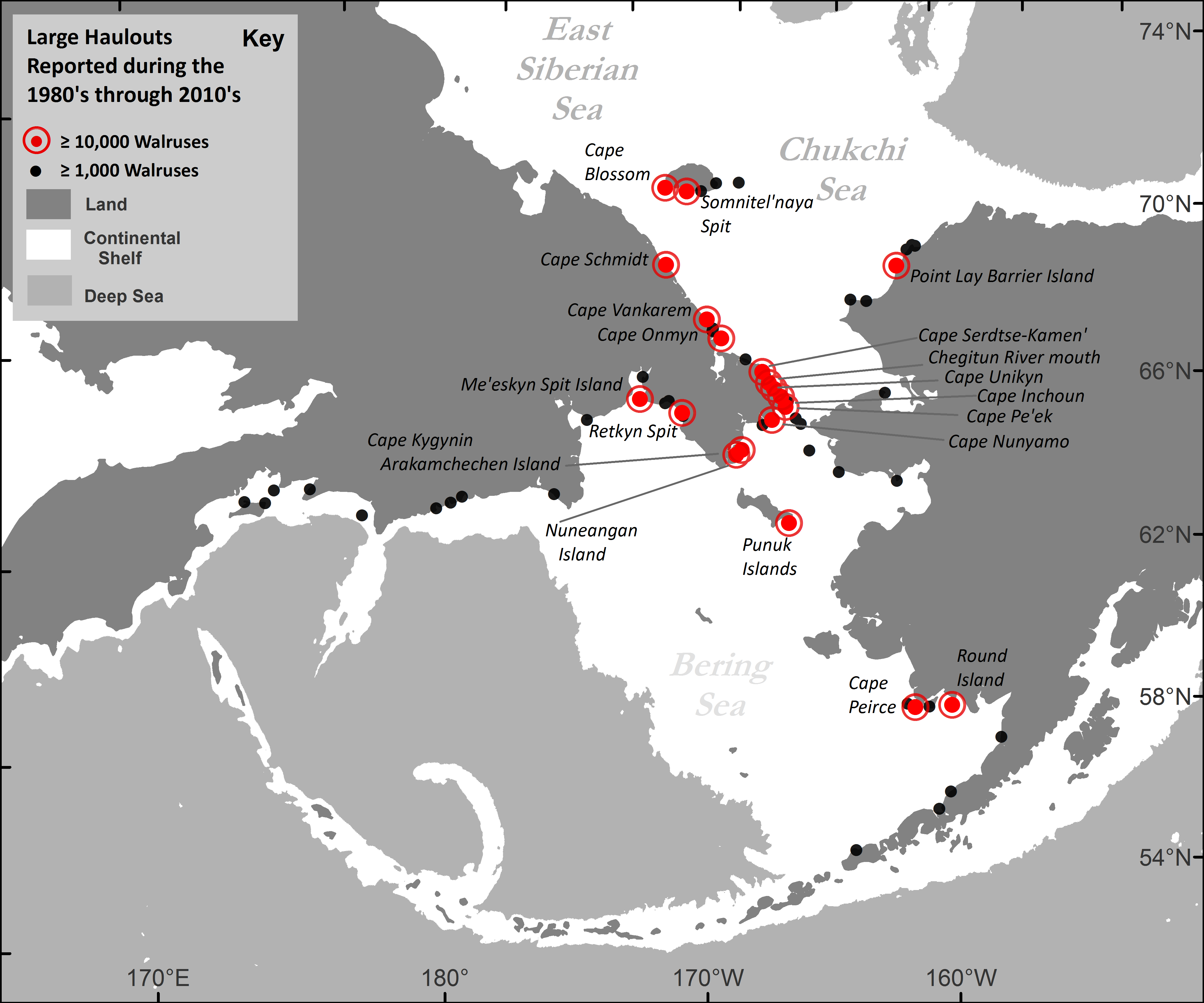
Locations where walruses routinely haulout in large numbers are well-known but difficult or impractical to monitor first-hand because they are extremely remote and scattered across a vast geography. What is even more difficult is that due to the marine coastal weather, most days that walrus rest onshore are cloudy such that monitoring walruses with aerial surveys and optical satellite imagery is not reliable. Synthetic aperture radar (SAR), however, can reliably image haulouts regardless of clouds or darkness.
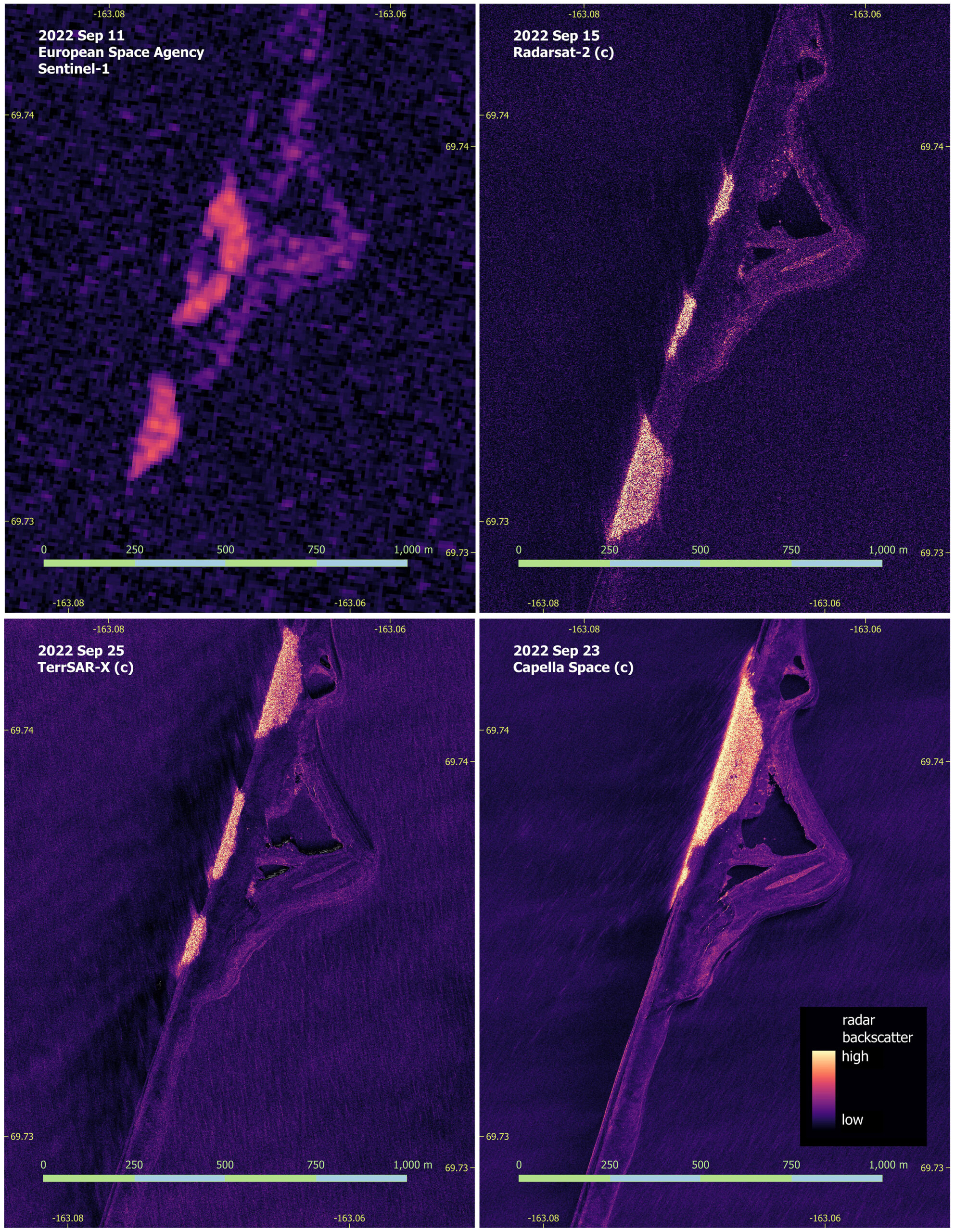
Large aggregations of walruses on sandy haulouts are readily detectable in SAR imagery owing to their strong radar backscatter. And with higher resolution, more information can be learned about the walrus population. For instance, Sentinel-1 SAR with 10-meter resolution can document the presence and approximate area occupied by walrus aggregations, while the ~1-meter resolution of the RADARSAT-2 and TerraSAR-X instruments provides much greater precision in discriminating an aggregation’s periphery. The most advanced commercially available SAR technology from Capella Space brings this resolution to ~50cm.
Remarkably, the sub-meter resolution of Capella Space SAR instruments offers new directions for walrus research that were never thought possible before. As demonstrated in the initial evaluations of SAR imagery from Capella Space (shown below), the sub-meter resolution of Capella SAR might be providing information about different densities of walruses within an aggregation. If so, that information could be used to estimate the actual number of individual walruses resting on shore with improved precision.
Partnering with Capella Space to explore the use of SAR in walrus monitoring and research
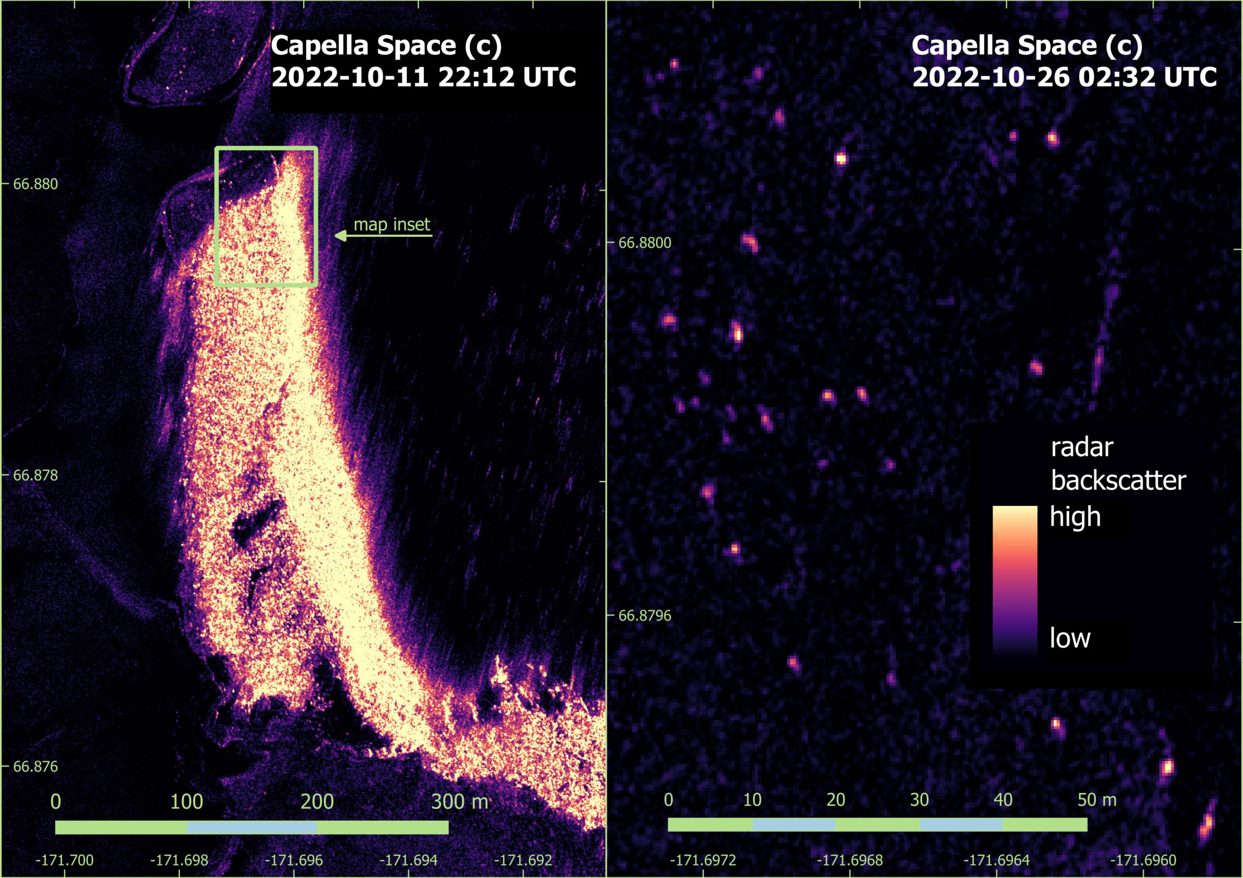
Over the next 2-3 years, the USGS Alaska Science Center plans to engage in a quantified assessment of estimating walrus density with SAR by collecting 2-cm resolution drone imagery as ground-truth at precisely the same time that Capella Space satellites collect SAR imagery of the same haulout. Another new research question under investigation is whether sub-meter SAR imagery can detect individual walrus carcasses, which commonly persist at a haulout after the walruses have departed. The extent to which Capella SAR imagery can provide information for assessing the occurrence of carcasses at large coastal haulouts became a topic of new research after seeing Capella imagery like that shown below.
Climate change has already profoundly changed the sea ice habitats of walruses, forcing them to engage new behaviors and migratory patterns. Monitoring walruses is becoming even more important as rapid warming continues to change the Arctic environment, while weather conditions continue to make research projects challenging. Capella’s constellation of all-weather sub-meter resolution SAR satellites offers the USGS Walrus Research Program a unique tool set that will play a pivotal role in helping to conserve the walrus population that faces increasing risk due to the warming climate in the Arctic.
This is an on-going project between Capella Space and USGS. Stay tuned for progress that is made with the help of SAR technology.
