%201.avif)
Secure Intelligence for National Security
We deliver commercially-built satellite constellations and persistent, all-weather synthetic aperture radar imagery. Trusted by global defense and intelligence agencies, you'll gain reliable constellations and fast, encrypted data through a secure TCPED for mission-critical operations.
Persistent ISR for Modern Defense Missions
Persistent Monitoring When It Matters Most
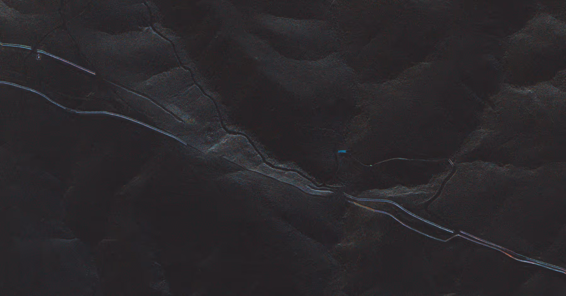
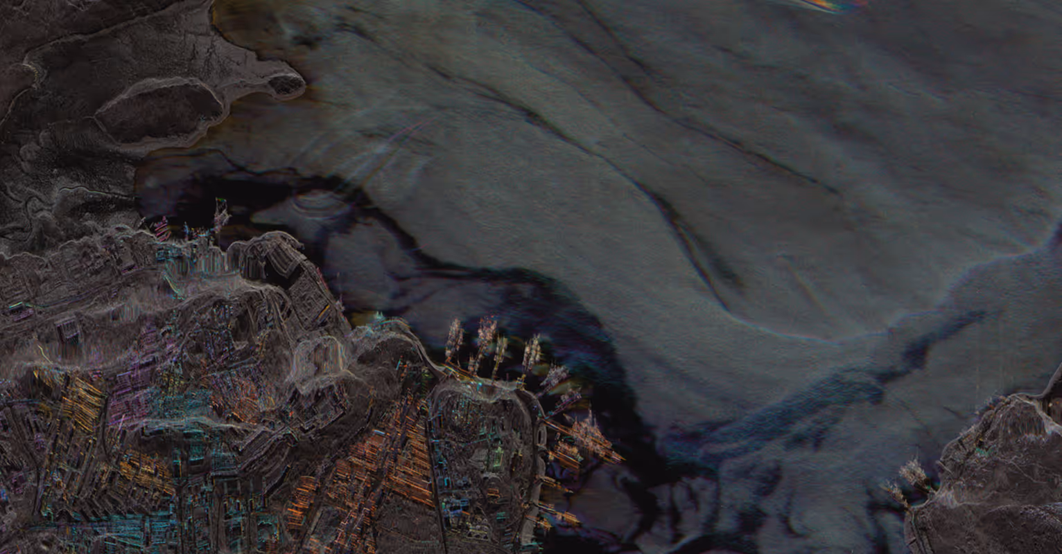
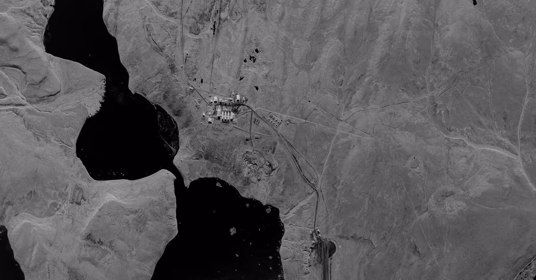
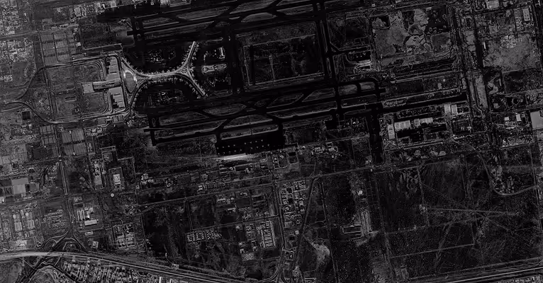
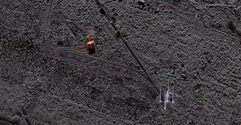
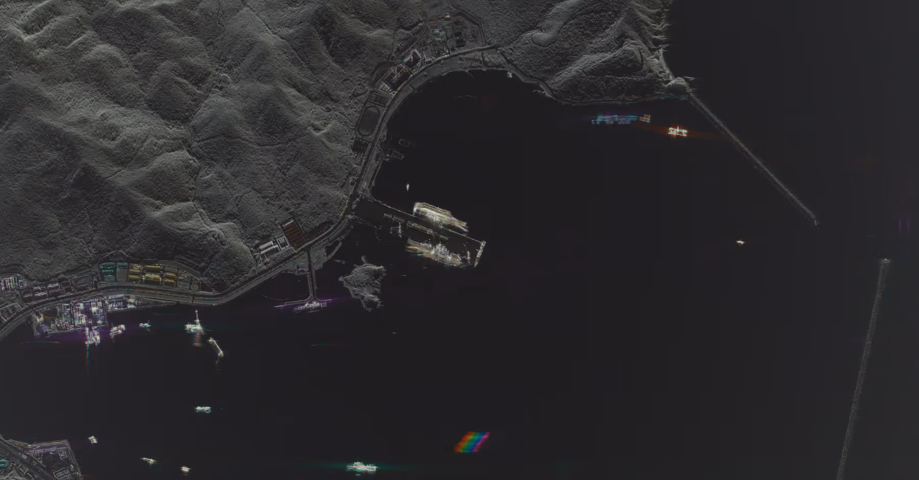
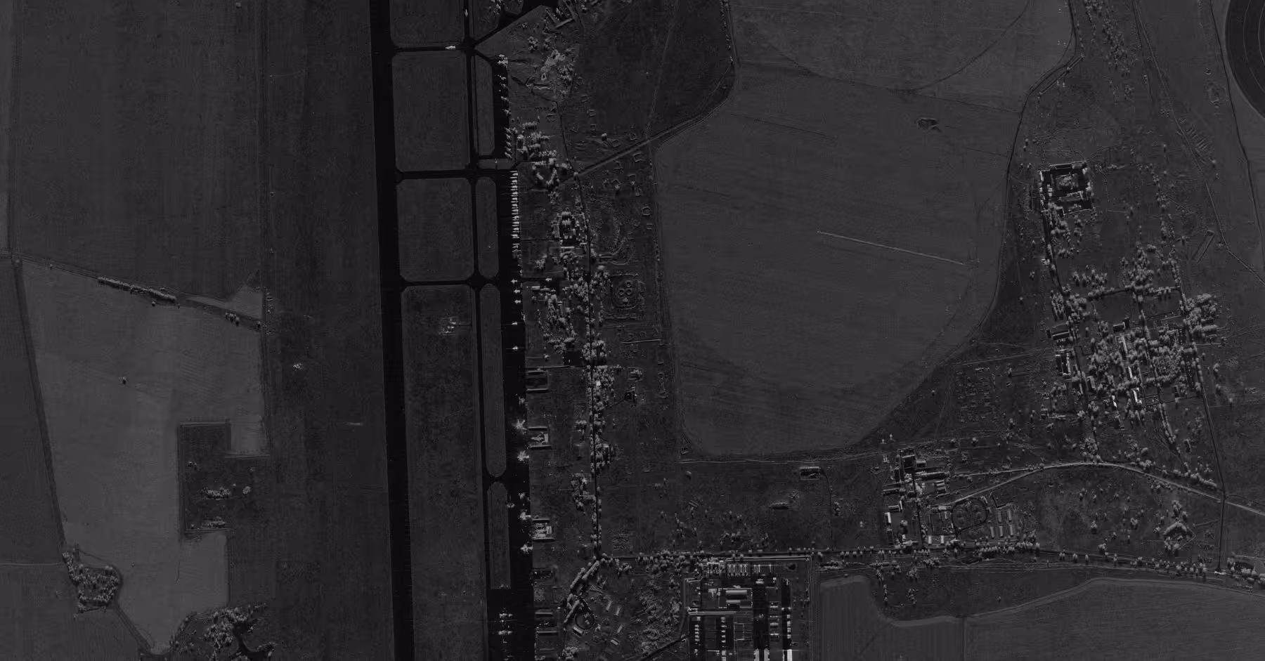
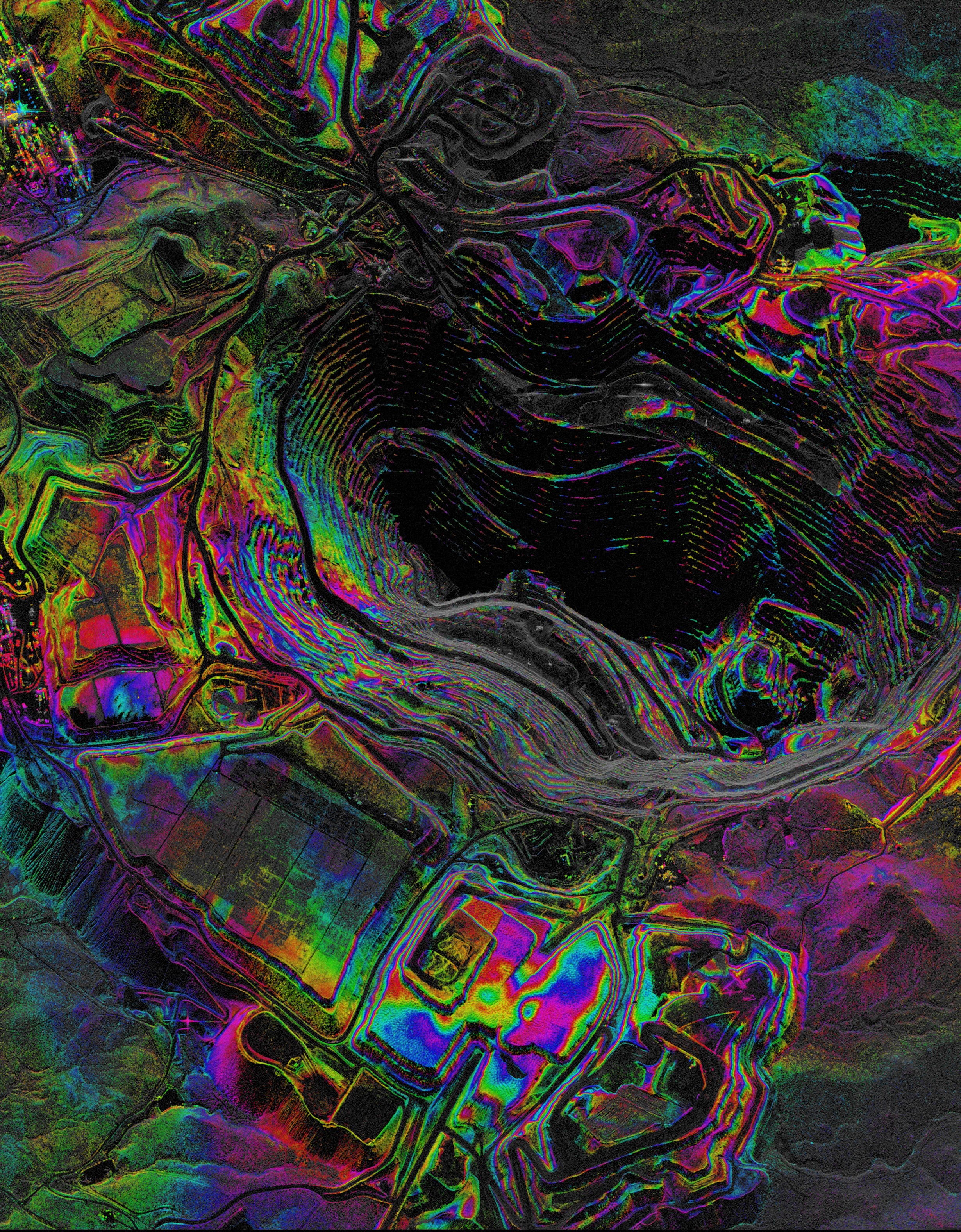
Survey movement across terrain and borders with high-resolution SAR that operates day or night through any conditions.
Monitor Activity Across Strategic Areas
Track activity and monitor critical infrastructure with low-latency, all-weather imaging to support ISR and time-sensitive missions.
Secure Space-based Intelligence
Built to meet defense and intelligence requirements with end to end encryption and security to handle sensitive information.
Mission Proven Defense & Intelligence Solutions
Capella is trusted by the NGA, NRO, U.S. Air Force, U.S. Space Force, and Defense Innovation Unit, delivering SAR data and vertically integrated spacecrafts needed for mission success.
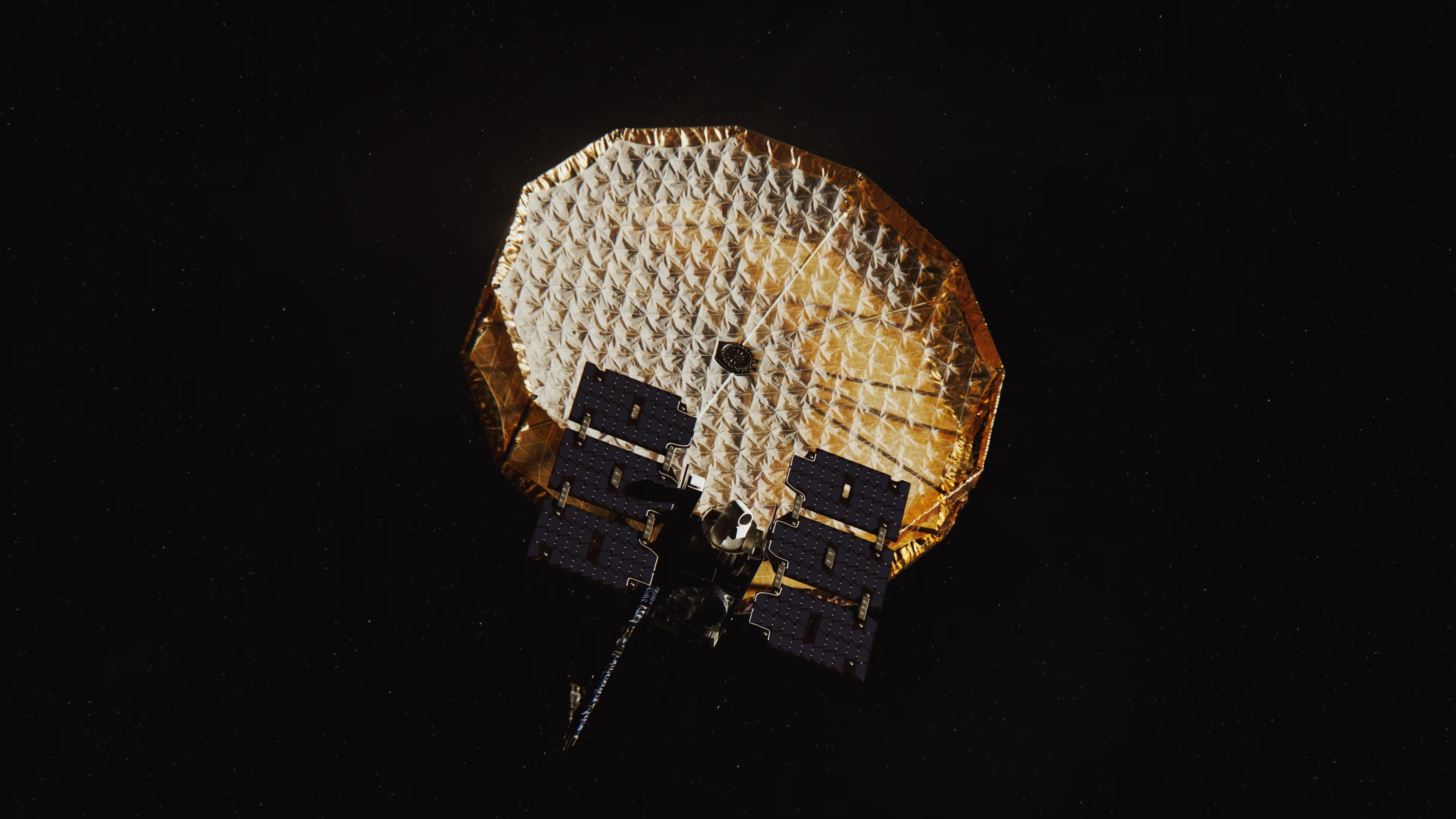
Dedicated Space Systems
Mission-proven constellation for national security and control over intelligence collection.
- Vertically integrated design and manufacturing of satellites and space systems, built and operated to customer mission needs
- Mission-tailored payloads, ground infrastructure, and imaging modes configured to your operational requirements
- Defense-grade security and compliance for sensitive information.
Learn more about Capella Space Systems
.avif)
.avif)
Mission-Grade Earth Intelligence
Persistent all-weather, high-resolution SAR imagery for uninterrupted intelligence with azimuth resolutions as low as 25 cm and revisit rates every 3-6 hours.
- Advanced imaging modes including CSI (Colorized Sub-aperture Image) and enhanced detection and classification of objects for analysis and threat identification
- Automated workflows and API integration deliver imagery within hours of tasking to support planning and rapid response in dynamic operational environments
- Proven track record with contracts supporting global defense and government agencies since 2021
.avif)
Learn more about Capella SAR data
Mission-Ready Advantages
Latest Insights And News
Capella Space Debuts InSAR Sat Service For Surface Monitoring


FAQ
Ask us anything
What Imaging Modes Does Capella Support?
Capella satellites support Spotlight (including Spotlight Ultra), Sliding Spotlight, Stripmap, and Parallel Stripmap imaging modes.
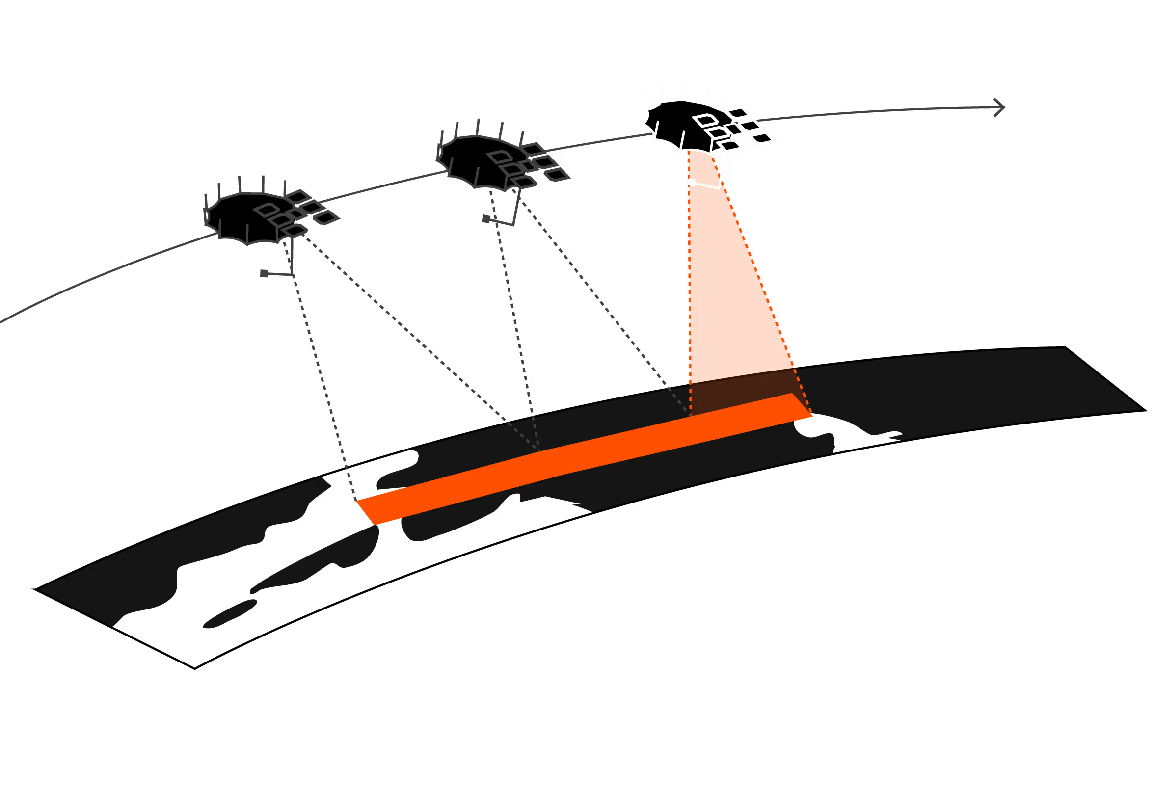
How Does Capella's Tasking System Work?
Capella's scheduler runs every 20 minutes and processes new acquisition tasking requests for a rolling one-week-out scheduling window. Users submit their desired imaging parameters through Console or API, receive cost review and approval notifications, then tasks enter the queue. Once the window open date is within the one-week scheduling horizon, the system automatically plans, schedules, collects, and delivers imagery based on collection tier priority (Urgent, Priority, Standard, Flexible, or Routine for repeats).
What Resolution And Image Quality Can Acadia Achieve?
Acadia delivers resolution ranging from 0.25 m to 1.2-meter azimuth resolution depending on imaging mode. Spotlight Ultra achieves 0.25 m azimuth with 0.25/0.3 m slant range resolution. The system uses single-polarization (HH or VV) X-band SAR with look angles from 15° to 50° and grazing angles from 73.5° to 33°. Multi-look processing (1-5 looks depending on mode) reduces speckle while maintaining spatial resolution.
What Data Formats And Products Are Available?
Capella provides Single Look Complex (SLC), Geocoded Ellipsoid Corrected (GEO), Geocoded Terrain Corrected (GEC), SICD, SIDD, CPHD, and Colorized Sub-aperture Imaging (CSI) products. All products can support machine learning and AI analytics development with STAC-compliant metadata for seamless integration into existing workflows and GIS platforms.
How Does Extended Imaging Capacity Work?
Acadia's 10 minutes of continuous imaging per orbit is enabled by larger batteries, enhanced solar arrays, and improved thermal management. The 600 MHz radar bandwidth combined with extended dwell times delivers more collection capacity per pass.
Can Acadia Support Persistent Monitoring?
Yes. Repeat tasking allows automated monitoring of any point target with user-defined repeat cycles (daily, weekly, custom intervals). The system can automatically plan, schedule, and deliver collections with optional geometrically similar parameters. Multi-orbit constellation (sun-synchronous and mid-inclination) enables multiple collection opportunities per day across global latitudes.
Haven’t Found What You Needed?
Our expert team is here to support your mission and help you get the insights you need.
.avif)
.avif)
Take Action When It Matters
Access reliable, all-weather intelligence to monitor, detect, and respond with confidence in any environment.
