.avif)
.avif)
.avif)
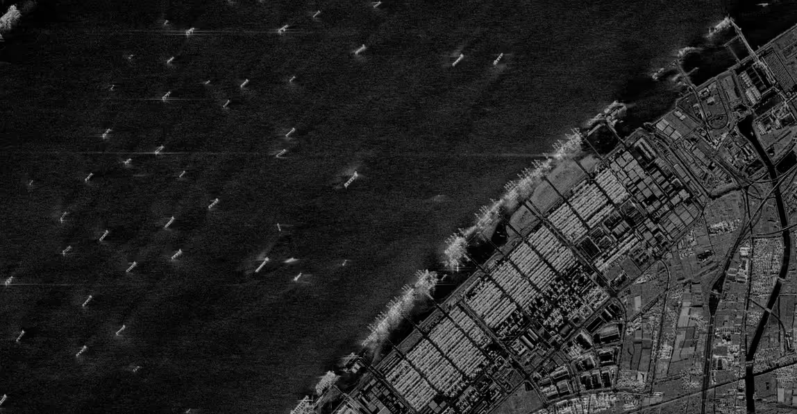
Persistent Maritime Intelligence
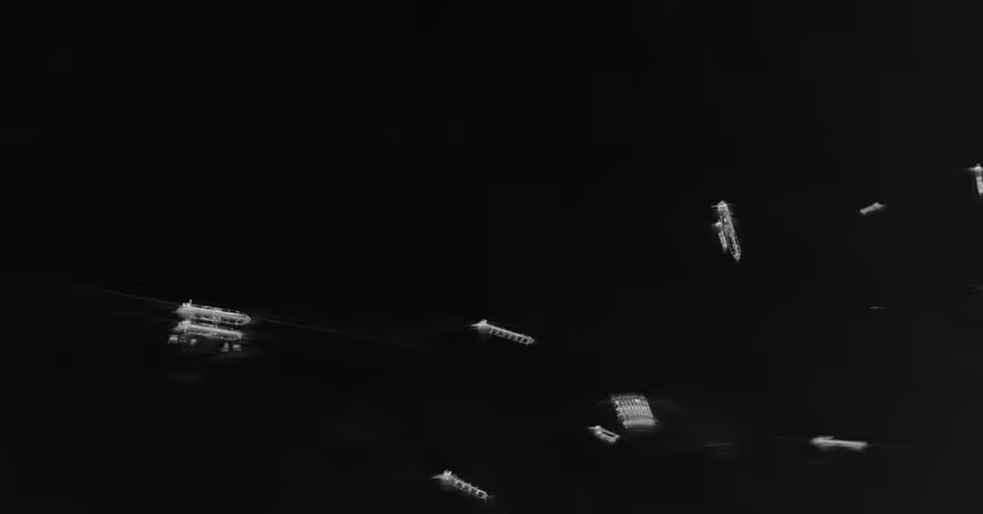
Capella's SAR imagery can detect and classify objects and vessels 24/7 through darkness and weather. Track dark fleets, monitor ports, and secure territorial waters with persistent all-weather coverage.
Persistent Visibility Across
Global Waters
Dark Fleet Detection & Vessel Monitoring
Supporting the detection of ghost ships across open oceans and contested zones. Counter IUU fishing, sanctions evasion, and illicit transfers where traditional monitoring fails.
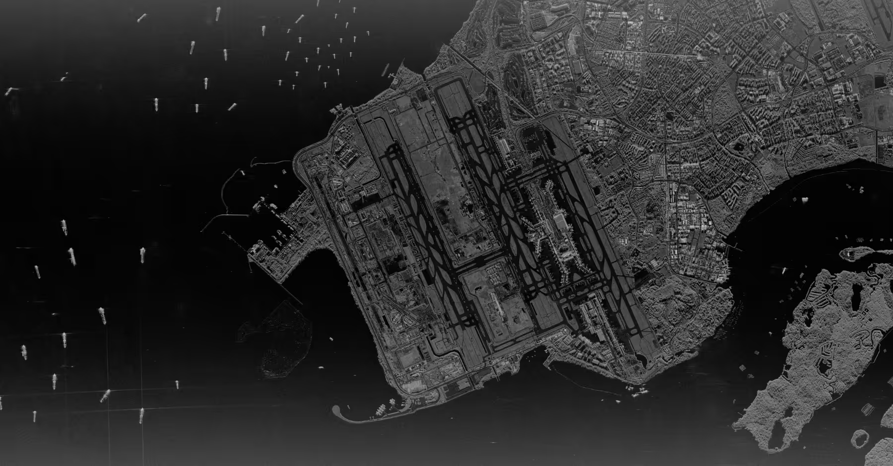
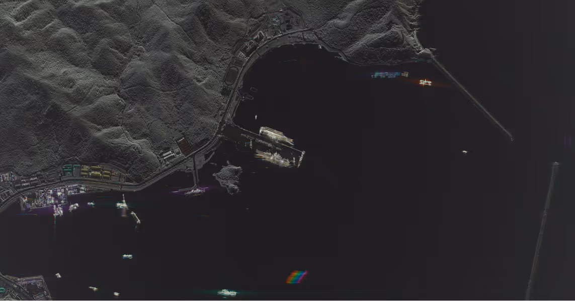
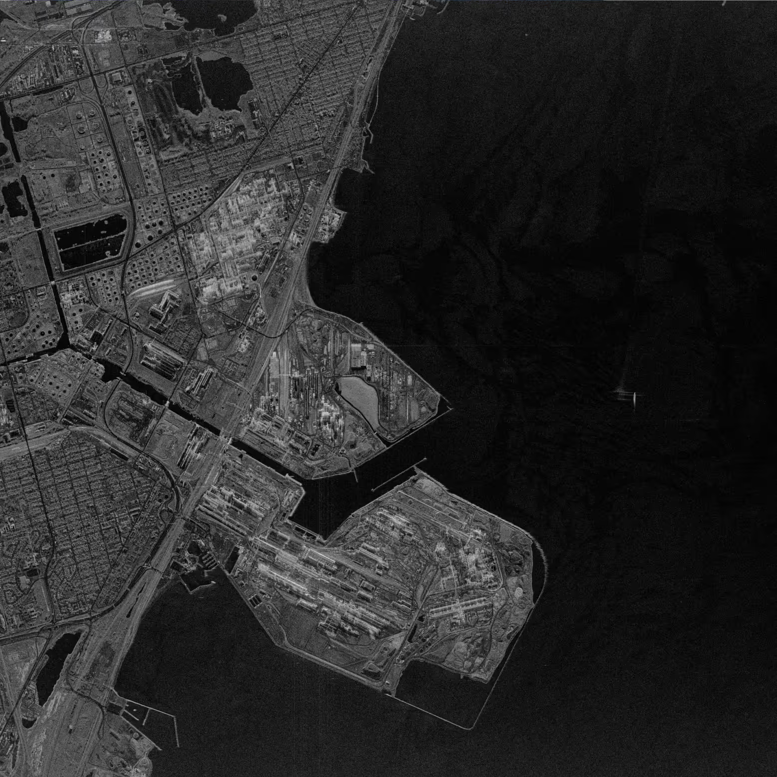
24/7 Oversight of Critical Maritime Assets
Monitor vessel movements and loading operations at ports and offshore terminals supporting supply chain analysis and security monitoring.
Protect Critical Territorial Waters & EEZs
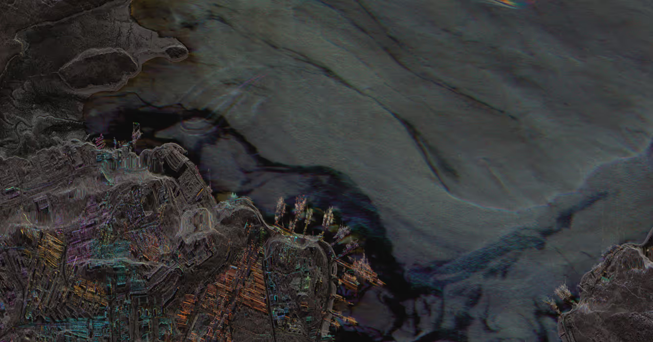
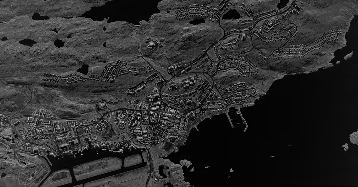
Maintain continuous surveillance of coastlines and exclusive economic zones (EEZs) with sub-daily revisit rates. Detect unauthorized activity, coastal development, and oil spills.
Mission-Proven Maritime Intelligence
From vessel classification SAR data to satellite systems, Capella delivers reliable monitoring capabilities maritime operators need for complete domain awareness.
All-Weather Maritime Intelligence
High-resolution SAR imagery and sub-daily revisit rates for persistent vessel detection and maritime monitoring across global waters, day or night.
- AI-powered automated vessel detection and classification integrated with tasking platform for defense-grade maritime intelligence
- Extensive archive covering hundreds of ports enables analysis of shipping patterns and infrastructure changes
- Analytics partners provide motion detection, site monitoring, and object classification solutions
.avif)
Learn more about Capella SAR data
.avif)
Dedicated Maritime Surveillance
Commercially built satellite systems and constellations for maritime monitoring missions and coastal surveillance operations.
- Deploy satellites configured specifically for your operational requirements with customizable payloads, ground infrastructure, and imaging modes.
- Proven platform trusted by defense agencies with rapid deployment in months, not years.
- Capella uses encryption, threat detection, and 24/7 monitoring across the delivery system, serving the most sensitive missions.
Learn more about Capella Space Systems
Mission-Ready Advantages
Latest Insights And News
Capella Space Debuts InSAR Sat Service For Surface Monitoring


FAQ
Ask us anything
What Imaging Modes Does Capella Support?
Capella satellites support Spotlight (including Spotlight Ultra), Sliding Spotlight, Stripmap, and Parallel Stripmap imaging modes.
How Does Capella's Tasking System Work?
Capella's scheduler runs every 20 minutes and processes new acquisition tasking requests for a rolling one-week-out scheduling window. Users submit their desired imaging parameters through Console or API, receive cost review and approval notifications, then tasks enter the queue. Once the window open date is within the one-week scheduling horizon, the system automatically plans, schedules, collects, and delivers imagery based on collection tier priority (Urgent, Priority, Standard, Flexible, or Routine for repeats).
What Resolution And Image Quality Can Acadia Achieve?
Acadia delivers resolution ranging from 0.25 m to 1.2 m azimuth resolution depending on imaging mode. Spotlight Ultra achieves 0.25 m azimuth with 0.25/0.3 m slant range resolution. The system uses single-polarization (HH or VV) X-band SAR with look angles from 15° to 50° and grazing angles from 73.5° to 33°. Multi-look processing (1-5 looks depending on mode) reduces speckle while maintaining spatial resolution.
What Data Formats And Products Are Available?
Capella provides Single Look Complex (SLC), Geocoded Ellipsoid Corrected (GEO), Geocoded Terrain Corrected (GEC), SICD, SIDD, CPHD, and Colorized Sub-aperture Imaging (CSI) products. All products can support machine learning and AI analytics development with STAC-compliant metadata for seamless integration into existing workflows and GIS platforms.
How Does Extended Imaging Capacity Work?
Acadia's 10 minutes of continuous imaging per orbit is enabled by larger batteries, enhanced solar arrays, and improved thermal management. The 600 MHz radar bandwidth combined with extended dwell times delivers more collection capacity per pass.
Can Acadia Support Persistent Monitoring?
Yes. Repeat tasking allows automated monitoring of any point target with user-defined repeat cycles (daily, weekly, custom intervals). The system can automatically plan, schedule, and deliver collections with optional geometrically similar parameters. Multi-orbit constellation (sun-synchronous and mid-inclination) enables multiple collection opportunities per day across global latitudes.
Haven’t Found What You Needed?
Our expert team is here to support your mission and help you get the insights you need.
.avif)
.avif)
Clarity Across Every Domain
Discover how persistent SAR monitoring enhances maritime awareness-tracking vessels, activity, and anomalies anywhere on the globe, day or night.
