Intelligence At The Speed Of Your Mission
Capella delivers high-resolution SAR data for rapid, all-weather insights. With extended duty cycles, mixed-orbit architecture, and sub-20 minute tasking confirmation, monitor critical areas of interest and make informed decisions with confidence.
.avif)
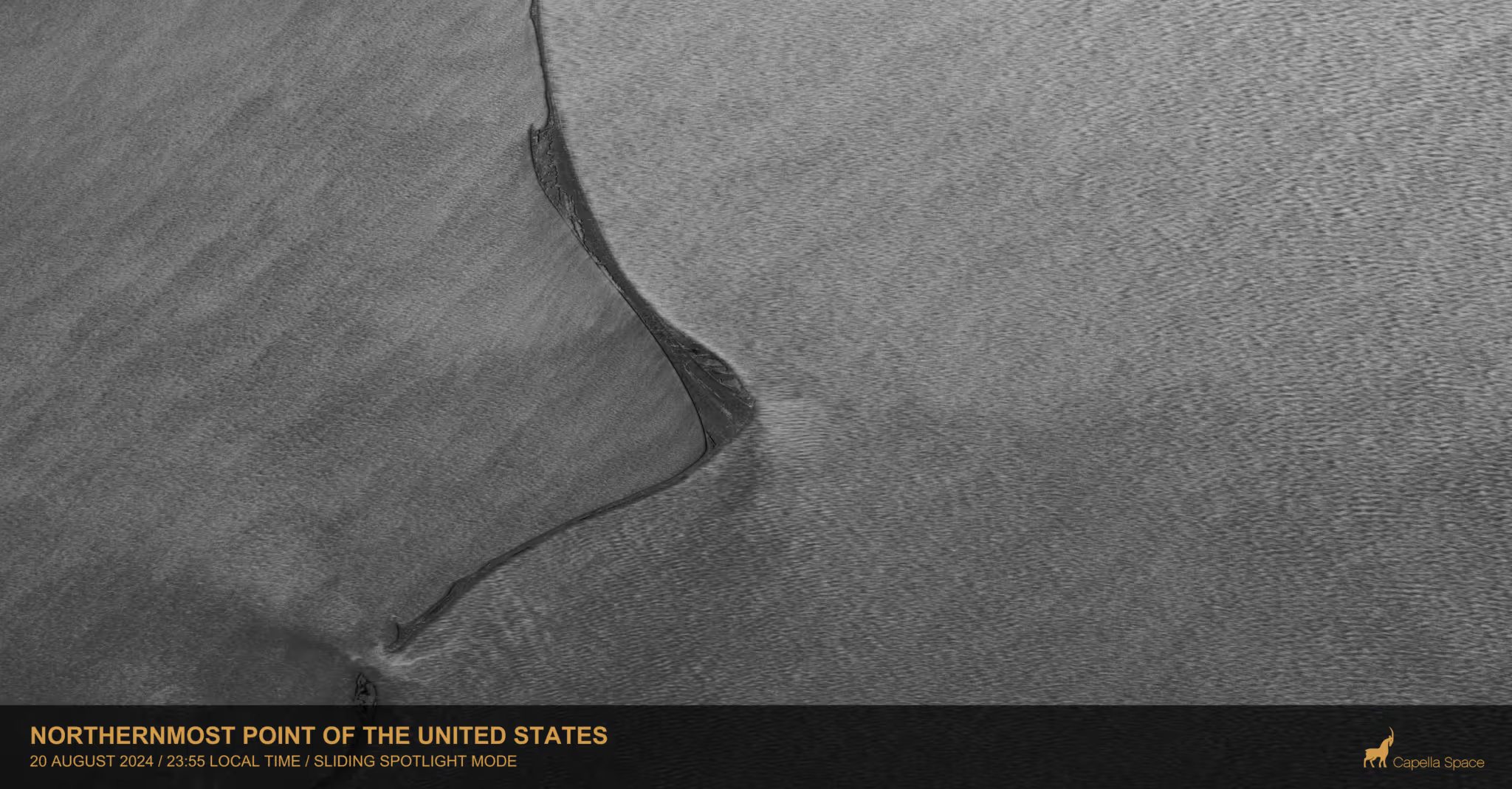
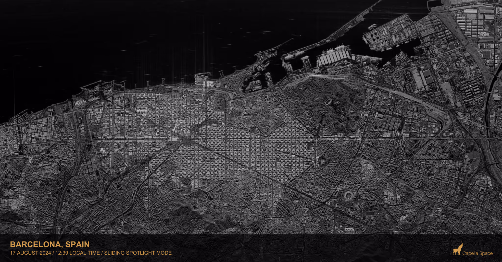
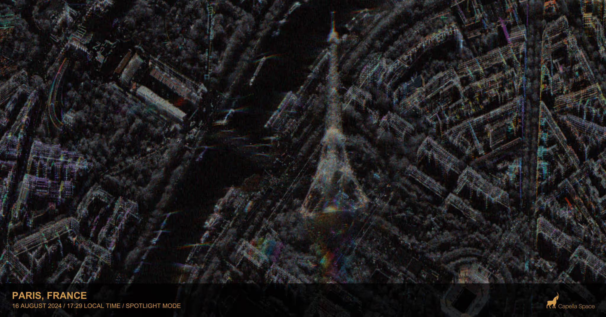
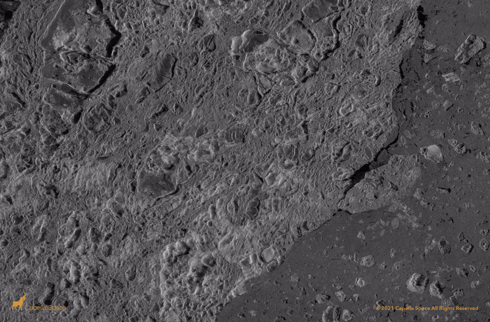
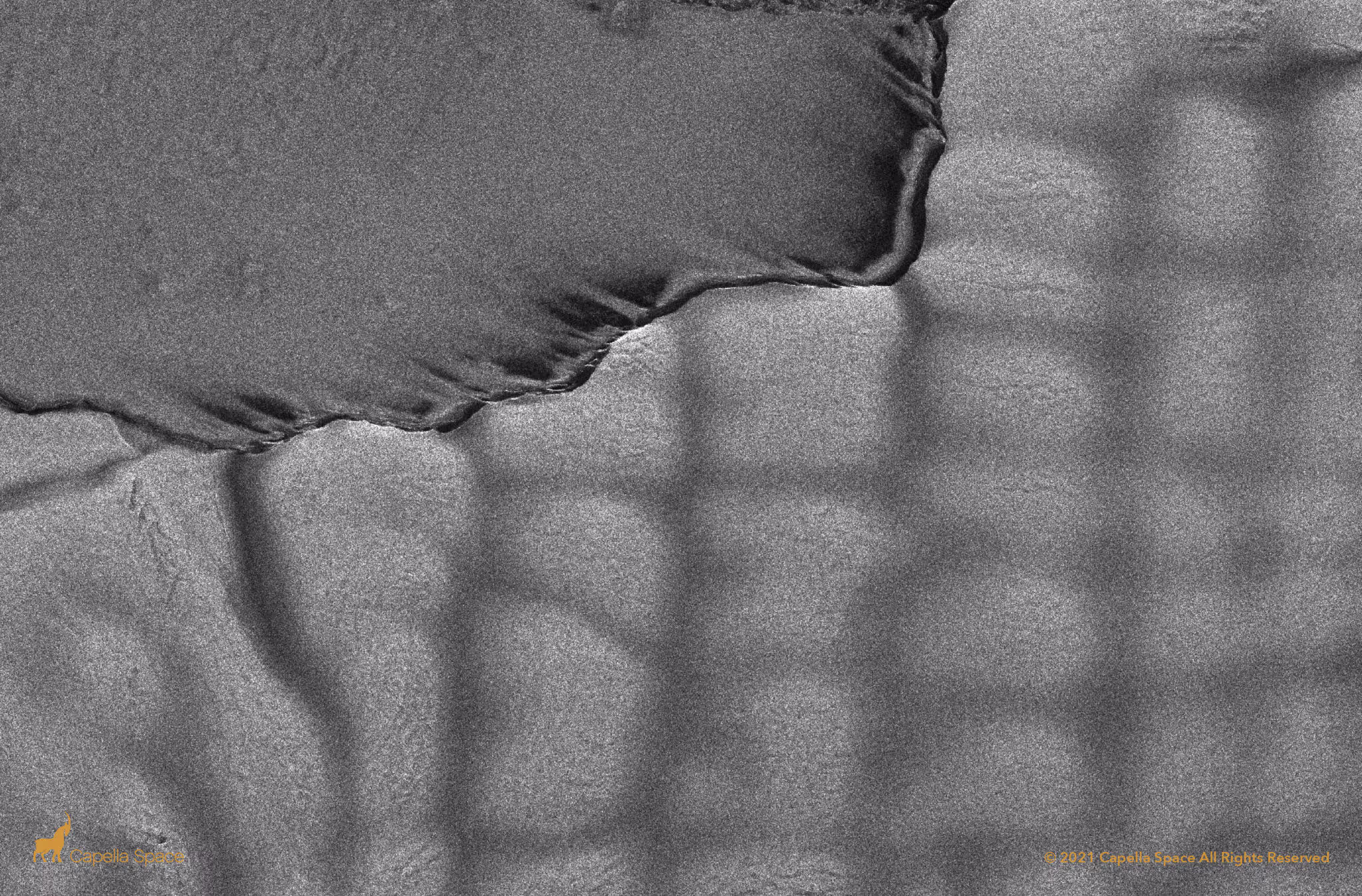
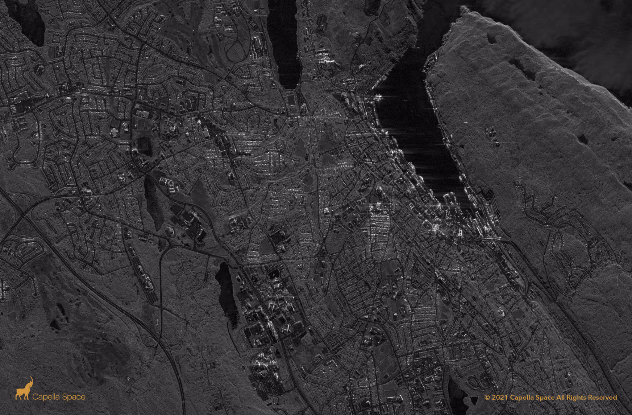
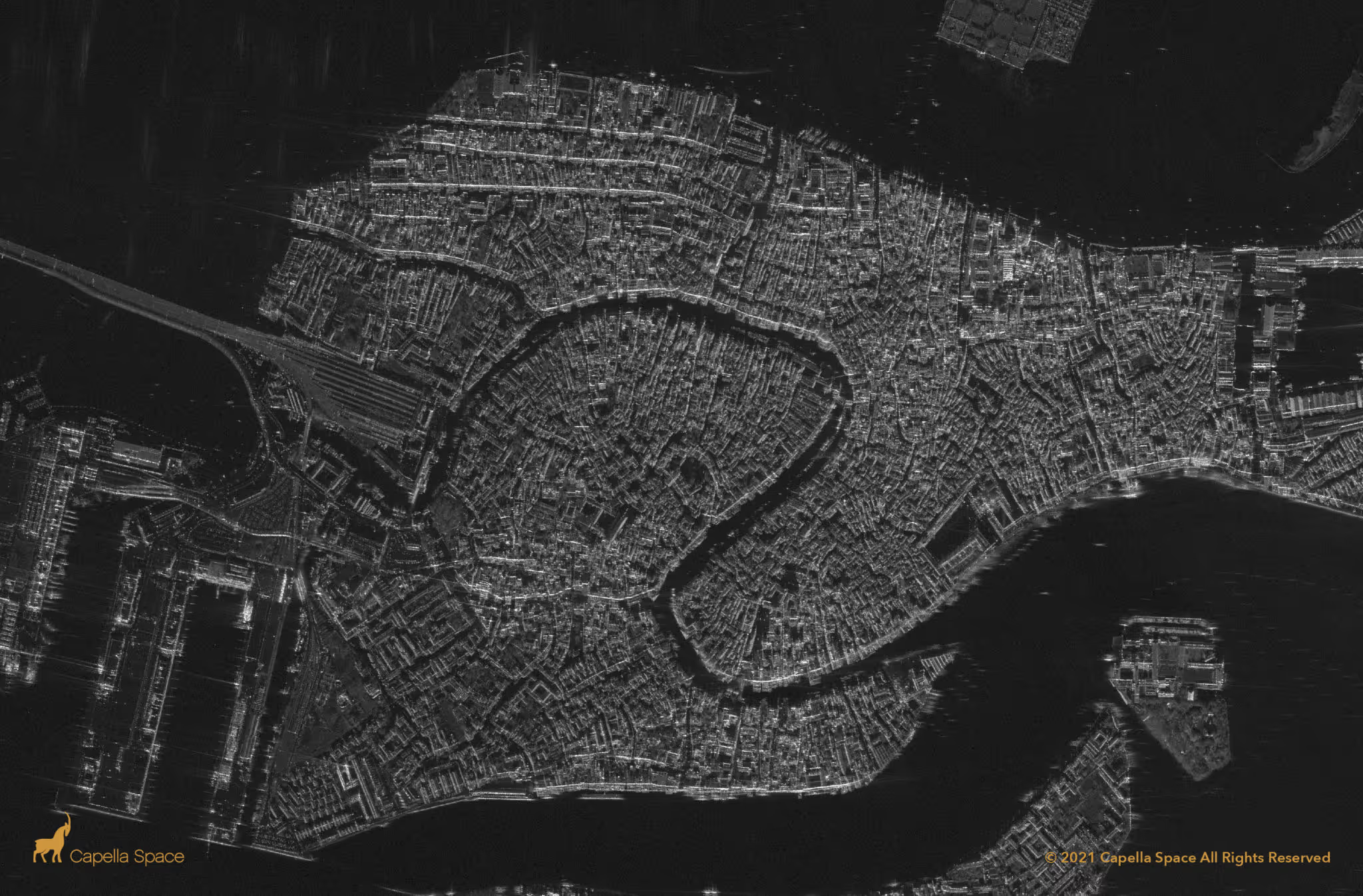
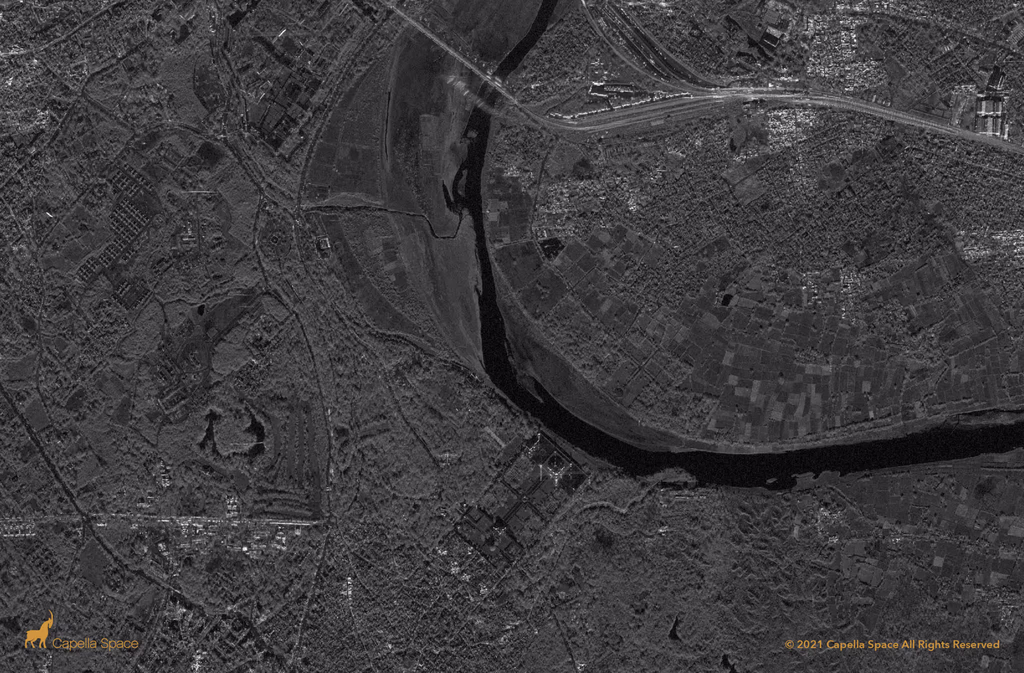
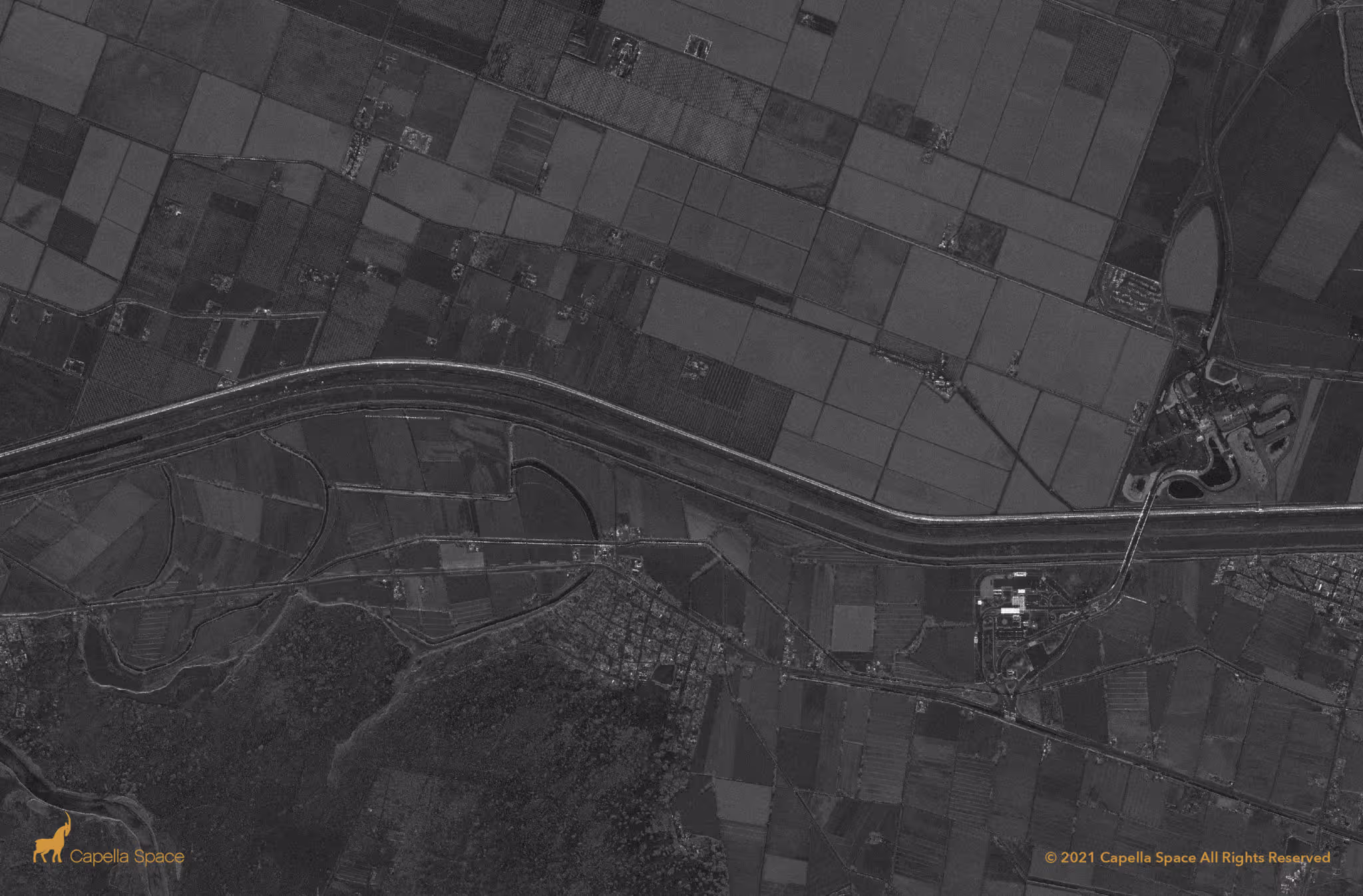
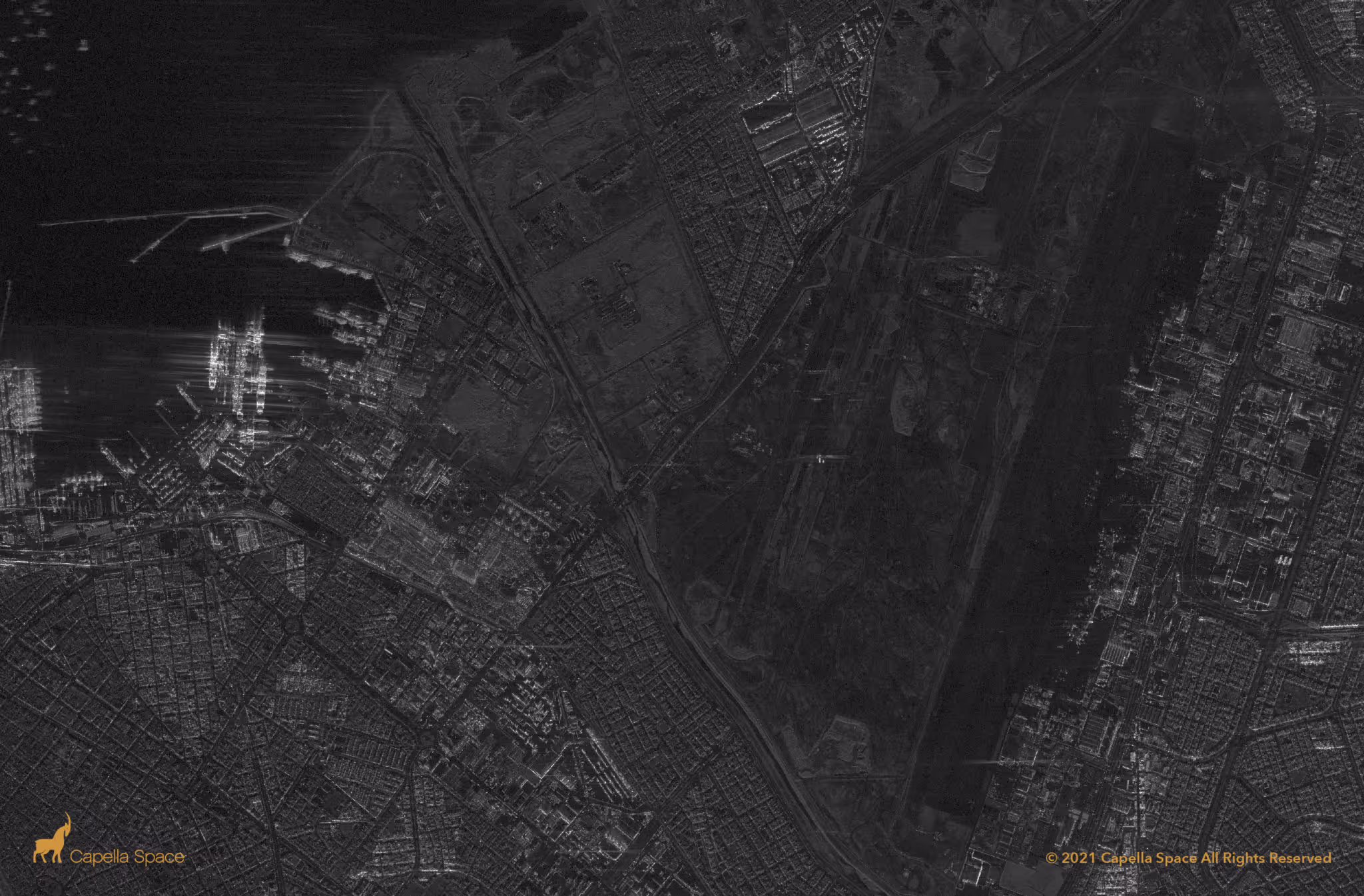
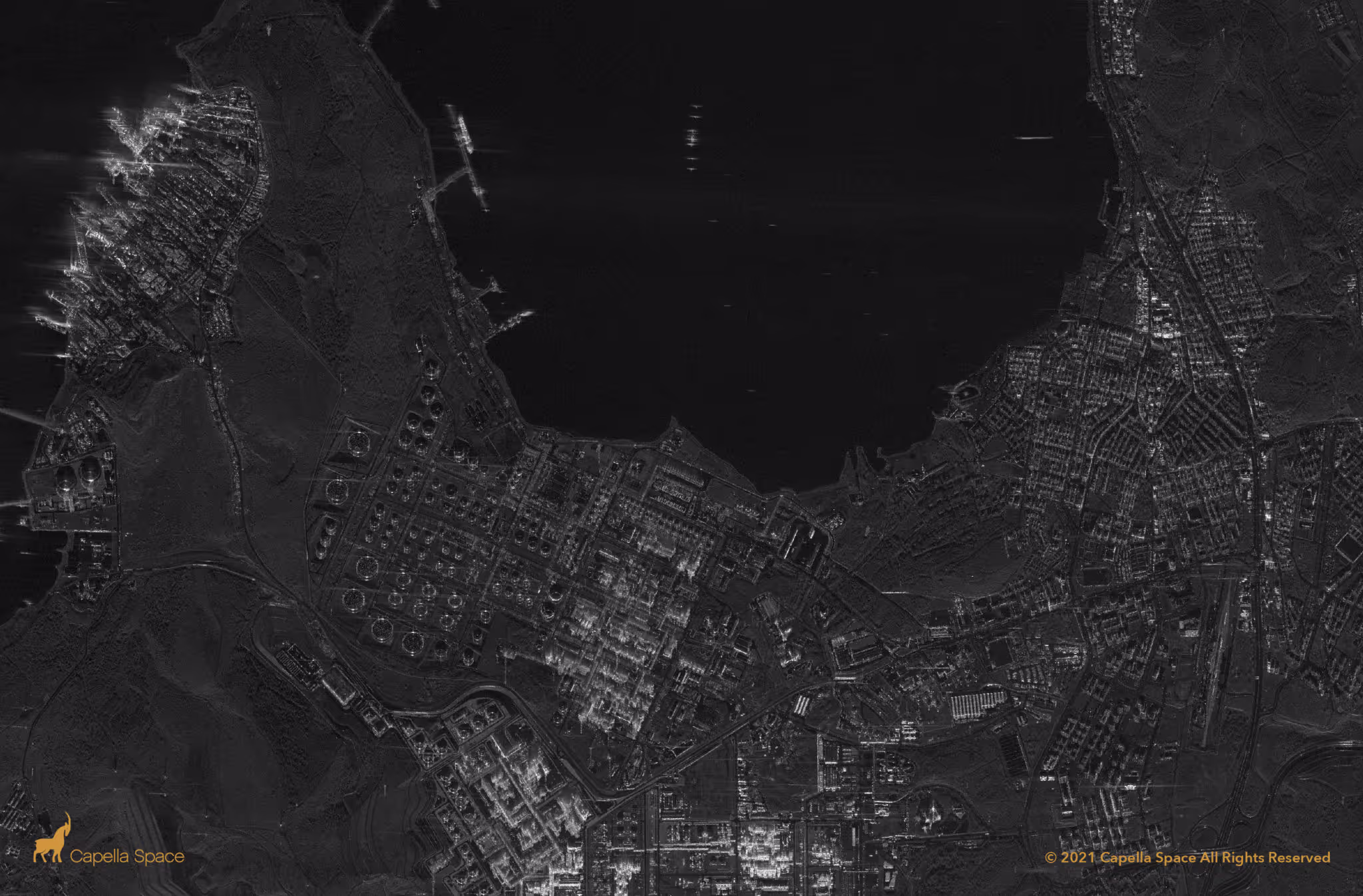
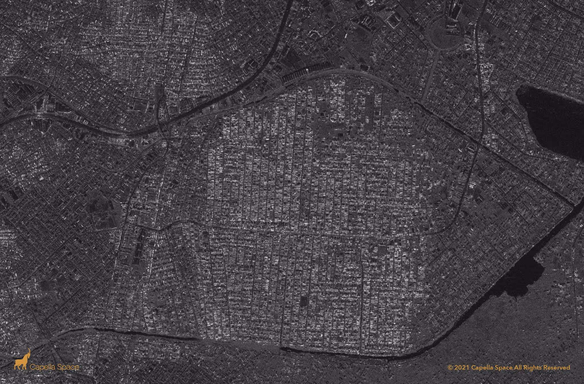
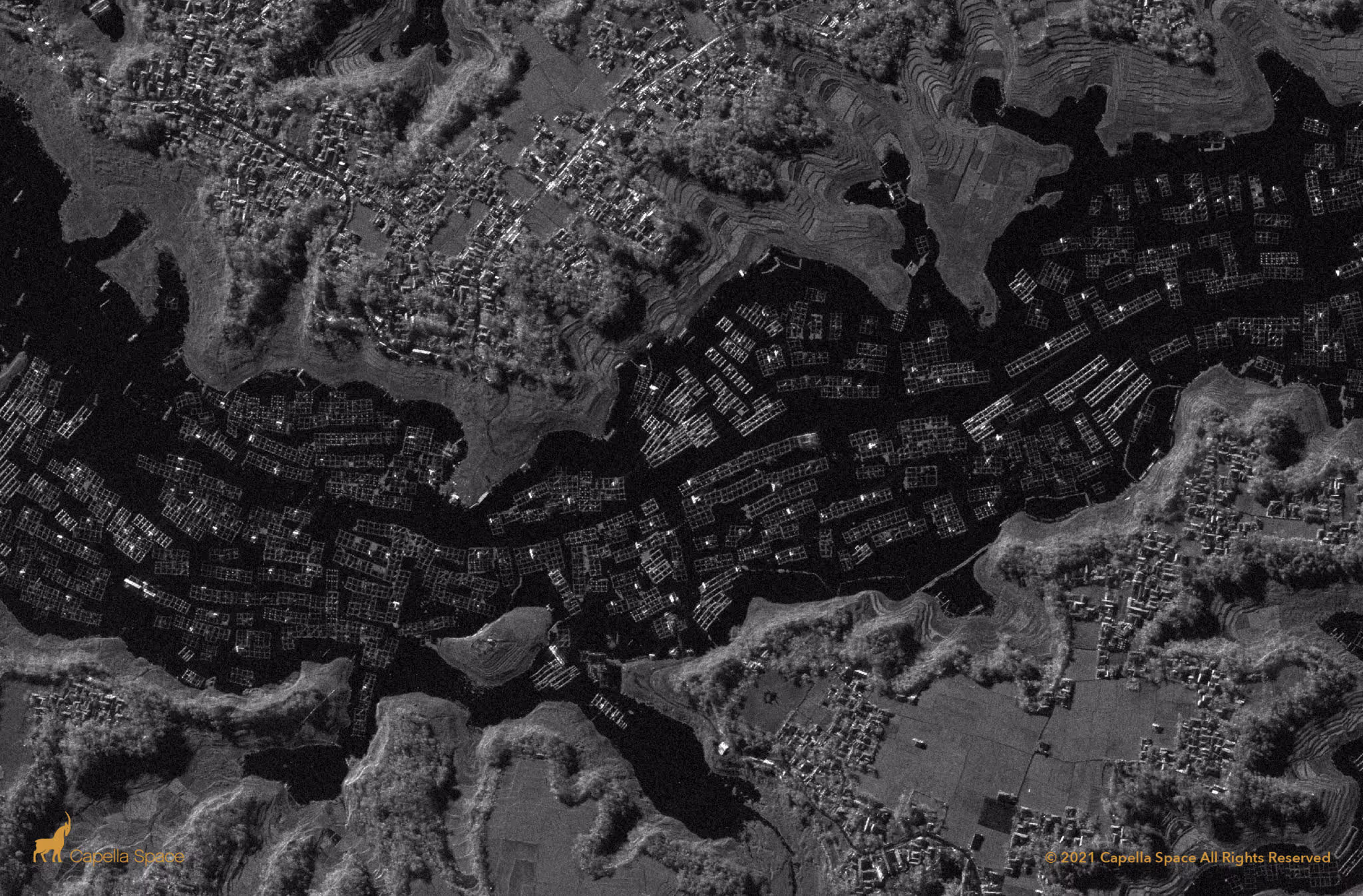
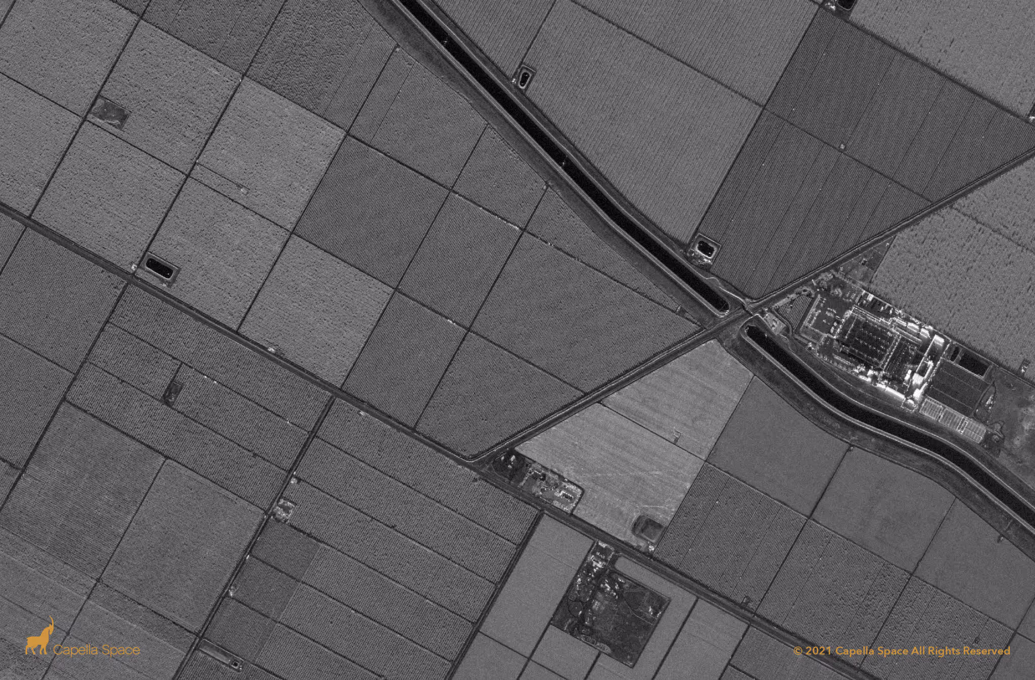
Highly Precise Radar Imaging For All-Weather, 24/7 Intelligence
Capella Collection Types
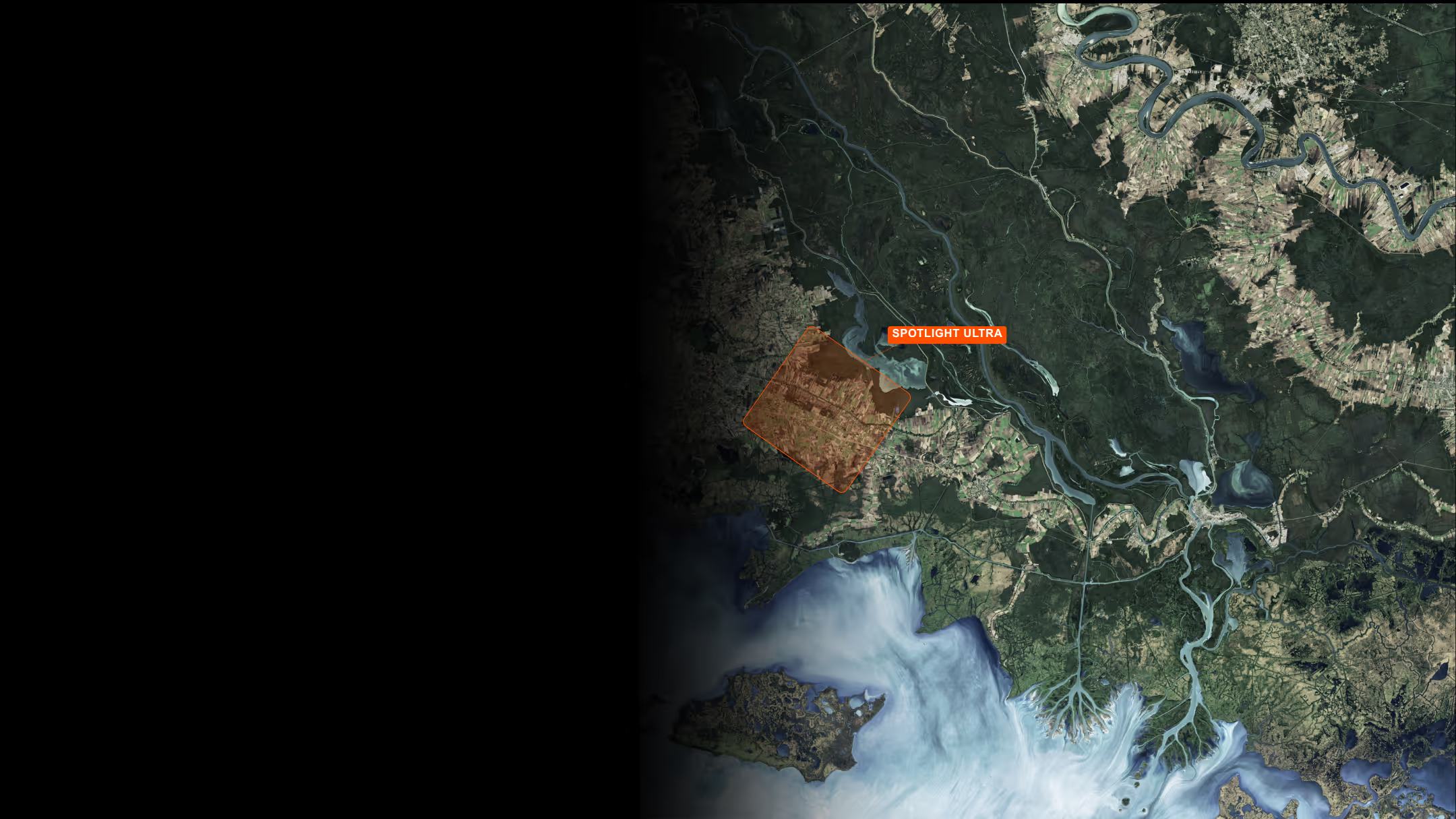
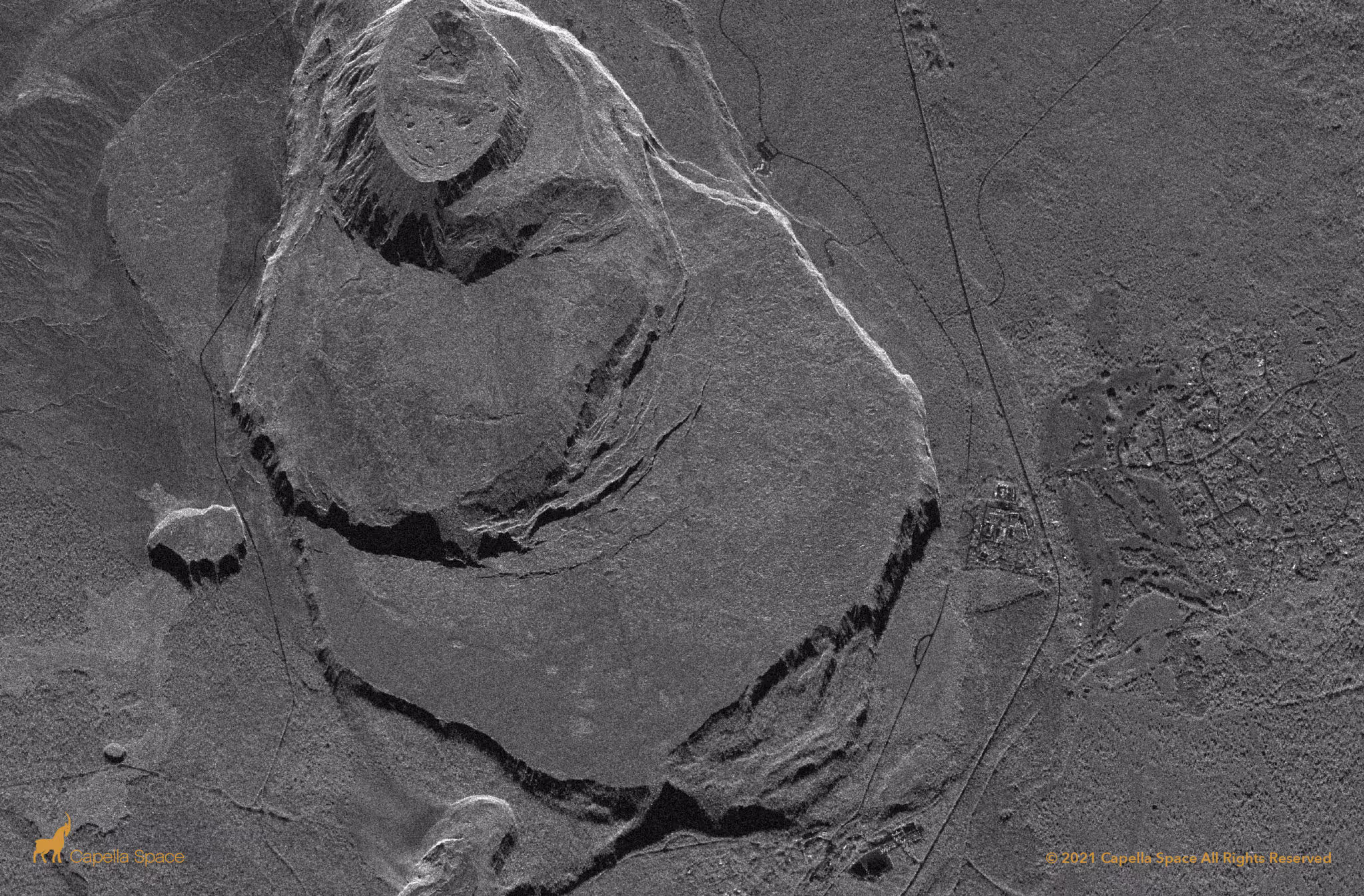
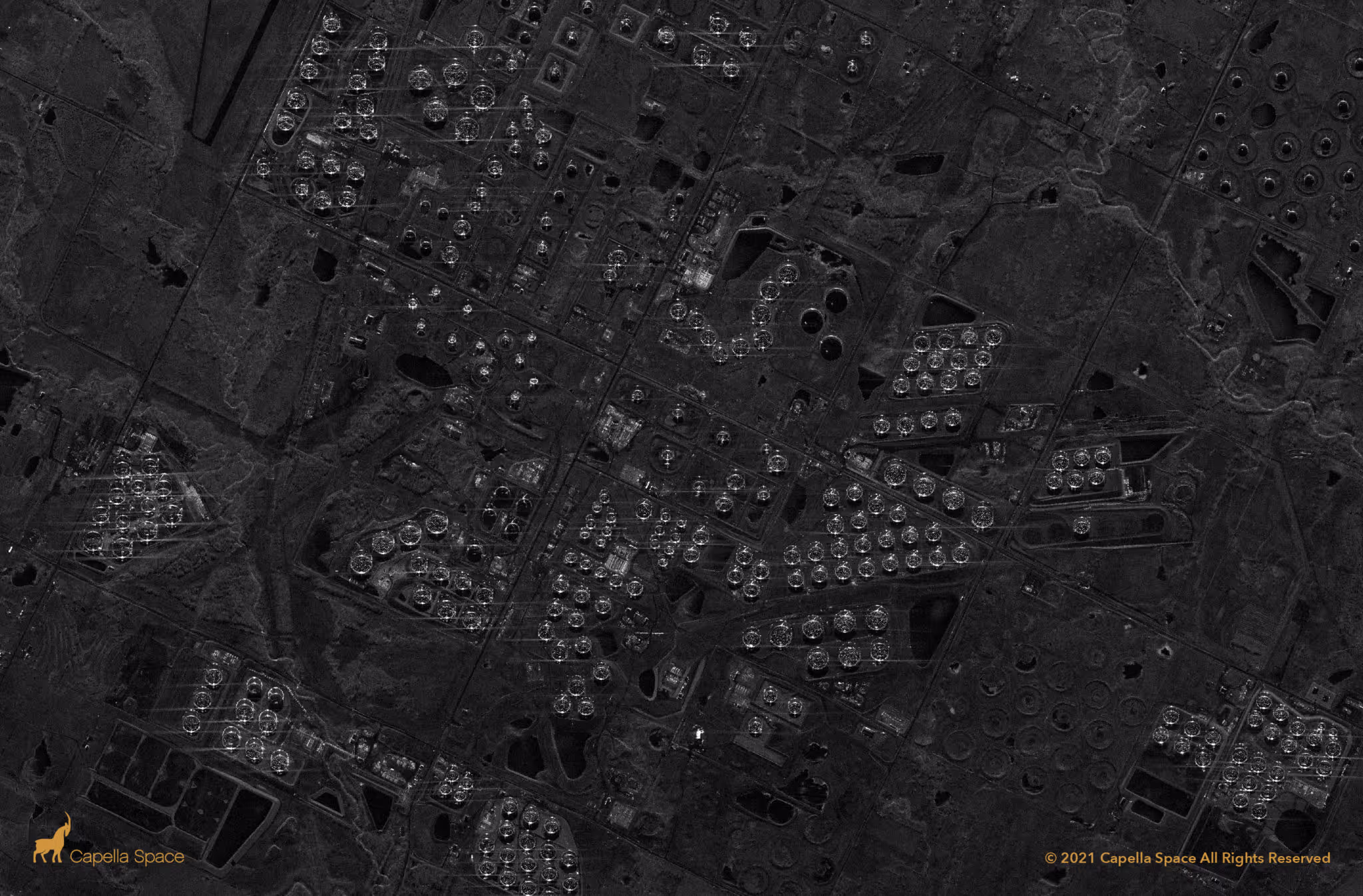
Spotlight Ultra
Leverage 0.25 m azimuth resolution with up to 60-seconds of dwell time to extract fine details like motion and obscured manmade object.
5 km x 5 km
0.25 m
0.25 m
5
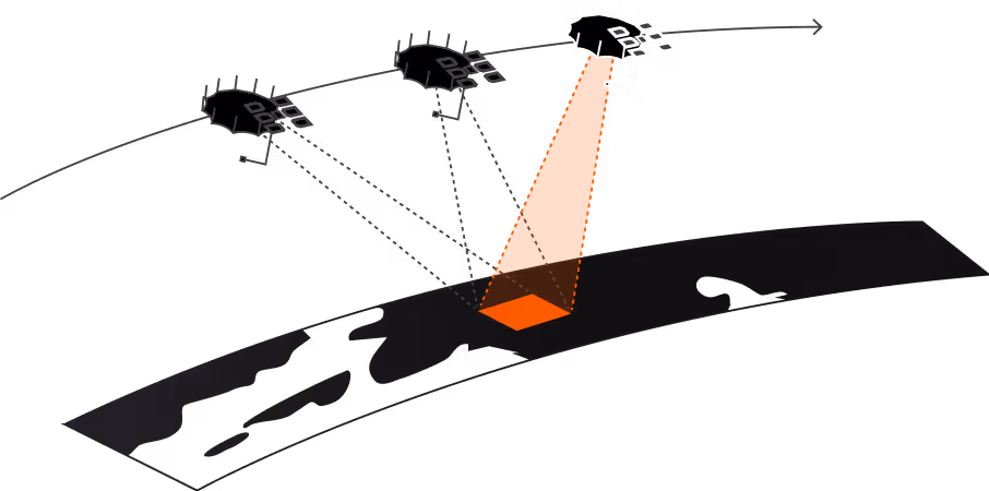
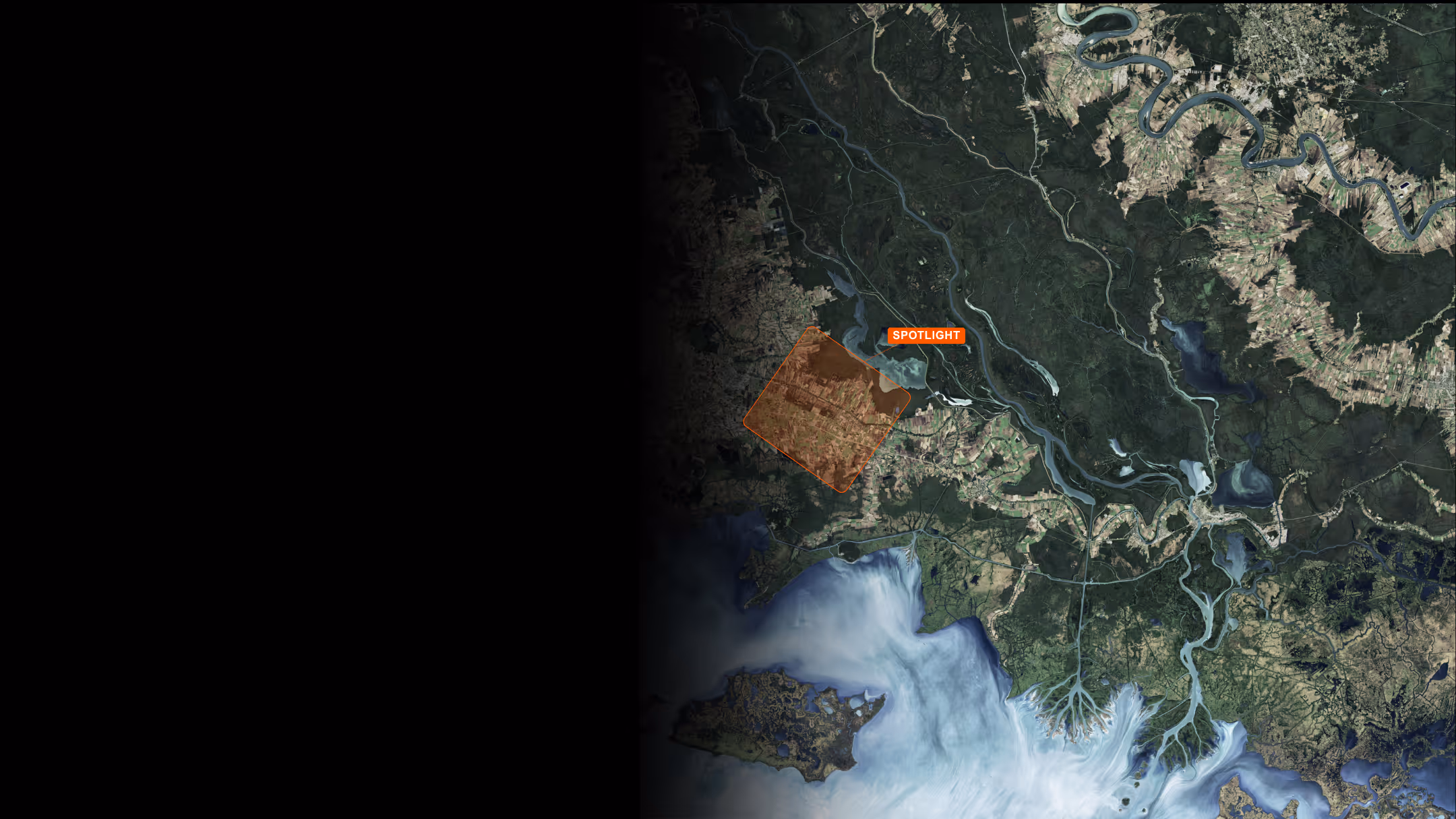
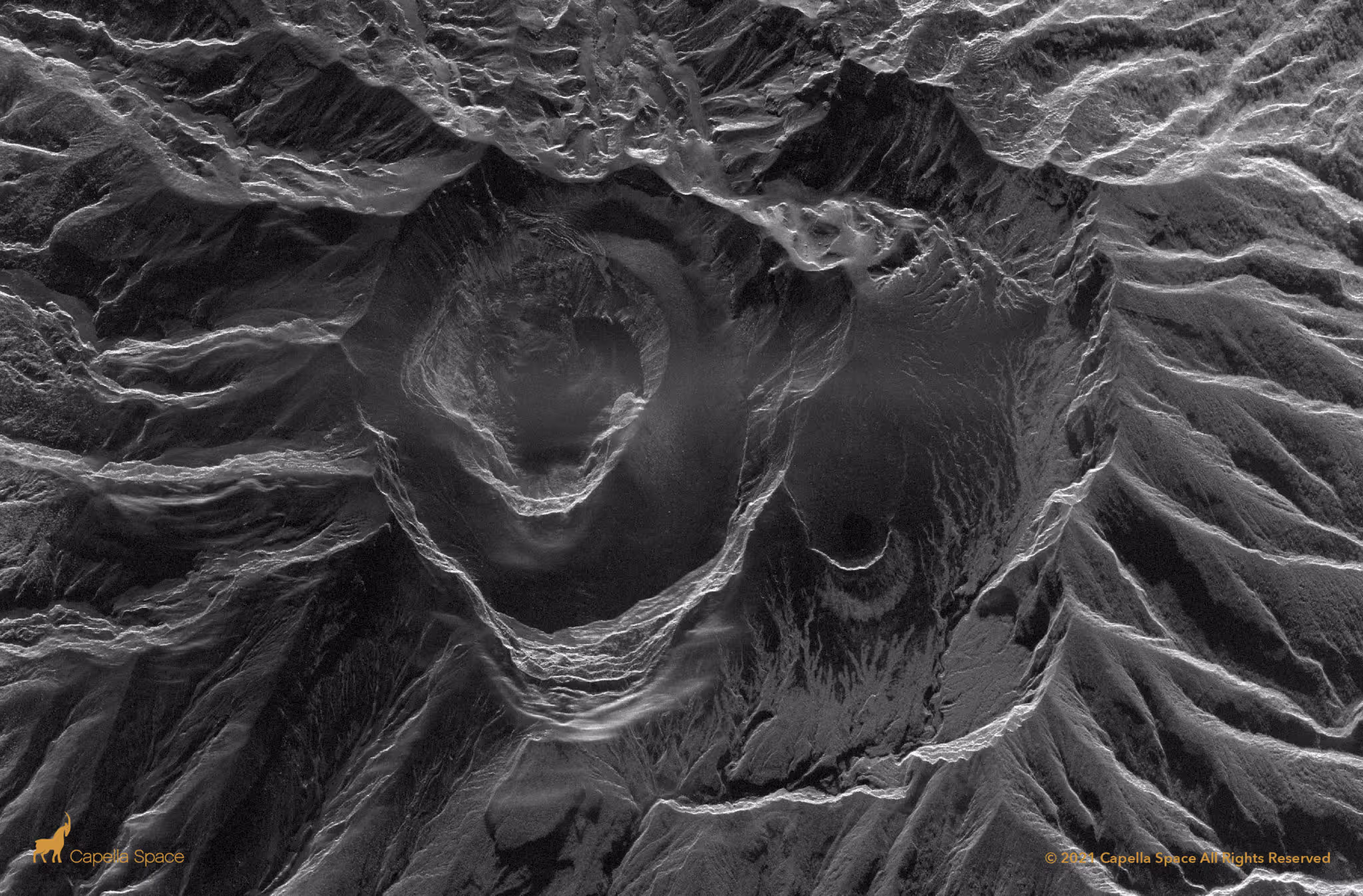
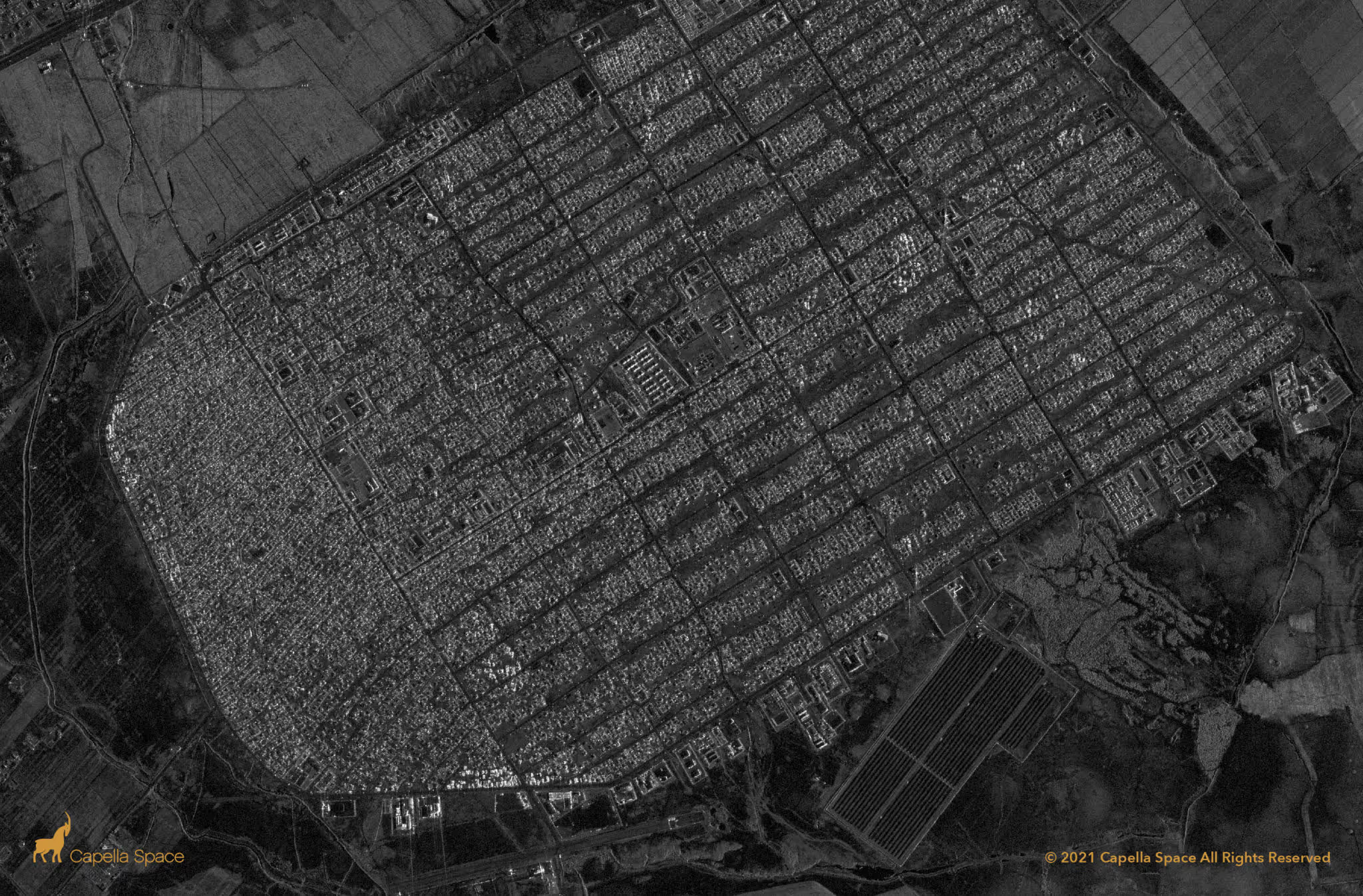
Spotlight
Classify objects, detect change and capture more targets than ever with very high-resolution, high-quality imagery optimized for volume and speed.
5 km x 5 km
0.5 m
0.25 m
3
.avif)
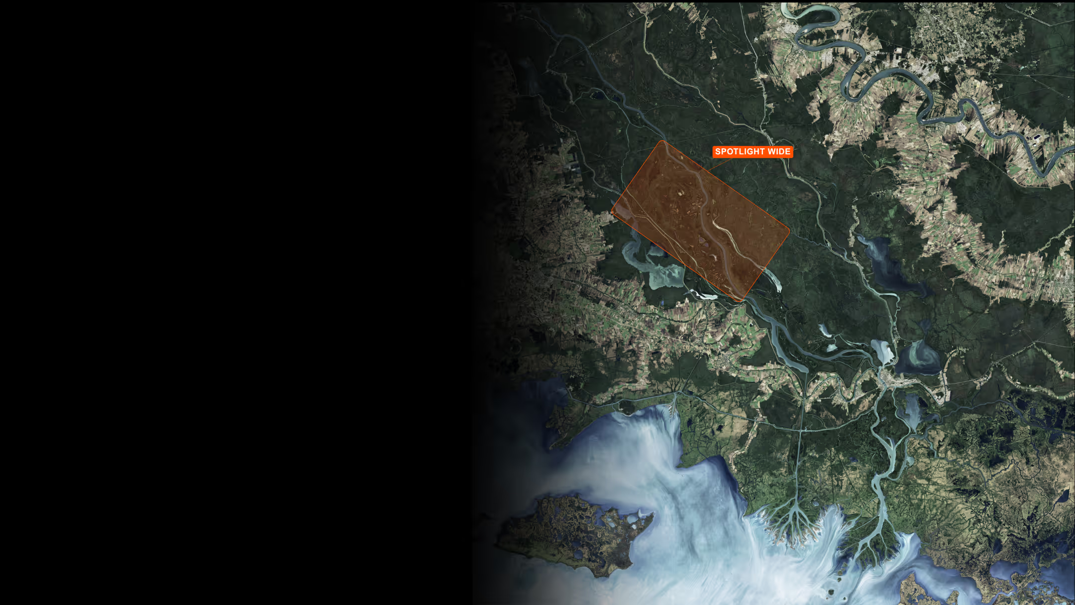
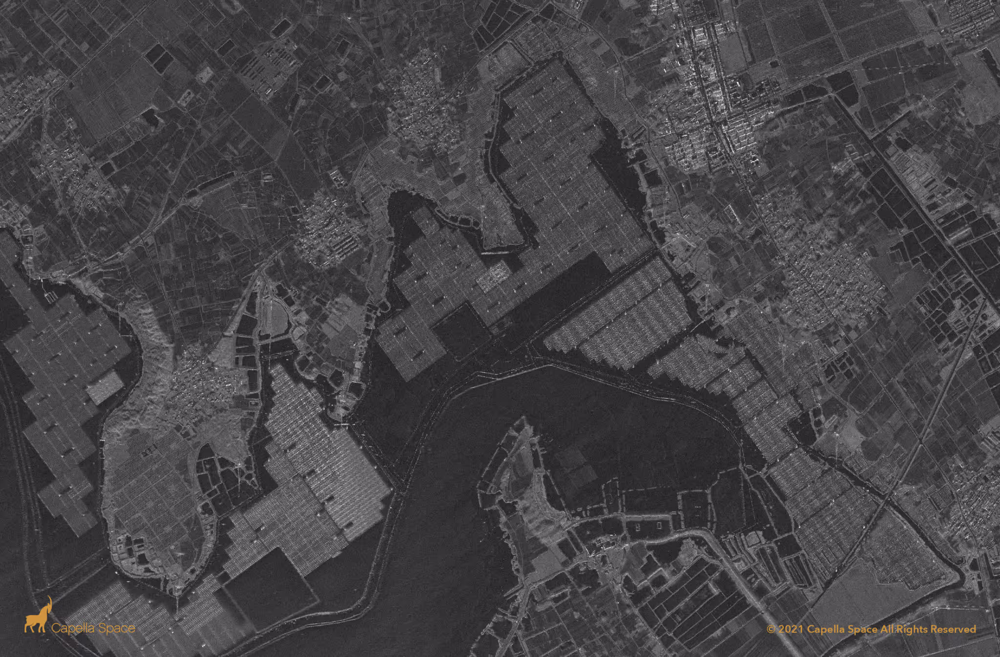
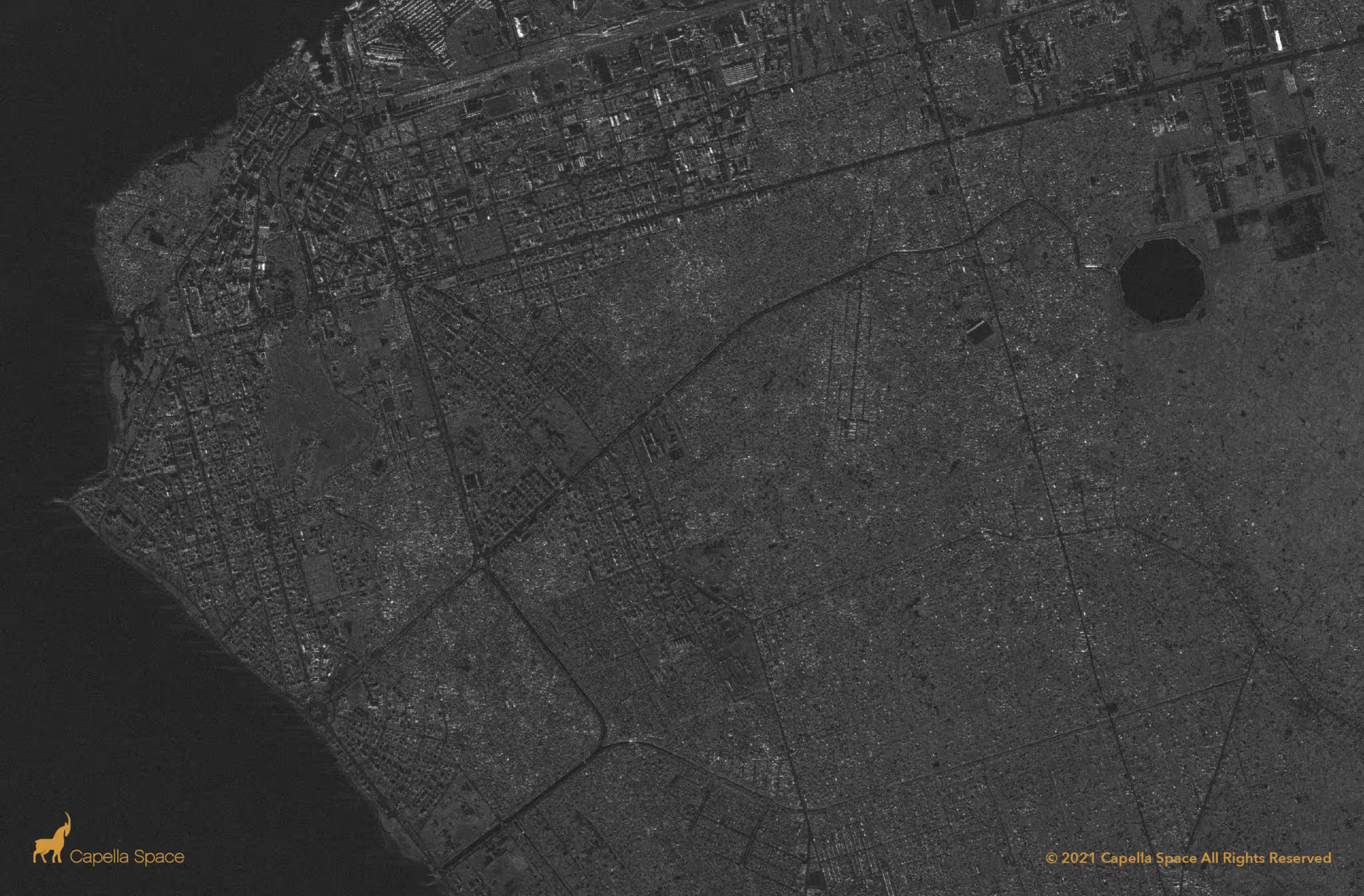
Spotlight Wide
Harness large-area monitoring with Spotlight Wide to track activity, detect anomalies, and monitor dynamic events.
10 km x 20 km
1.0 m
0.5 m
3
.avif)
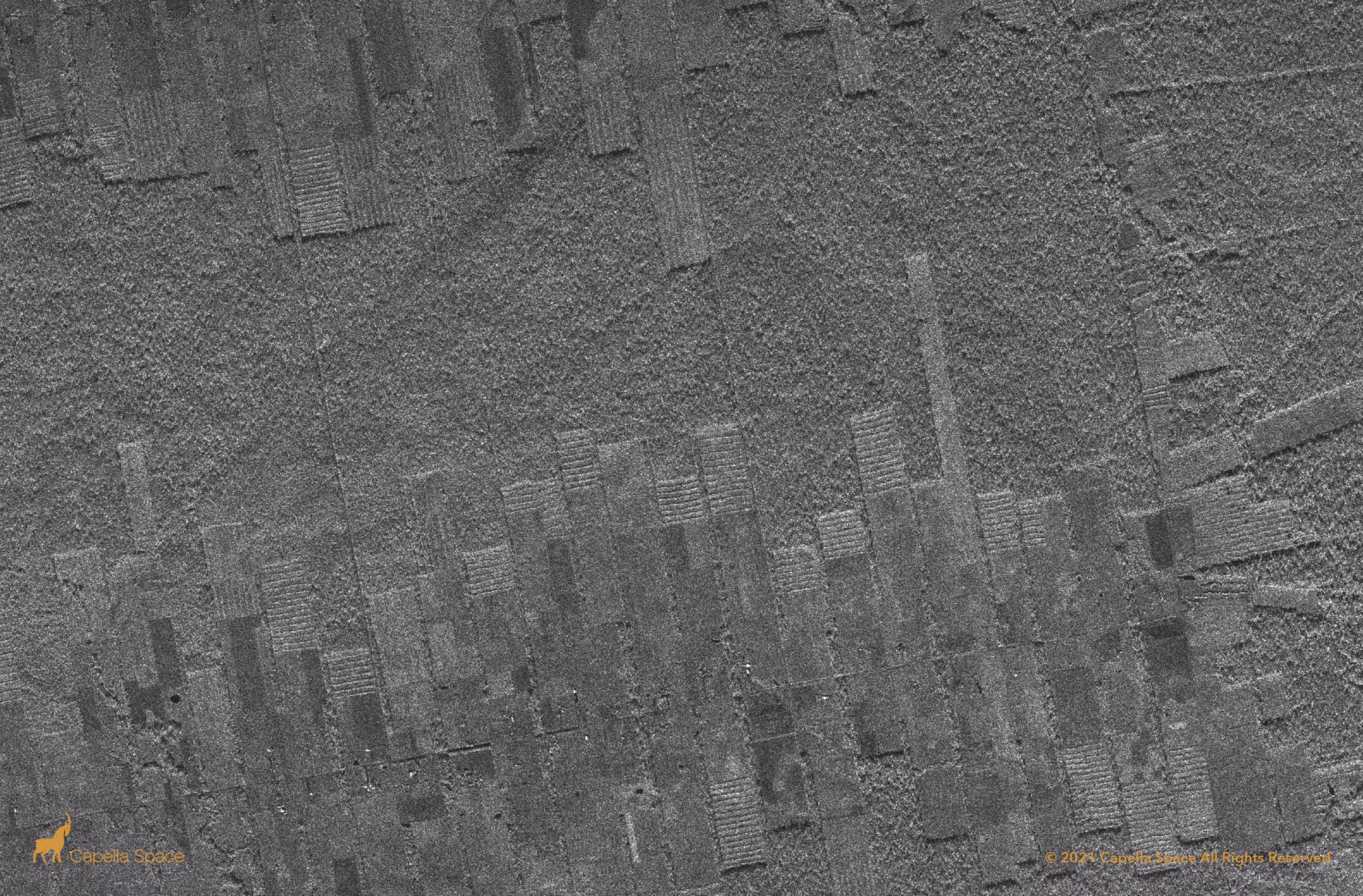
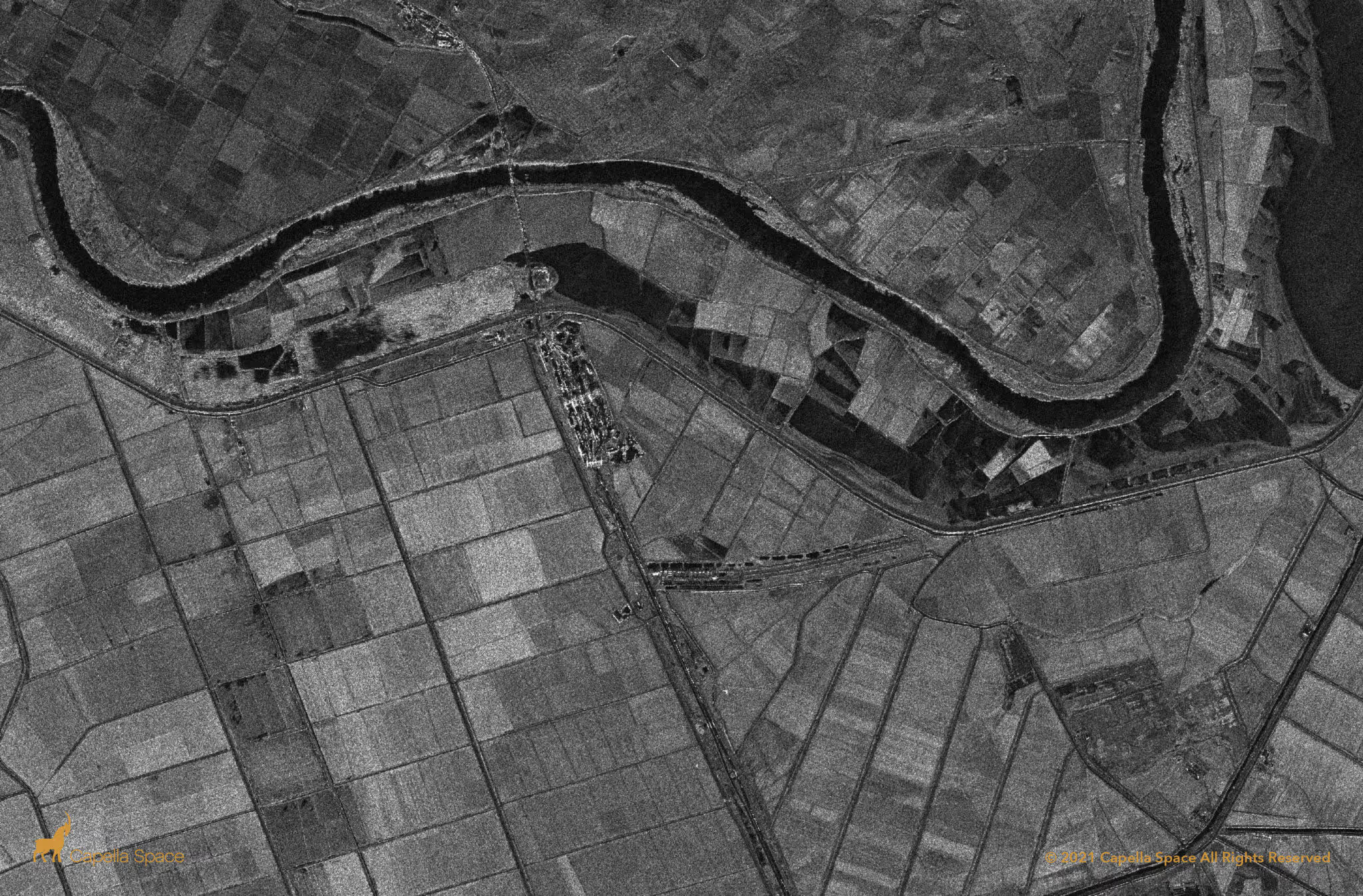
Stripmap
Get the most coverage over your target area of interest for broader land use monitoring and baseline mapping.
5-10 km x 20km - 100 km
1.2 m
0.75 m
1
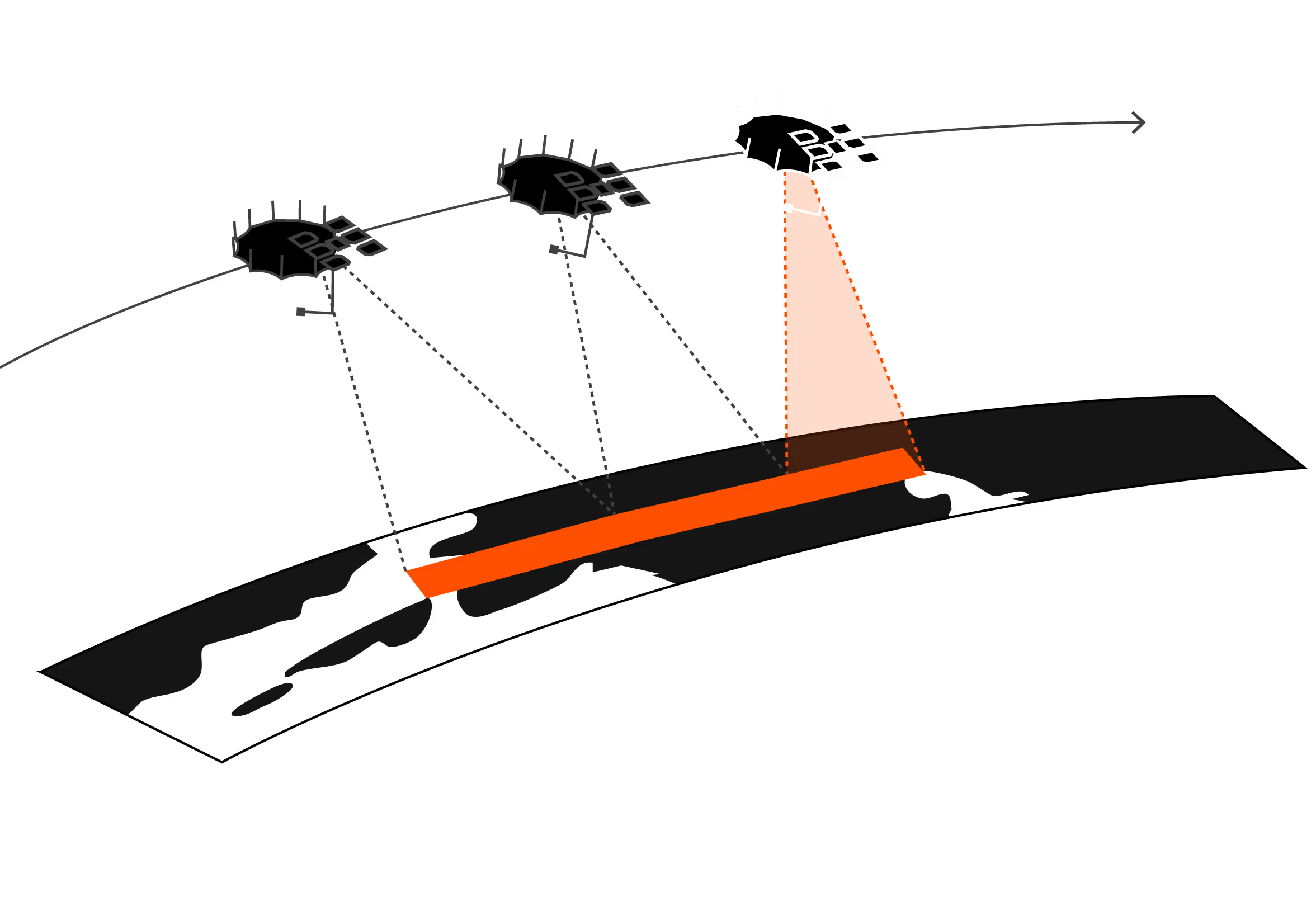

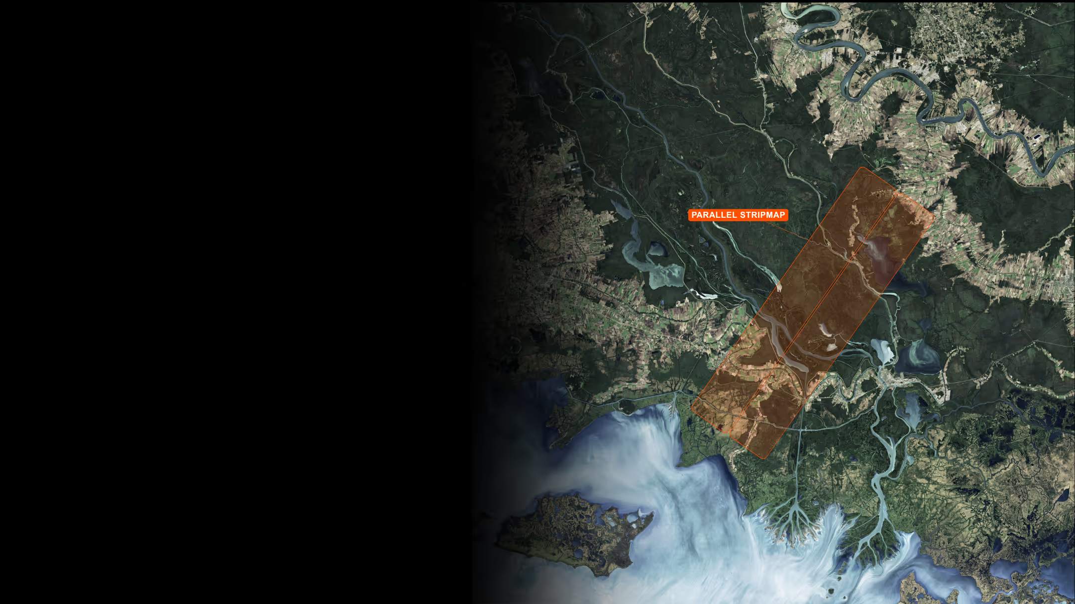
Parallel Stripmap
Get double the coverage by leveraging multiple squinted Stripmaps tasked and imaged in a single pass while retaining high-resolution.
20 km x 20 km - 100 km
1.2 m
0.75 m
1
.avif)

TRULY PERSISTENT monitoring
Actionable Global Insights
Cut through the noise and gain clear signals with Capella’s SAR data capabilities. We provide a range of imagery and data types, resolutions, and coverage to power mission-critical decisions and drive results.
Available in detected (SIDD, GEO, GEC, CSI) and complex (SICD, SLC, CPHD) data formats
Market-leading Noise Equivalent Sigma Zero (NESZ)
Easily integrated into common geospatial software applications
BENEFITS OF CAPELLA SAR
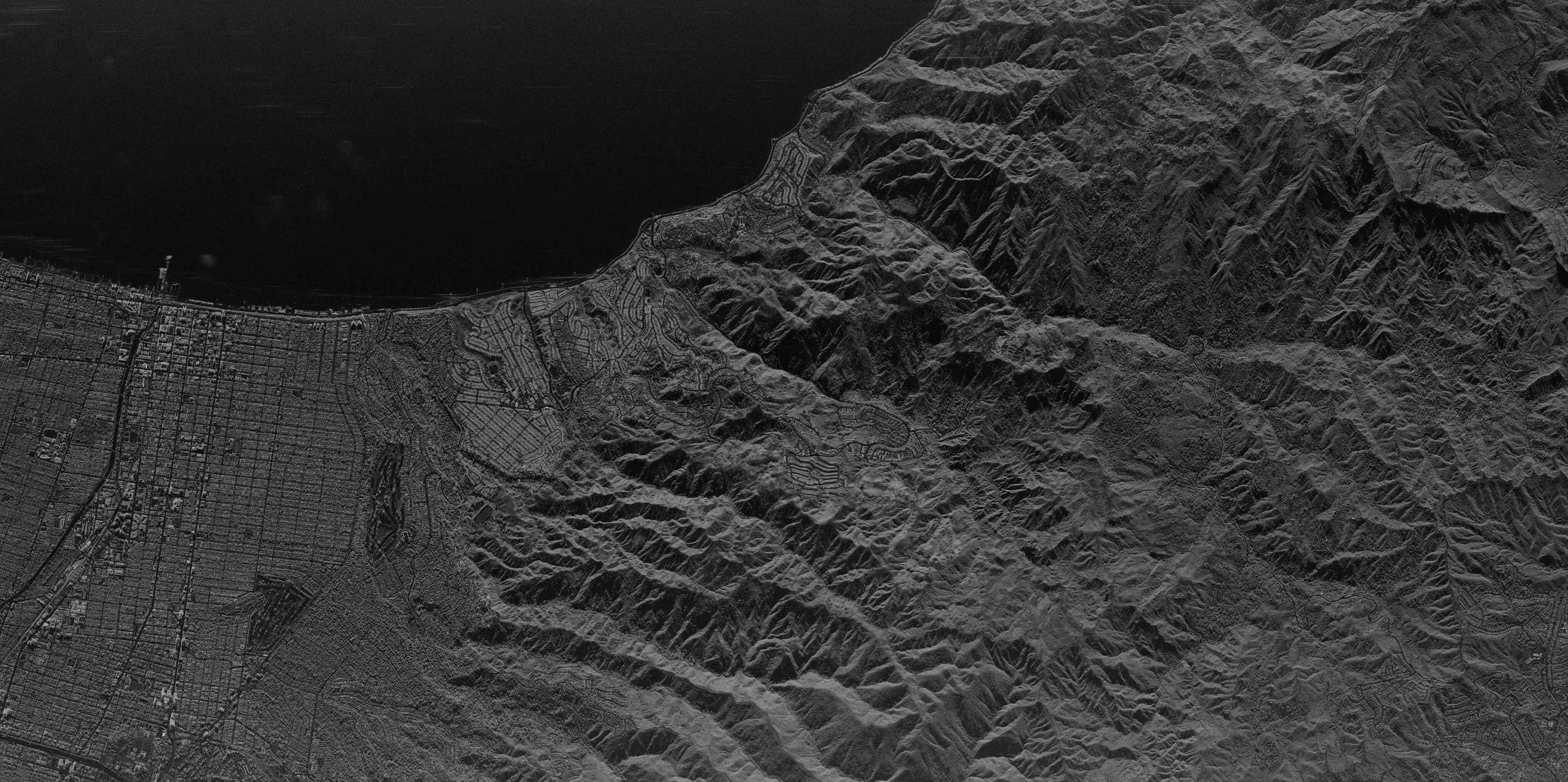
High-Precision Radar Imaging For All-Weather, 24/7 Intelligence
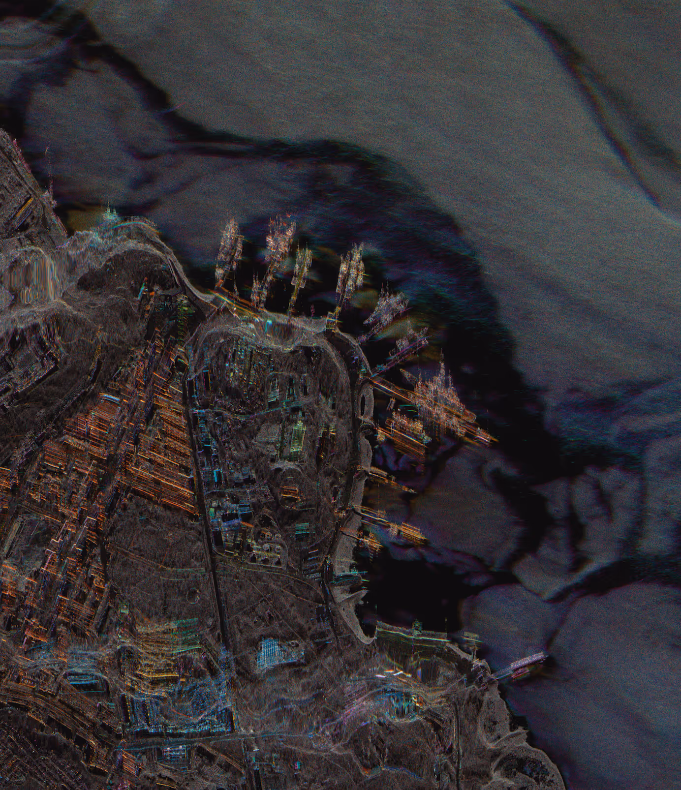
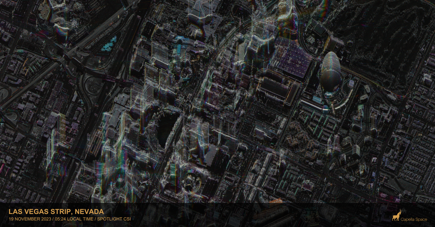
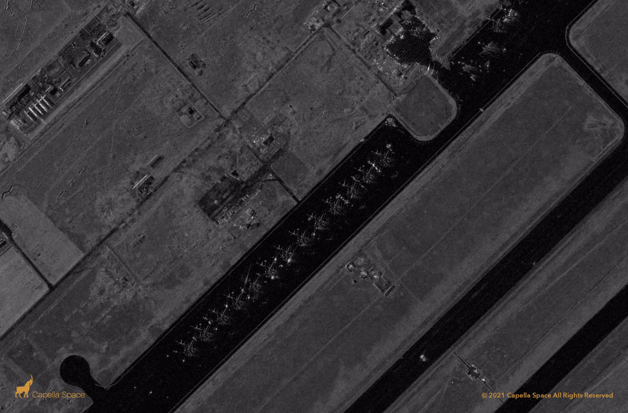
Advanced & Actionable SAR Imagery
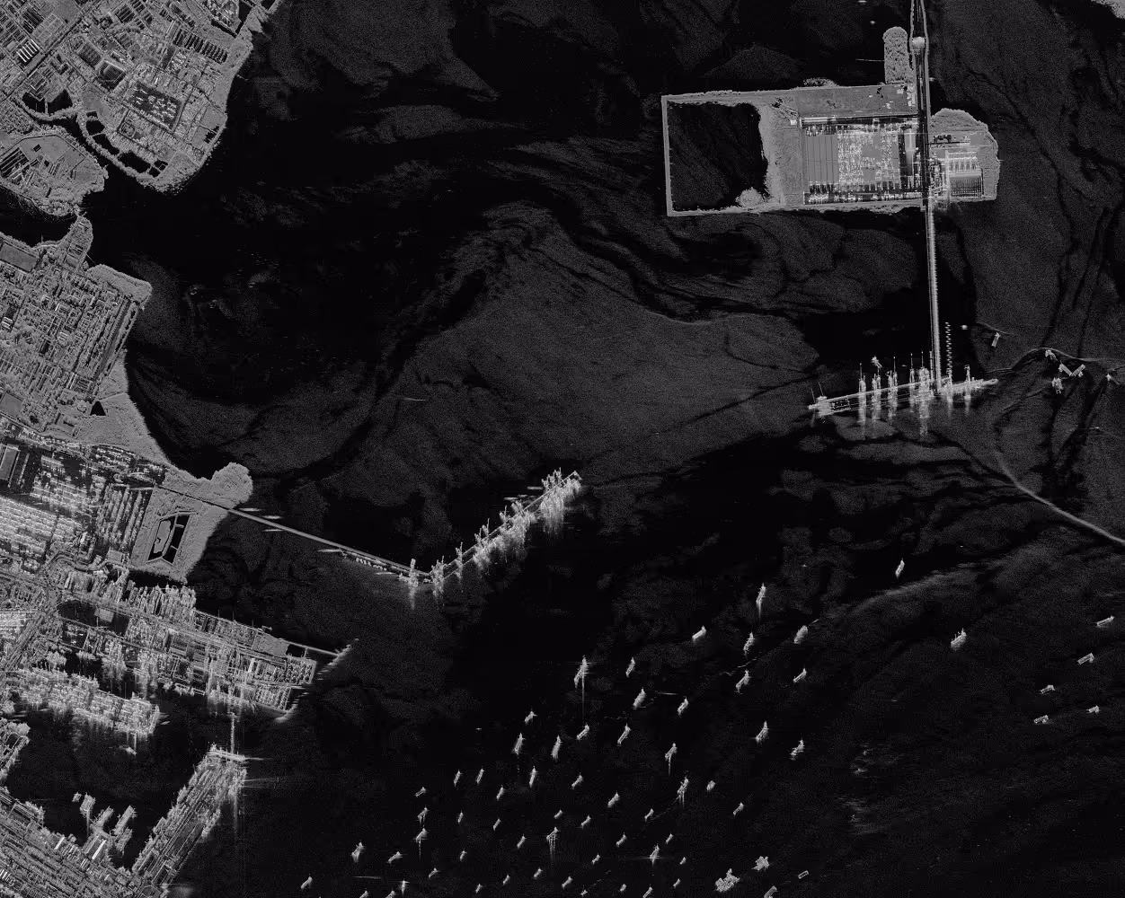
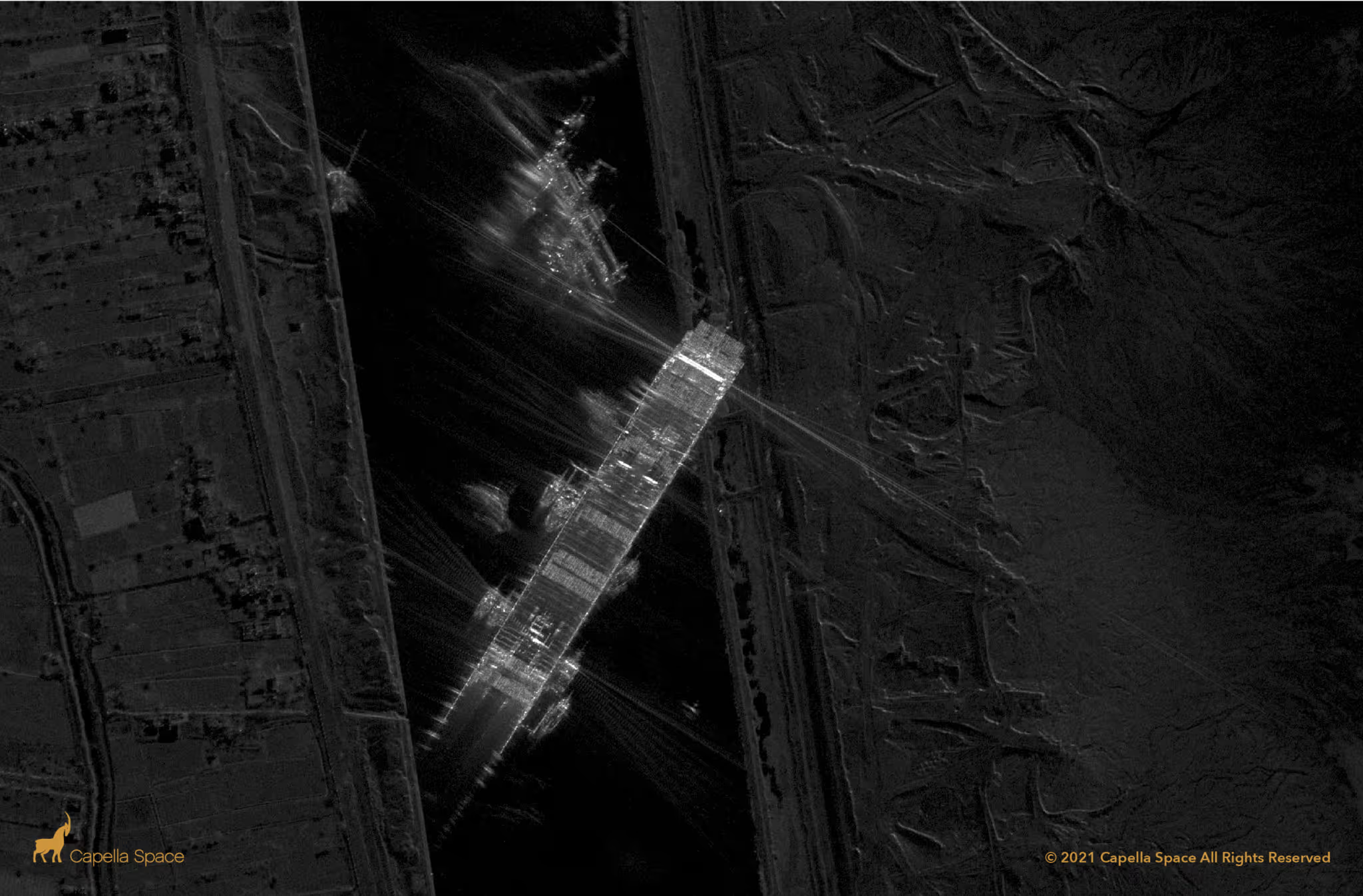
Vessel classification and Colorized Sub-aperture Imaging (CSI) provides precise vessel classification and object movement in vivid color.
- Automate detection and classification across maritime and terrestrial environments
- Reveal what others can't: CSI can reveal objects, day or night, through any weather
Multi-Orbit Global Coverage
Our constellation combines a variety of mid-inclination (MIO) and sun-synchronous (SSO) orbit satellites that expand collection opportunities and enable broader area coverage across regions.

Security & Trust
Capella is built for the most demanding operational environments, with security and compliance across the entire data chain. End-to-end encrypted tasking and delivery, continuous threat monitoring, and alignment to U.S. NIST 800-171 requirements.
Automated Delivery to Your Systems
Cloud-native fully automated tasking, queuing, uplink, and downlink for fast, hands-off intelligence collection. Access, analyze, and integrate Capella data with our cloud-based web console or flexible API
.avif)
INDUSTRIES
Mission-Ready Intelligence
Capella's reliable SAR data supports decisions across missions, industries, and environments.
.avif)
.avif)
Defense & Intelligence
Secure, persistent SAR imagery commercially-built for intelligence and national security missions.
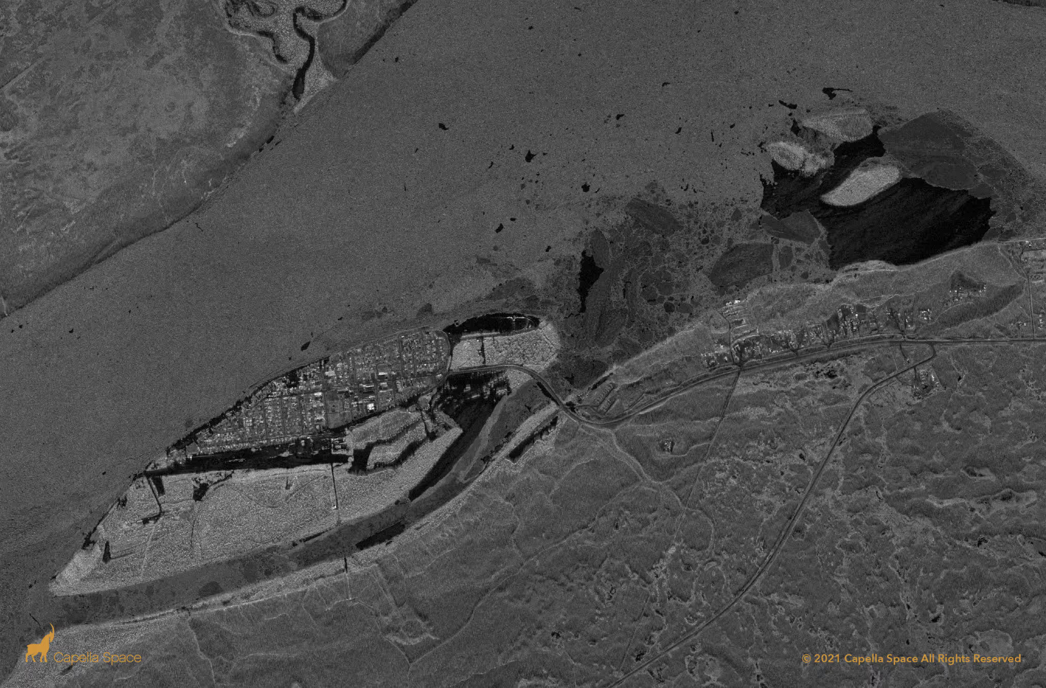
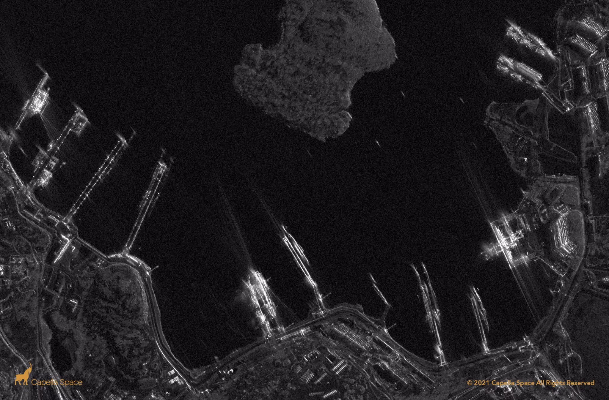
Maritime Awareness
Automate detection and classification across ports, shipping lanes, and exclusive economic zones.
Disaster Response
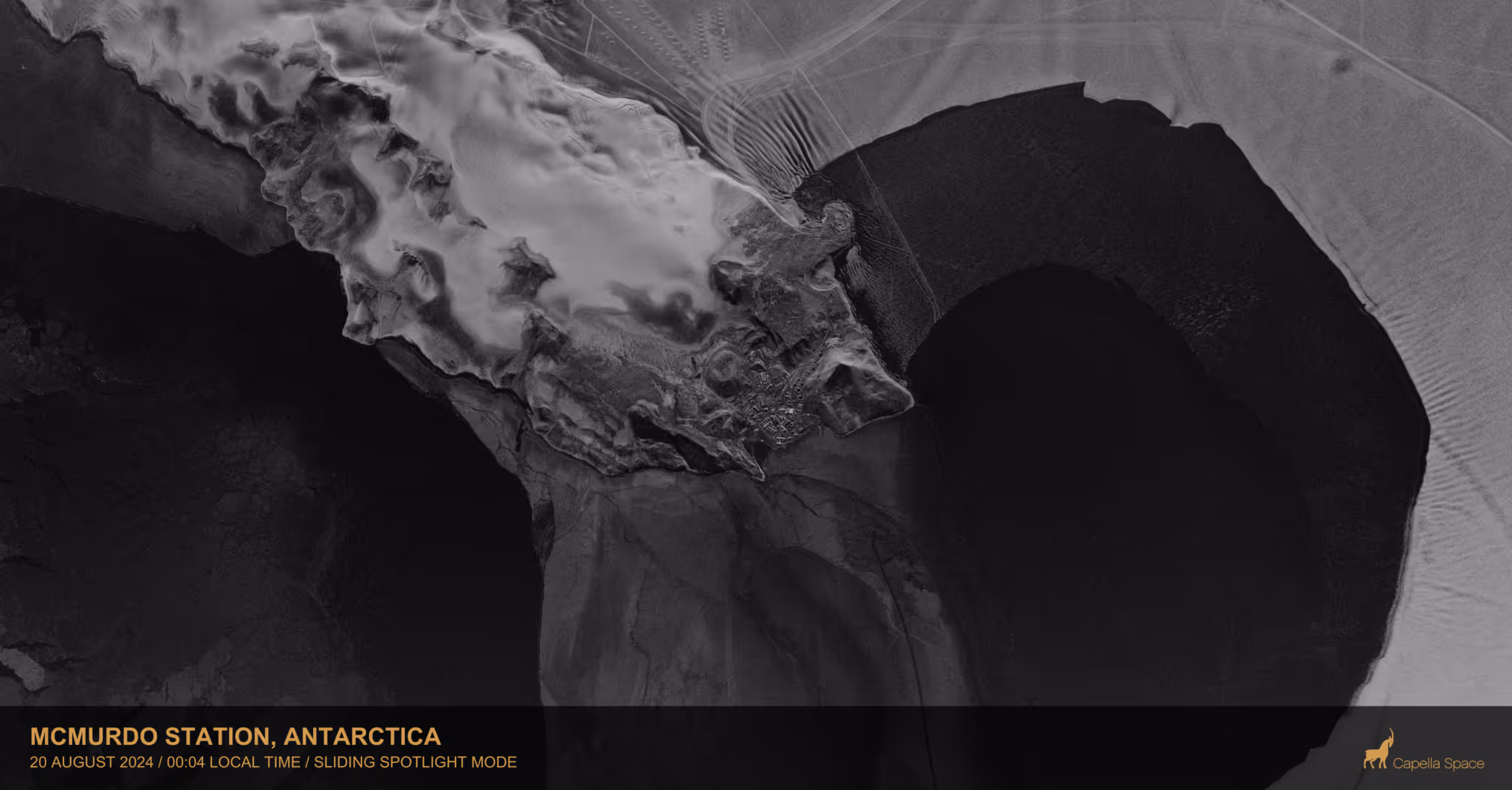
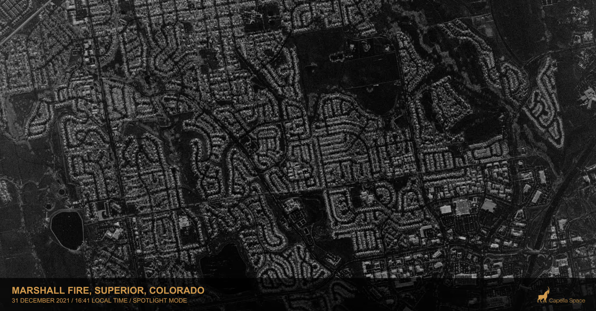
SAR delivers life-saving intelligence through clouds, smoke, dust, ash, storms, debris, haze, and darkness—cutting through obstructions to support decisions in high-risk missions.
Infrastructure & Asset Monitoring
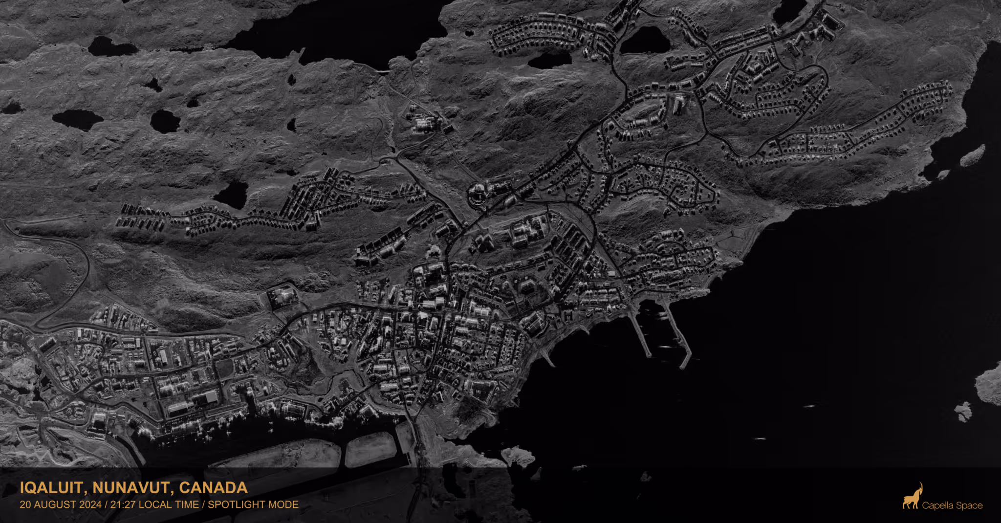
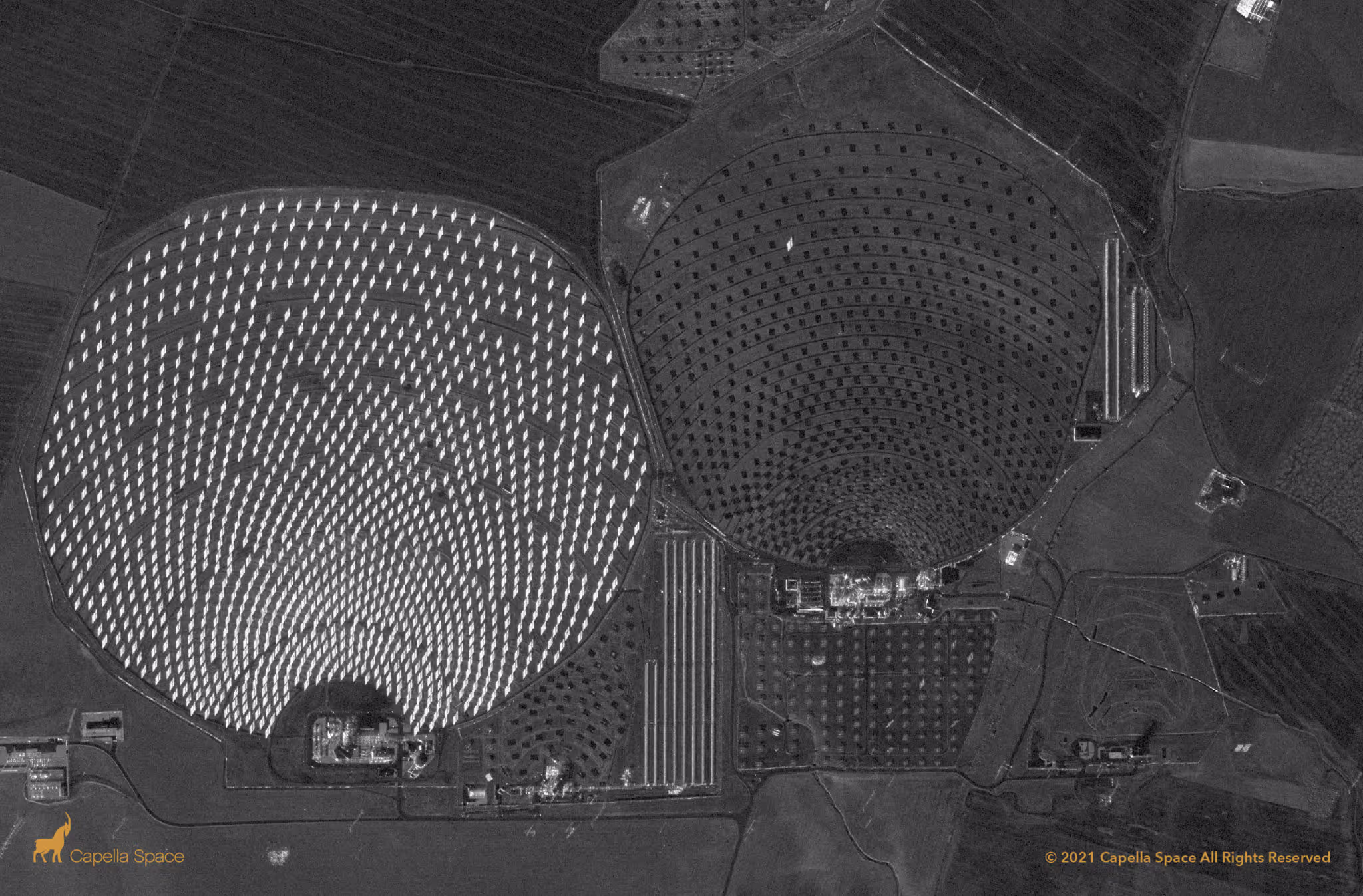
Monitor infrastructure and environmental change with persistent, all-weather SAR intelligence—detecting deformation, tracking climate impact, and enabling early, data-driven intervention.
Open Data Program
Join a community of researchers, data scientists, and software engineers globally uncovering novel use cases for SAR data and transforming how we monitor our Earth.
We offer a growing dataset of archive scenes from around the globe, supporting research work across forestry, glaciology, volcanology, oil spill detection, disaster response and more. This dataset includes multi-modal data across geographically diverse areas of land cover and land use types. Download SAR data through the Capella's Open Data AWS S3 bucket.
Resources on AWS:
Capella Open Data SLC, GEO, GEC, SICD, SIDD, CPHD scenes
S3 Bucket
arn:aws:s3:::capella-open-data/data/
us-west-2
aws s3 ls —no-sign-request s3://capella-open-data/data/
Explore Sample SAR Data


.avif)


Please adjust the filters.
.avif)
Recommended Resources

Capella Launches Taskable InSAR for Automated, Millimeter-Scale Earth Monitoring
.jpg)
Constellation Reliability: Why Orbital Precision Defines Reliable SAR Data
.png)
How AI Supercharges SAR Intelligence
.png)
Signal in the Sand: How SAR Supports Search and Rescue When Every Hour Counts
.png)
Seeing Beyond the Smoke: SAR for Wildfires
%2520copy.png)
Monitoring Energy Infrastructure with SAR
.png)
Tracking Ghost Ships Around the Globe
.png)
Border Vigil: How Capella SAR Brings Night Visibility to the World’s Hardest Frontiers
.png)
Monitoring Coastlines with SAR for Smarter Maritime Awareness
FAQ
Ask us anything
What Imaging Modes Does Capella Support?
Capella satellites support Spotlight (including Spotlight Ultra), Sliding Spotlight, Stripmap, and Parallel Stripmap imaging modes.
How Does Capella's Tasking System Work?
Capella's scheduler runs every 20 minutes and processes new acquisition tasking requests for a rolling one-week-out scheduling window. Users submit their desired imaging parameters through Console or API, receive cost review and approval notifications, then tasks enter the queue. Once the window open date is within the one-week scheduling horizon, the system automatically plans, schedules, collects, and delivers imagery based on collection tier priority (Urgent, Priority, Standard, Flexible, or Routine for repeats).
What Resolution And Image Quality Can Acadia Achieve?
Acadia delivers resolution ranging from 0.25 m to 1.2 m azimuth resolution depending on imaging mode. Spotlight Ultra achieves 0.25 m azimuth with 0.25 slant range resolution. The system uses single-polarization (HH or VV) X-band SAR with look angles from 15° to 50° and grazing angles from 73.5° to 33°. Multi-look processing (1-5 looks depending on mode) reduces speckle while maintaining spatial resolution.
What Data Formats And Products Are Available?
Capella provides Single Look Complex (SLC), Geocoded Ellipsoid Corrected (GEO), Geocoded Terrain Corrected (GEC), SICD, SIDD, CPHD, and Colorized Sub-aperture Imaging (CSI) products. All products can support machine learning and AI analytics development with STAC-compliant metadata for seamless integration into existing workflows and GIS platforms.
How Does Extended Imaging Capacity Work?
Acadia's 10 minutes of continuous imaging per orbit is enabled by larger batteries, enhanced solar arrays, and improved thermal management. The 600 MHz radar bandwidth combined with extended dwell times delivers more collection capacity per pass.
Can Acadia Support Persistent Monitoring?
Yes. Repeat tasking allows automated monitoring of any point target with user-defined repeat cycles (daily, weekly, custom intervals). The system can automatically plan, schedule, and deliver collections with optional geometrically similar parameters. Multi-orbit constellation (sun-synchronous and mid-inclination) enables multiple collection opportunities per day across global latitudes.
Haven’t Found What You Needed?
Our expert team is here to support your mission and help you get the insights you need.
.avif)
.avif)
Unlock the Power of SAR
Access all-weather, 24/7 space-based radar intelligence and make confident decisions in any environment.
