%20copy%201.avif)
%201.avif)
Infrastructure & Asset Monitoring
Capella's SAR satellites deliver persistent, high-resolution intelligence through darkness, clouds, and adverse weather — enabling continuous oversight of critical infrastructure and industrial assets anywhere on Earth.
Full-Scope 24/7 Visibility Across Your Operations
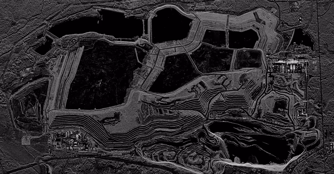
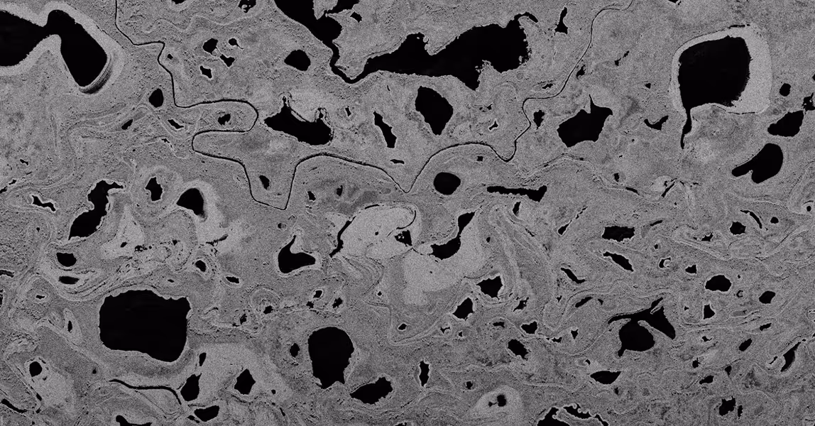
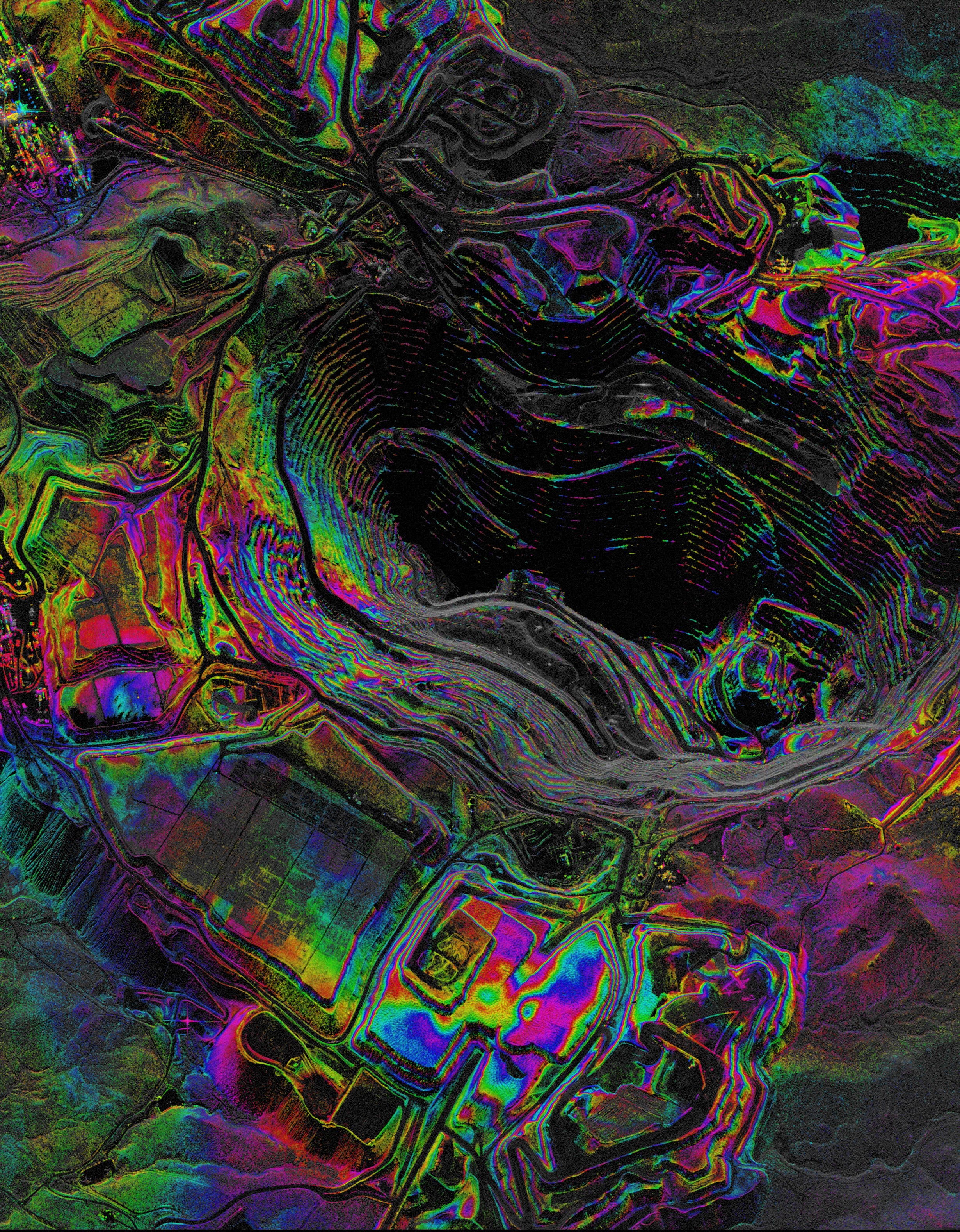
Track Changes Across Remote Operations
Track excavation progress, material stockpiles, and terrain changes at remote sites with high-resolution SAR that delivers consistent insights. Monitor activity over time, detect subtle shifts, and support operational planning.
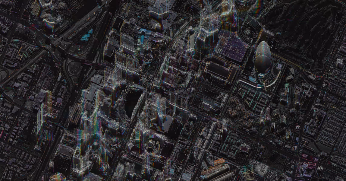
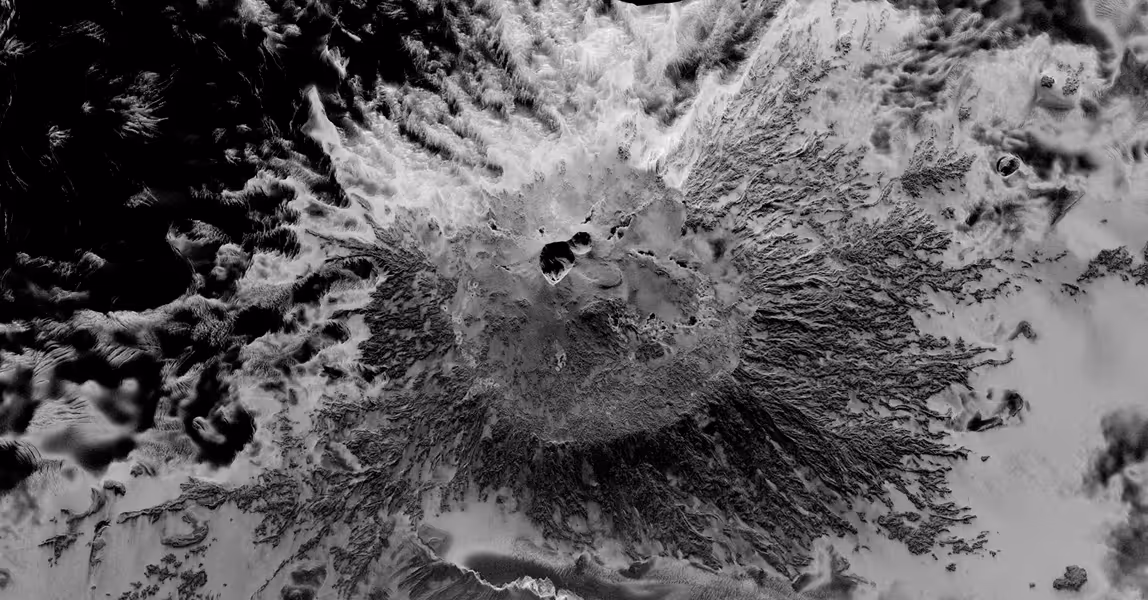
Maintain Visibility Across Distributed Infrastructure
Monitor pipelines, bridges, transport corridors, and facilities spread across regions with revisit and wide-area coverage. Detect unauthorized activity, track construction progress, and identify change before it becomes a problem.
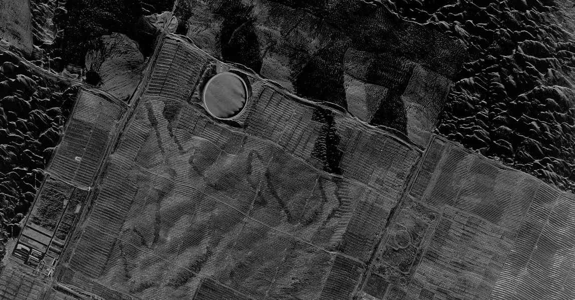
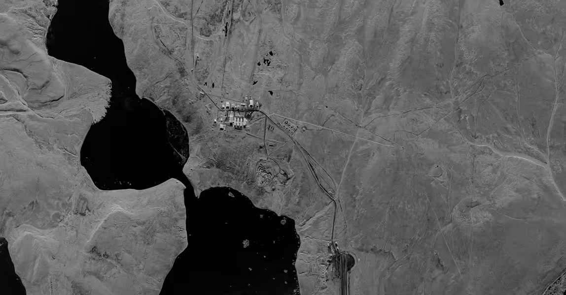
Monitor Energy Assets in Any Condition
Monitor tank fill levels, vessel activity, and operations at power plants and ports day or night, in any weather. Integrate with analytics partners to track reserve levels and support supply chain protection.
Infrastructure & Asset
Monitoring Solutions
Capella delivers the data and tools you need to maintain continuous oversight of critical assets. Our SAR imagery and automtated tasking provide end-to-end capabilities for monitoring infrastructure and assets in any environment.
All-Weather Intelligence For
Mission-Critical Monitoring
Capella's synthetic aperture radar data delivers high-resolution imagery 24/7, penetrating darkness, clouds, haze, and dust to provide uninterrupted monitoring of critical infrastructure.
- Monitor infrastructure with sub-daily revisit to catch changes as they happen
- Capture high-resolution detail that lower-resolution sensors miss
- Seamlessly integrate with analytics ecosystems for advanced analytics, forecasting, and analysis
.avif)
Learn more about Capella's SAR data


Streamlined Tasking and Access for Infrastructure Operators
Task new collections, view archives, and access imagery through a single interface built for operational workflows.
- Submit rapid collection requests and receive imagery within hours
- Access historical archives to establish baselines and track change over time
- Integrate via API to automate tasking and delivery into existing systems
Learn more about Automated Tasking
Mission-Ready Advantages
Latest Insights And News
Capella Space Debuts InSAR Sat Service For Surface Monitoring


FAQ
Ask us anything
What Imaging Modes Does Capella Support?
Capella satellites support Spotlight (including Spotlight Ultra), Sliding Spotlight, Stripmap, and Parallel Stripmap imaging modes.
How Does Capella's Tasking System Work?
Capella's scheduler runs every 20 minutes and processes new acquisition tasking requests for a rolling one-week-out scheduling window. Users submit their desired imaging parameters through Console or API, receive cost review and approval notifications, then tasks enter the queue. Once the window open date is within the one-week scheduling horizon, the system automatically plans, schedules, collects, and delivers imagery based on collection tier priority (Urgent, Priority, Standard, Flexible, or Routine for repeats).
What Resolution And Image Quality Can Acadia Achieve?
Acadia delivers resolution ranging from 0.25 m to 1.2 m azimuth resolution depending on imaging mode. Spotlight Ultra achieves 0.25 m azimuth with 0.25/0.3 m slant range resolution. The system uses single-polarization (HH or VV) X-band SAR with look angles from 15° to 50° and grazing angles from 73.5° to 33°. Multi-look processing (1-5 looks depending on mode) reduces speckle while maintaining spatial resolution.
What Data Formats And Products Are Available?
Capella provides Single Look Complex (SLC), Geocoded Ellipsoid Corrected (GEO), Geocoded Terrain Corrected (GEC), SICD, SIDD, CPHD, and Colorized Sub-aperture Imaging (CSI) products. All products can support machine learning and AI analytics development with STAC-compliant metadata for seamless integration into existing workflows and GIS platforms.
How Does Extended Imaging Capacity Work?
Acadia's 10 minutes of continuous imaging per orbit is enabled by larger batteries, enhanced solar arrays, and improved thermal management. The 600 MHz radar bandwidth combined with extended dwell times delivers more collection capacity per pass.
Can Acadia Support Persistent Monitoring?
Yes. Repeat tasking allows automated monitoring of any point target with user-defined repeat cycles (daily, weekly, custom intervals). The system can automatically plan, schedule, and deliver collections with optional geometrically similar parameters. Multi-orbit constellation (sun-synchronous and mid-inclination) enables multiple collection opportunities per day across global latitudes.
Haven’t Found What You Needed?
Our expert team is here to support your mission and help you get the insights you need.
.avif)
.avif)
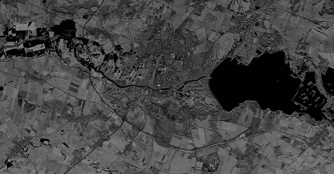
See Change as It Happens
Explore how consistent SAR monitoring reveals subtle changes across infrastructure and environments—supporting long-term planning and operational confidence.
