Capella Space
Case study
December 22, 2022
Climate change has been accelerating rapidly in the arctic and sub-arctic. Air temperatures have increased at a much higher rate than lower latitudes, leading to enhanced permafrost melt, increased wildfire frequency, and changes to the hydrology, physiography, and vegetation of these northern regions. High latitude ecosystems are integral to Earth’s carbon cycle, and provide crucial habitats for wildlife and natural resources that sustain human populations. Woodwell Climate Research Center is collaborating with Capella Space to leverage high-resolution Synthetic Aperture Radar (SAR) imagery for enhanced monitoring of northern tundra landscapes with applications in carbon cycling, community risk, and wildlife habitat.

The Yukon-Kuskokwim Delta (YKD), a tundra landscape in Southwestern Alaska, is home to over 50 indigenous communities, making it one of the most populated rural regions in Alaska. Encompassing the Yukon National Wildlife Refuge, the delta is rich in biodiversity, providing a migratory home to a world-class variety of waterfowl species. Around 10 ─ 50% of the landscape here is underlain by permafrost that is melting at an increasing rate. Elevated greenhouse gas emissions from recently thawed permafrost are significant on a global scale. Melting permafrost also leads to visible changes to the morphology, vegetation, and hydrology of the landscape. To compound on these landscape alterations, increasingly frequent wildfires further affect vegetation cover and increase the rate of permafrost melt. Given the remoteness and vastness of the YKD, satellite remote sensing is required in order to track these changes and assess their impacts on wildlife, the carbon cycle, and communities inhabiting this region. Optical remote sensing is difficult in the YKD, as the area is mostly cloudy for over 60% of the year. SAR imagery allows for observations that penetrate this persistent cloud cover.
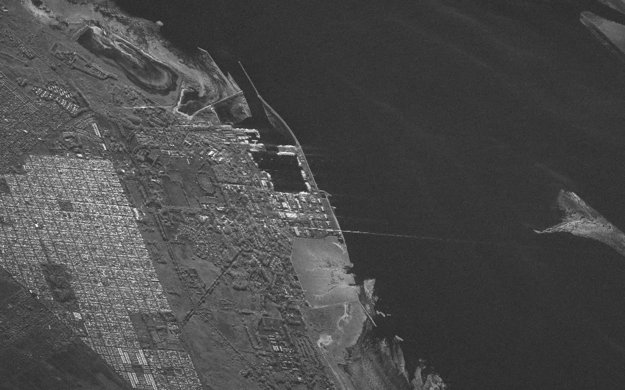
Capella Space SAR imagery is well-fit for automated detection of very small to large water bodies. Lakes and ponds are important features of tundra landscapes, as they respond rapidly to climatic changes. Land subsidence as a result of melting permafrost can lead to creation of features such as degraded peat plateaus that evolve into small ponds. Additionally, land that has subsided has an increased susceptibility to flooding, presenting a risk to remote communities in low-lying delta regions. Newly formed ponds are often hotspots for emission of methane, a potent greenhouse gas, but these emissions often go unaccounted for due to limitations in the spatial resolutions of commonly used satellite sensing platforms. High- resolution imagery from Capella Space allows for detection of water bodies from large lakes to small ponds, providing the means for enhanced greenhouse gas emissions modeling and flood monitoring.
Vegetated areas that are saturated with water such as fens and flooded vegetation are other key components of tundra landscapes identifiable in Capella Space SAR imagery. These saturated areas can emit more methane than open water and are crucial zones of food production for a wide variety of animal species. SAR imagery offers a powerful avenue for detection of these features and can complement observations from optical sensors.
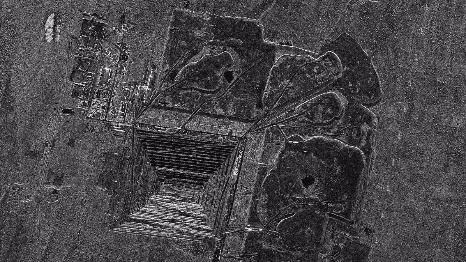
Wildfires have become increasingly frequent in the high latitudes due to rising air temperatures, changes in vegetation cover, and increased frequency of lightning ignition events. Identification of burned areas, as shown in the Capella SAR image, can help assess fire-induced changes in vegetation cover and permafrost depth, and better quantify the role of wildfires in carbon cycling.
Capella SAR imagery shows the capacity to monitor a wide range of landscape characteristics in rapidly-changing high latitude tundra environments. The abrupt changes experienced by these landscapes have long-term impacts on their ecosystems and comprehensive monitoring allows for improved projections of future conditions.
Curious Which Of Our Analytics Partners
Can Support Your Mission?
Contact our team to explore the possibilities. Our experts can help
you determine the optimal solutions for your unique needs.

Keywords
.png)
Stay Informed. Stay Ready.
Get briefings on new capabilities, technology improvements, and upcoming events.


.avif)
