Capella Space
Blog
April 2, 2025

What is Synthetic Aperture Radar (SAR)?
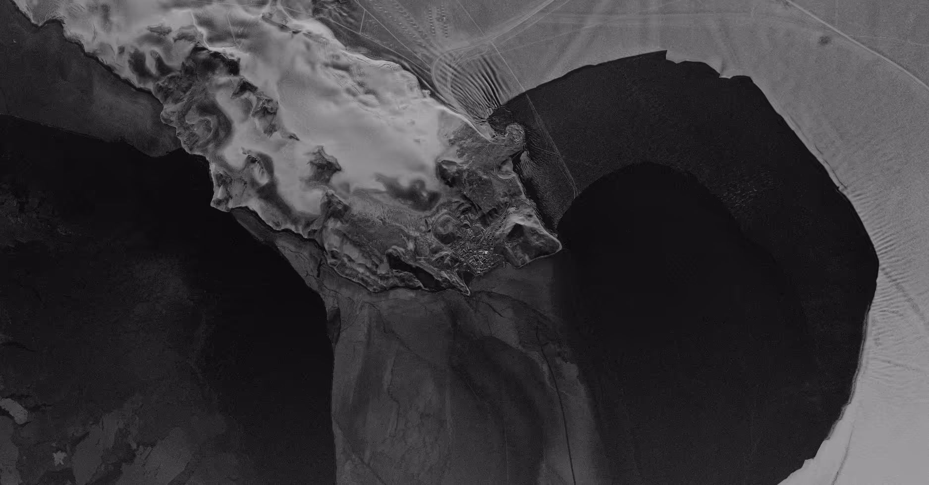
Let’s start with the basics: Synthetic Aperture Radar (SAR) is a powerful remote sensing technology that allows us to capture detailed images of Earth’s surface, regardless of weather conditions or time of day. Unlike traditional optical satellites, which rely on sunlight to illuminate the scene, SAR uses radar signals to ‘see’ through clouds, darkness, and even smoke. This makes it an indispensable tool for continuous Earth monitoring.
By transmitting radar pulses toward the ground and analyzing the signals that bounce back, SAR generates high-resolution imaging data of landscapes, cities, and natural phenomena. Whether it's tracking deforestation, monitoring infrastructure, or assessing natural disasters, SAR provides unparalleled clarity and reliability for global Earth observation.
What is Interferometric Synthetic Aperture Radar (InSAR)?
Interferometric Synthetic Aperture Radar, or InSAR, takes SAR to the next level by comparing multiple SAR images taken at different times. This technique detects subtle shifts in Earth’s surface—down to millimeters—by analyzing changes in radar phase information. InSAR is a game-changer for applications like monitoring land deformation, detecting ground subsidence, and even predicting volcanic eruptions or landslides before they happen.
Here’s how it works: Imagine taking two SAR snapshots of the same location days, months, or even years apart. By comparing them, analysts can measure tiny shifts in terrain that might indicate underground movements, tectonic activity, or infrastructure instability. This makes InSAR an incredibly valuable tool for governments, scientists, and industries needing to track environmental changes with precision.
Advancing SAR and InSAR Technology
Capella Space is pushing the boundaries of what’s possible with SAR and InSAR. Capella's high-resolution SAR satellites provide persistent, reliable coverage of any location on Earth—day or night, rain or shine. This continuous monitoring capability is critical for industries and agencies that need fast, data-driven insights.
By integrating cutting-edge radar imaging with advanced data analytics, Capella’s technology enables near real-time monitoring of infrastructure, environmental changes, and even security-related activities. Whether it’s detecting illegal deforestation, tracking urban expansion, or assessing the stability of bridges and dams, our SAR and InSAR solutions empower decision-makers with accurate, timely intelligence.
Why SAR and InSAR Matter for the Future
As our world faces increasing environmental and geopolitical challenges, the need for persistent, high-resolution Earth observation has never been greater. SAR and InSAR are revolutionizing the way we monitor our planet, providing the insights necessary to drive smarter decisions, mitigate risks, and respond to emerging threats with confidence.
At Capella Space, we’re committed to advancing SAR and InSAR technology to ensure that governments, businesses, and researchers have the tools they need to monitor, predict, and respond to Earth’s dynamic changes. The future of Earth observation is here—and it’s powered by radar.
Looking for SAR solutions? Chat with our team.
Curious Which Of Our Analytics Partners
Can Support Your Mission?
Contact our team to explore the possibilities. Our experts can help
you determine the optimal solutions for your unique needs.

Keywords

Stay Informed. Stay Ready.
Get briefings on new capabilities, technology improvements, and upcoming events.


.avif)
