Back to Resources
Case study
A Deep Learning Approach to Field Boundary Segmentation Using Very High-resolution X-band SAR Data
February 12, 2025
The Future of Smarter, Faster, and Precise Farming
Agriculture has always been a game of precision—knowing when to plant, where to irrigate, and how to maximize yields. But as technology advances, so do the tools that help farmers make these critical decisions. Today, Capella Space is pushing the boundaries of Earth observation with high-resolution Synthetic Aperture Radar (SAR) data, combined with cutting-edge artificial intelligence, to revolutionize the way we map and manage farmland from space.
Why Field Boundaries Matter
Imagine trying to farm without clear field boundaries. You’d struggle with efficient irrigation, accurate crop monitoring, and even the operation of autonomous farming equipment. Traditionally, field mapping has relied on optical satellite imagery or manual surveys—both of which have limitations. Optical satellites can be obstructed by clouds and darkness, and manual surveys take time and resources.
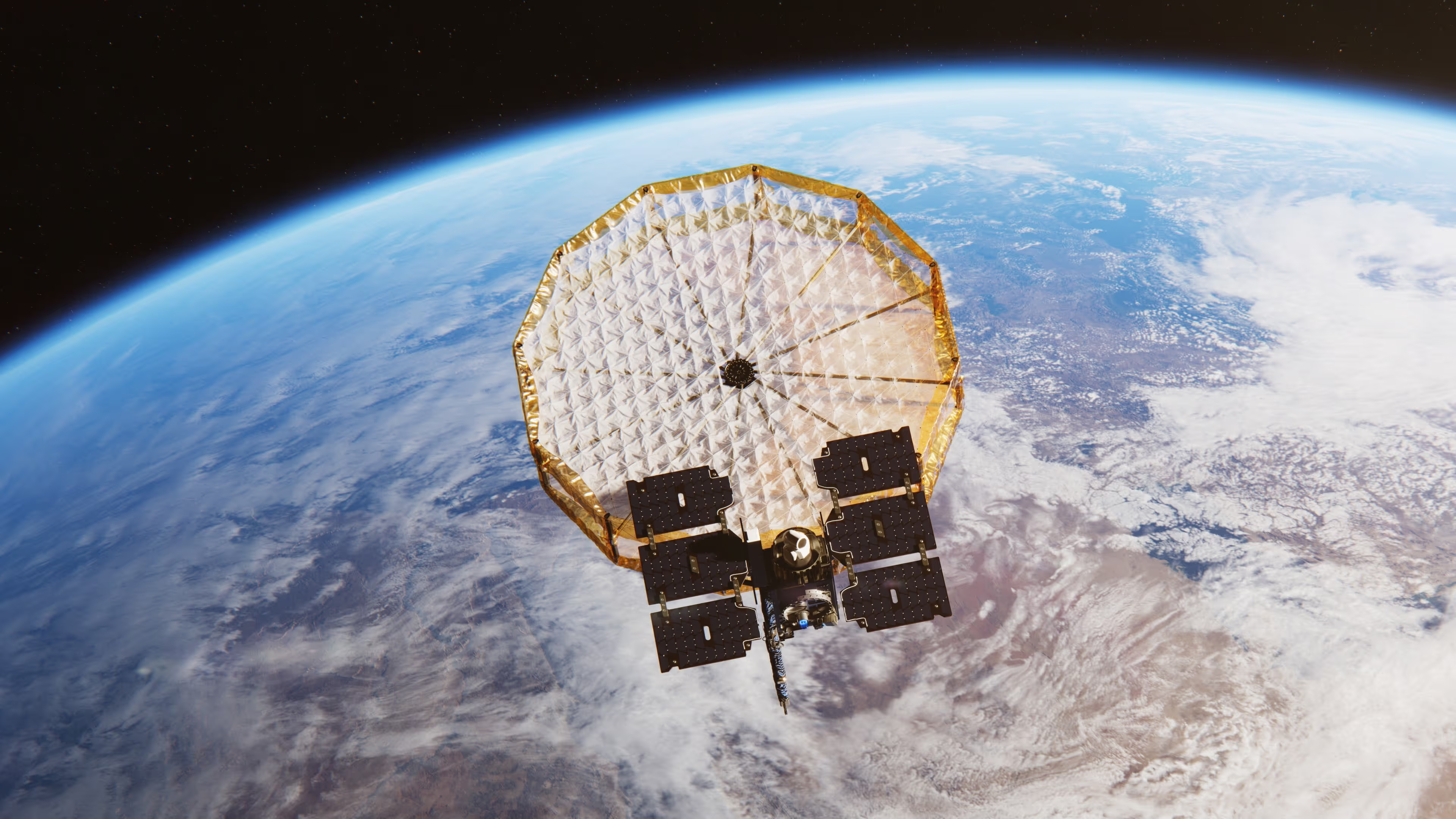
Enter SAR: Unlike traditional optical imaging, SAR can penetrate clouds, capture images day or night, and reveal the fine details of the landscape with sub-meter precision. And with the power of AI-driven segmentation, Capella Space is taking this capability to the next level.
How AI and SAR are Mapping Fields Like Never Before
Capella’s latest research explores the use of deep learning techniques to automatically delineate agricultural field boundaries from Very High-Resolution (VHR) SAR imagery. This approach integrates modern AI frameworks with traditional segmentation techniques to ensure precision and reliability.
Here’s how it works:
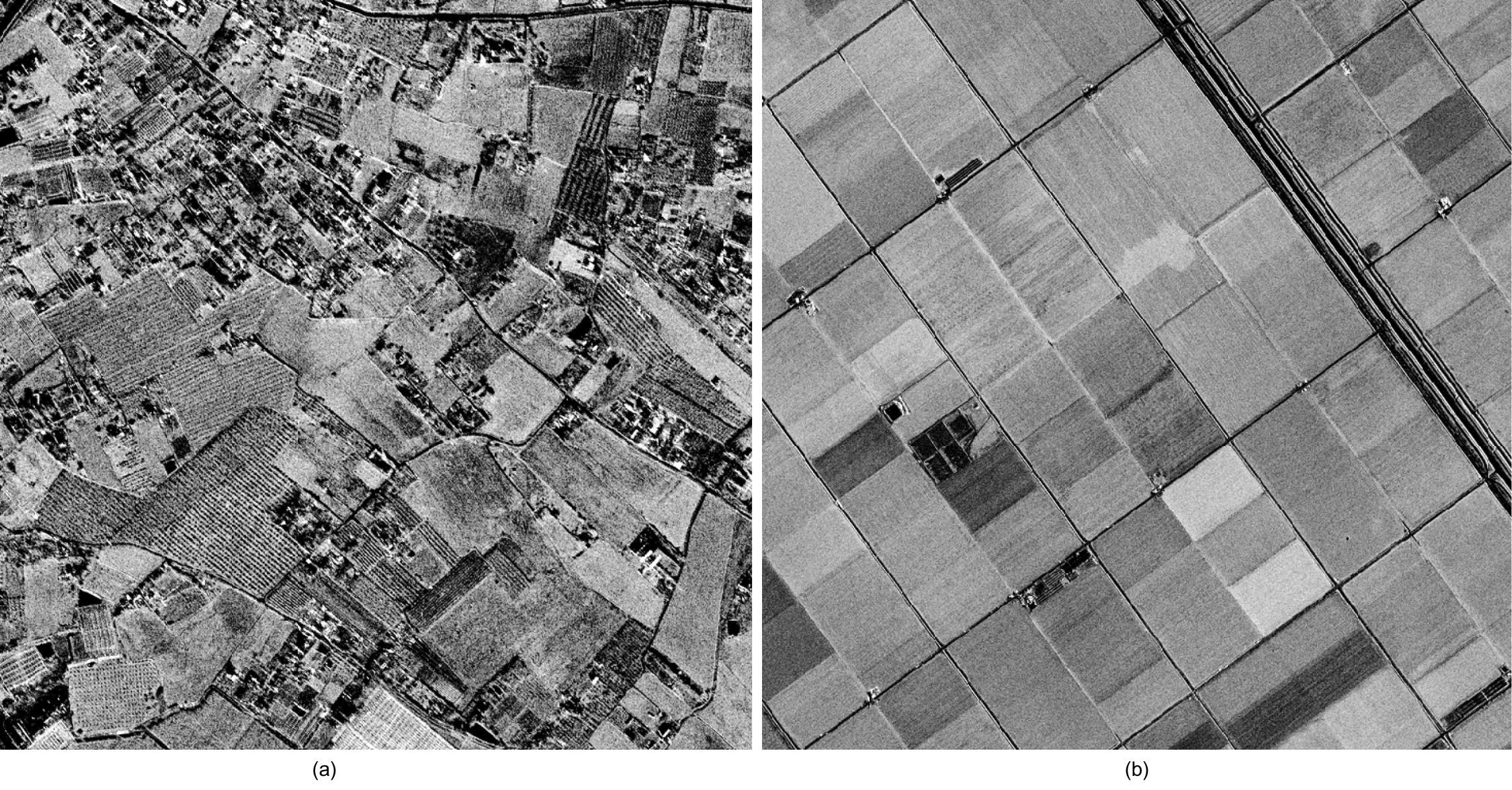
- High-Resolution SAR Imaging: Using Capella’s X-band SAR satellites in Spotlight mode, we capture sub-meter resolution images of agricultural landscapes.
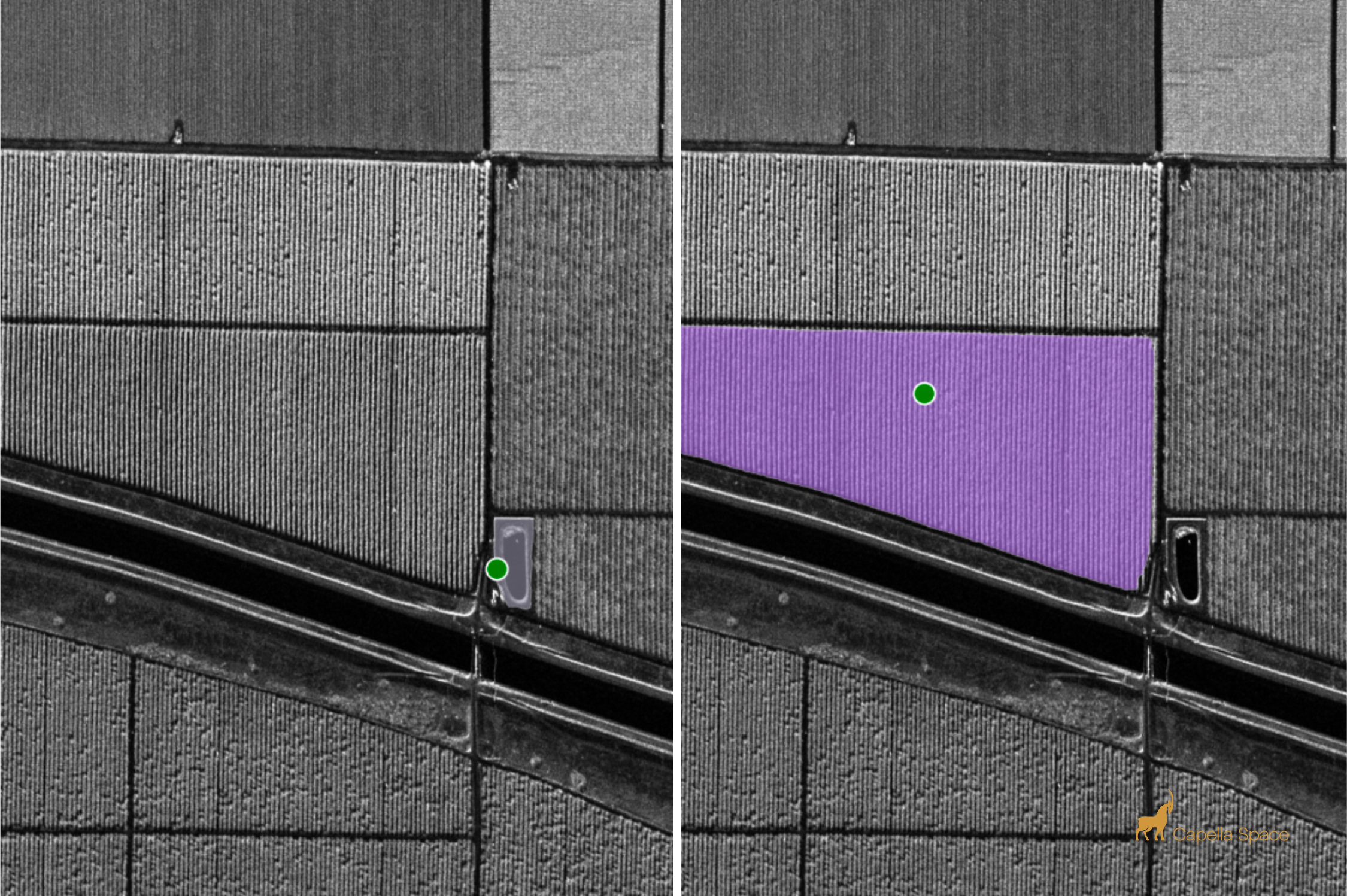
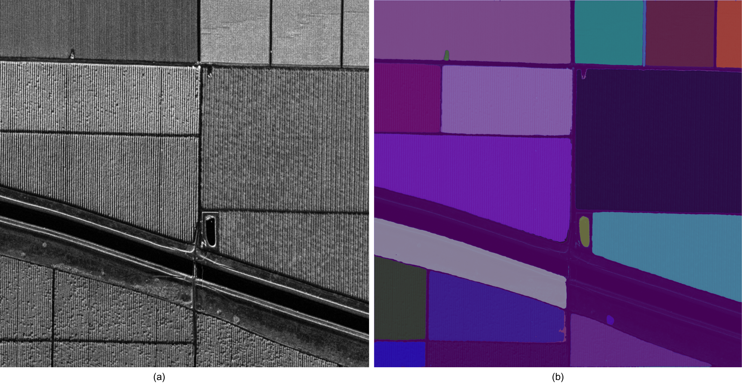
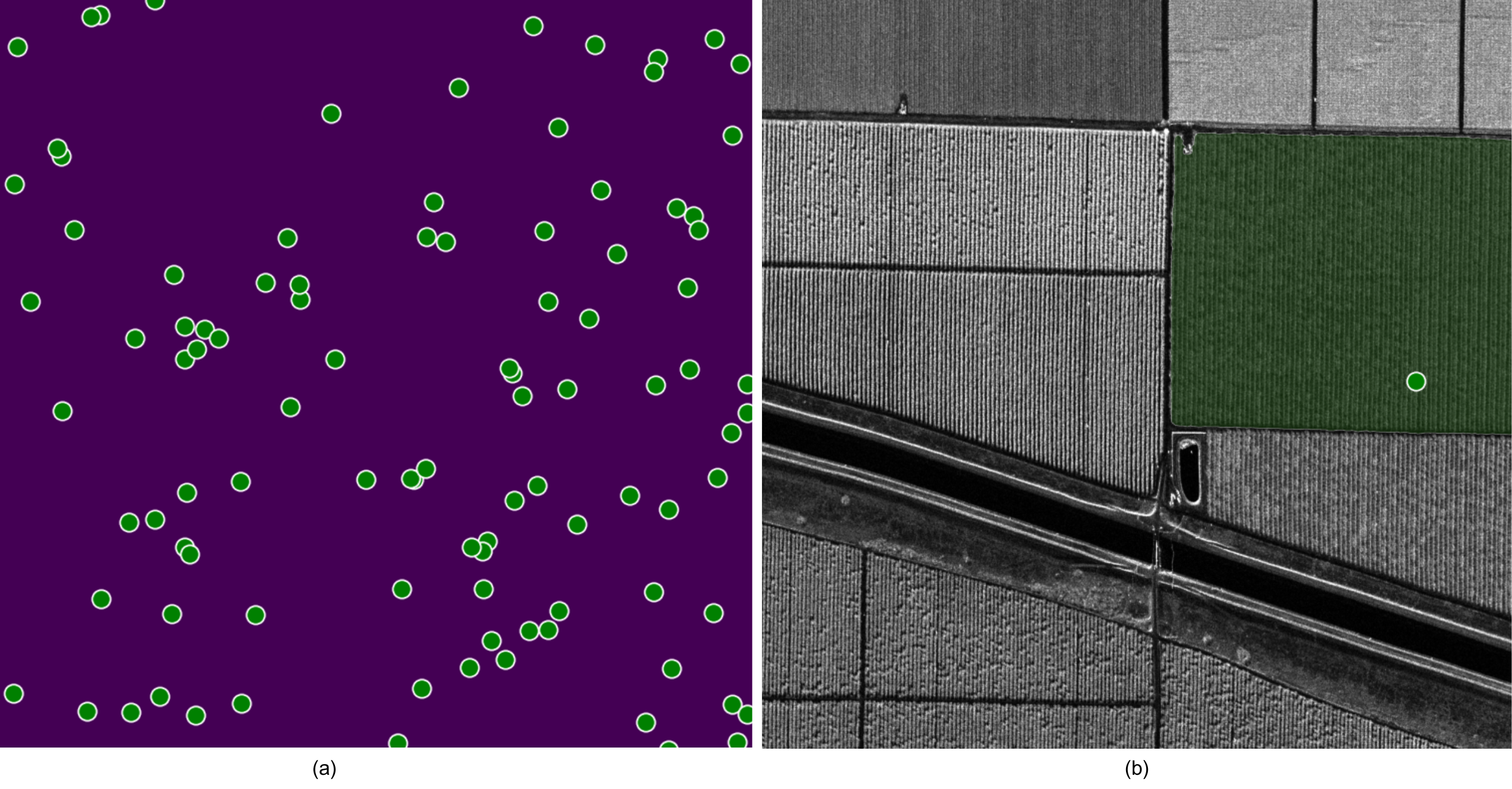
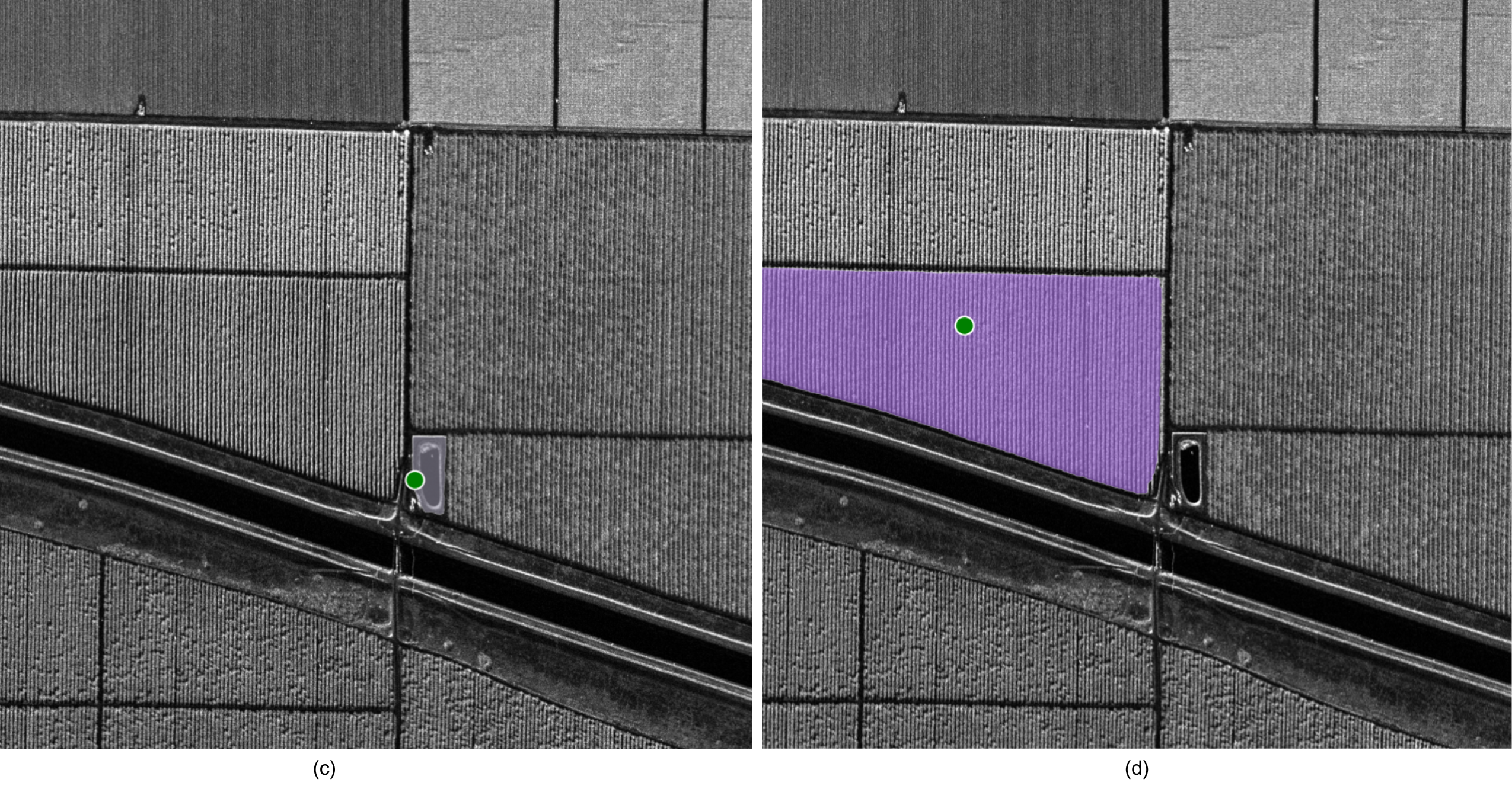
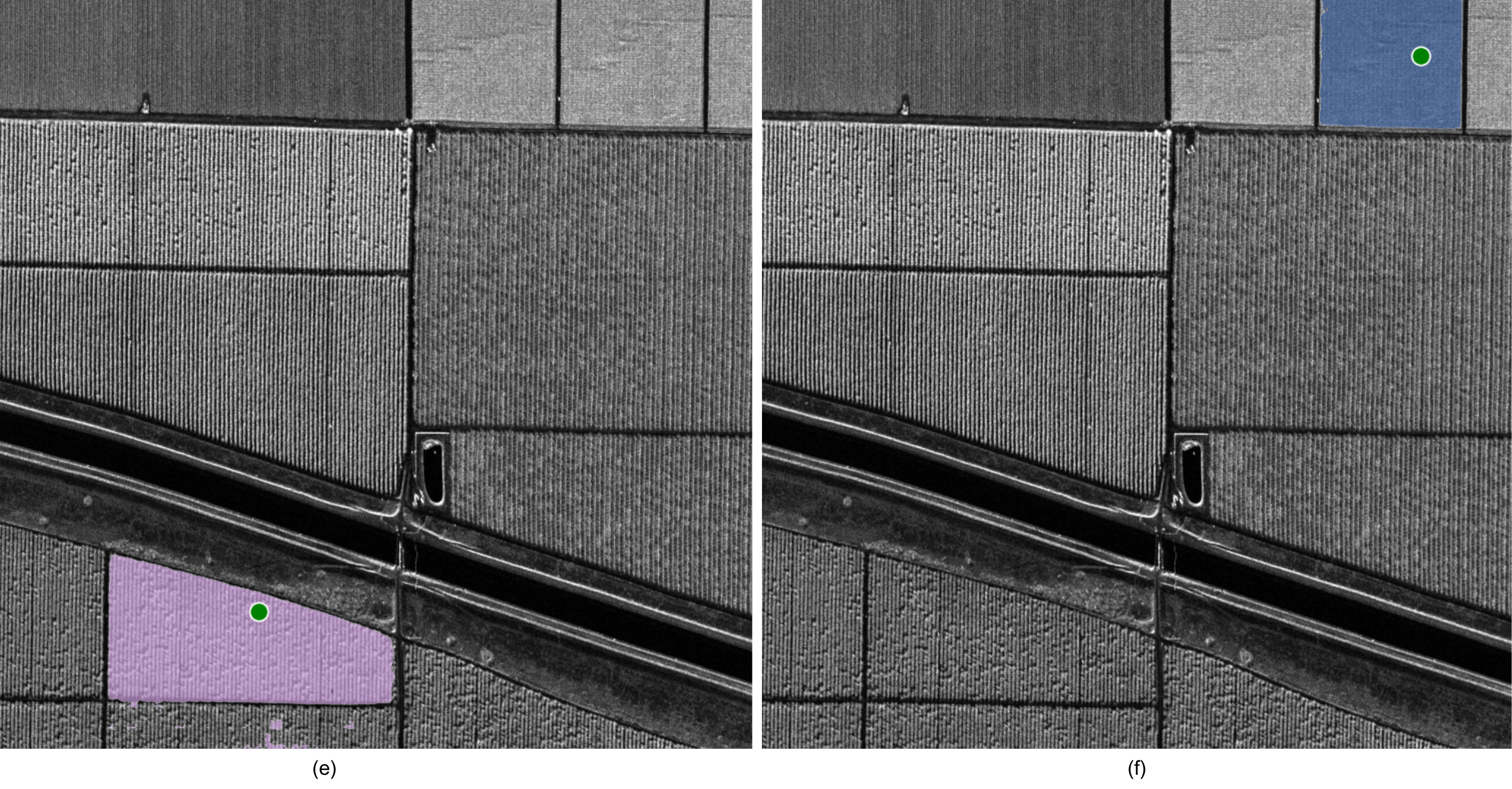
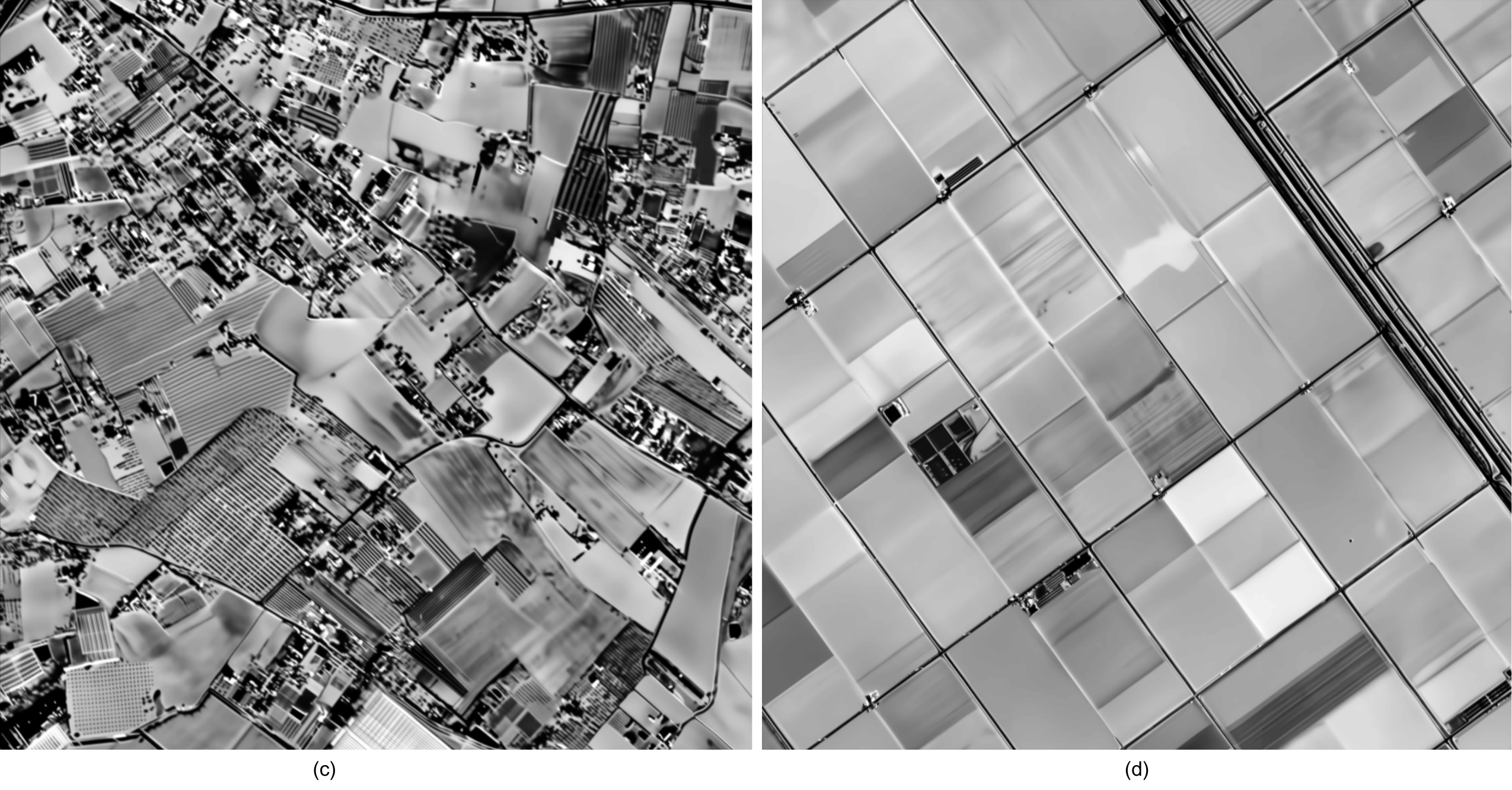
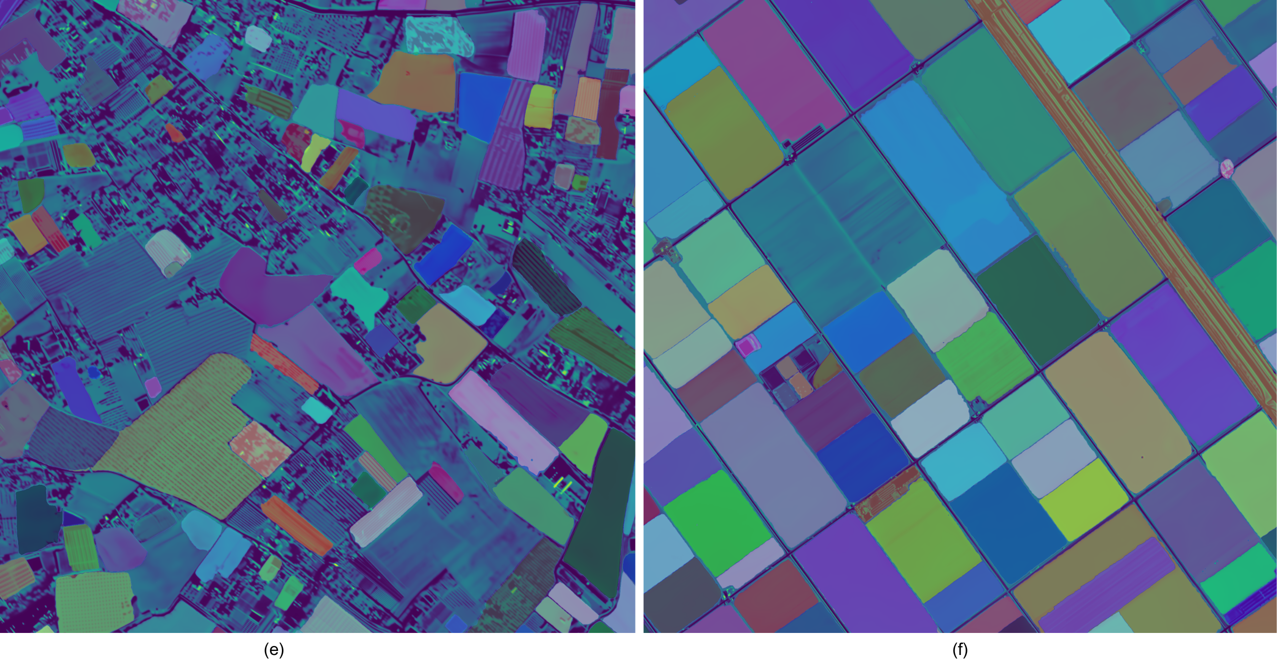
- AI-Powered Image Processing: Our system applies deep learning models—specifically the Segment Anything Model (SAM2)—to identify and segment individual fields within the SAR data.
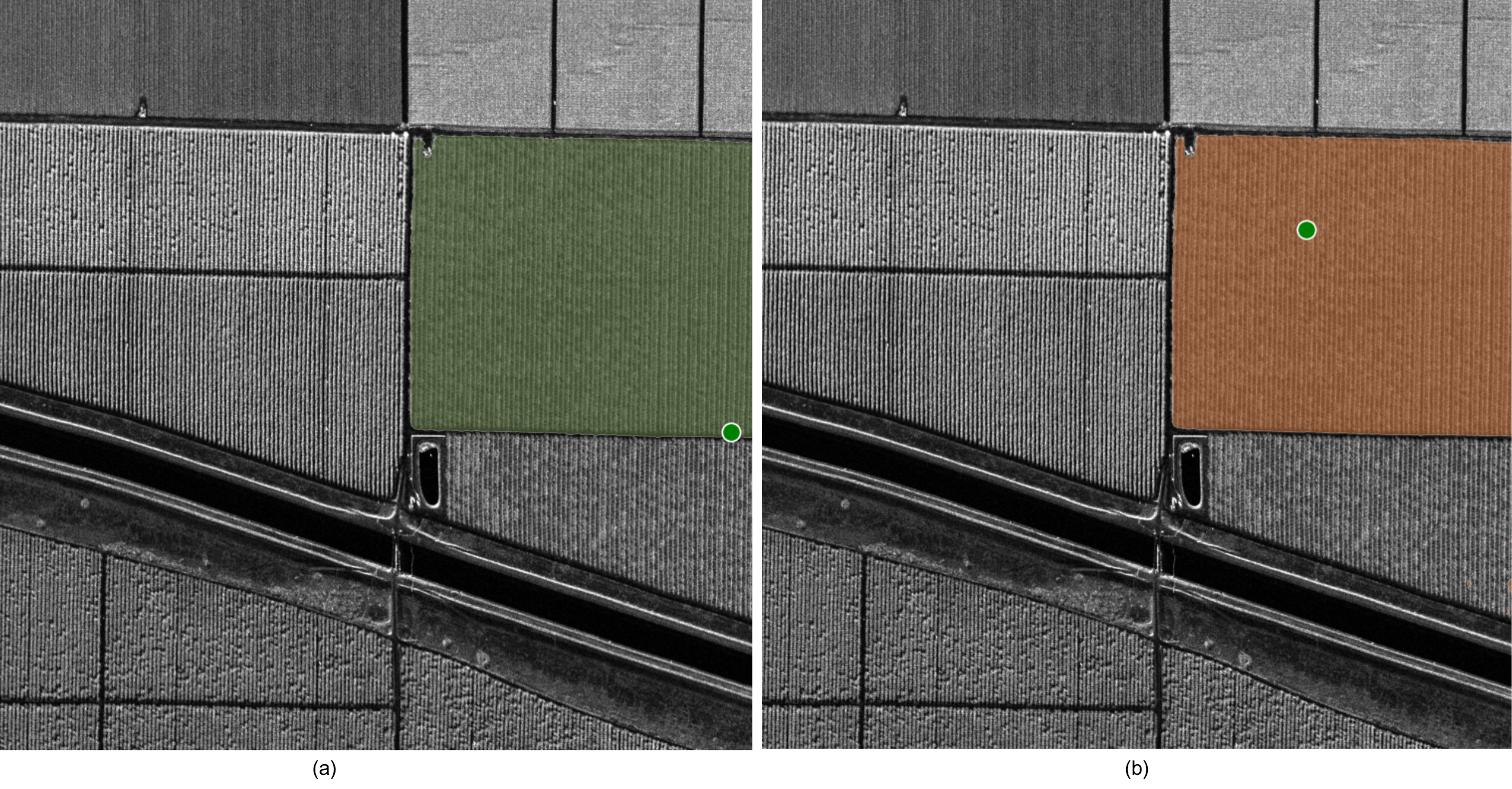
- Refinement with Classical Methods: We enhance segmentation accuracy by merging redundant segments and eliminating inconsistencies using traditional region-merging techniques.
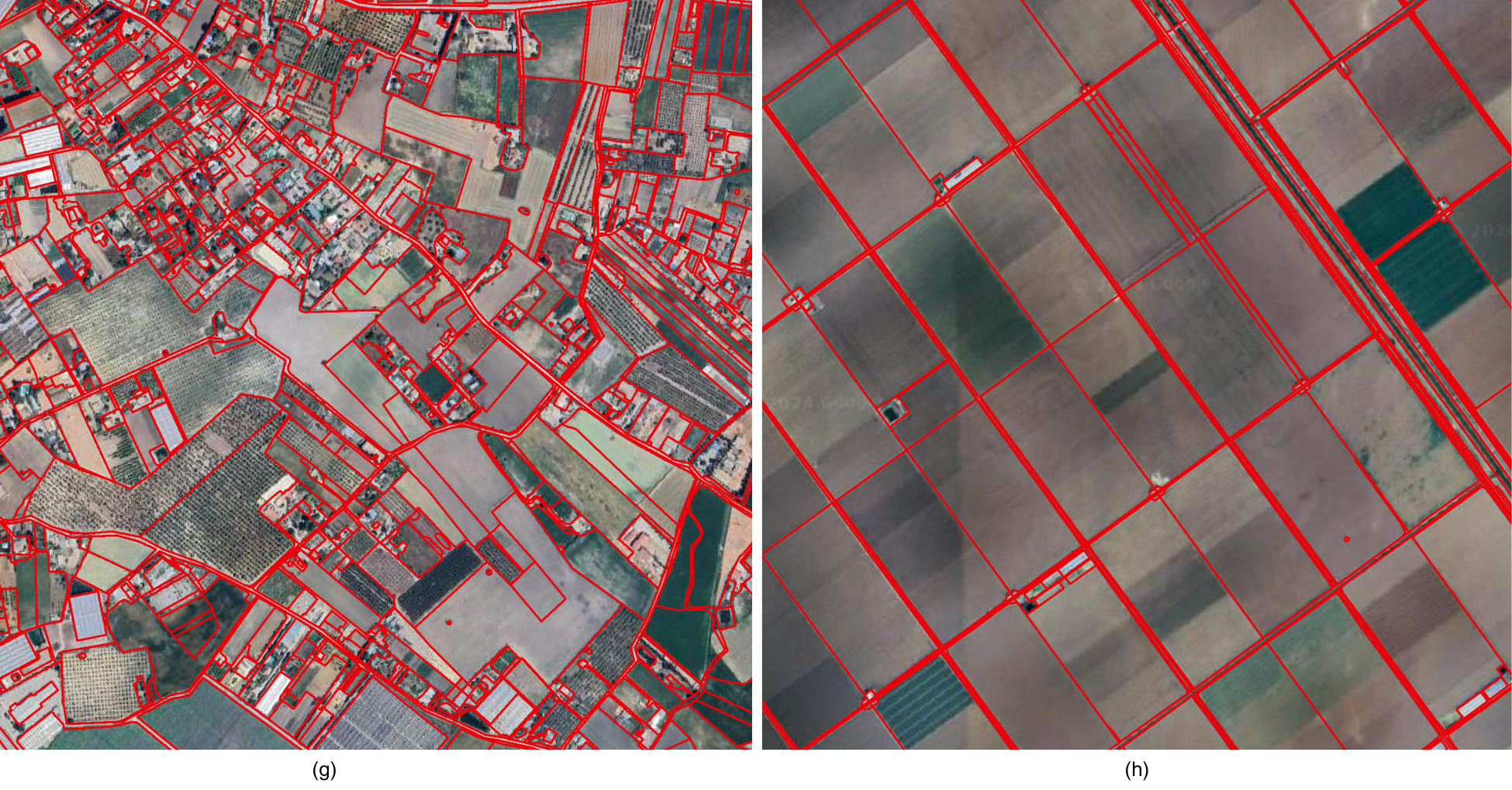
- Final Field Mapping: The result? A highly accurate, automated map of field boundaries that can be used for everything from farm management to autonomous tractor navigation.
Real-World Testing: From California to Spain
To test the effectiveness of this AI-SAR fusion, Capella’s team analyzed fields in two very different agricultural regions—Bakersfield, California, and Lebrija, Spain.
- Bakersfield: Known for its structured, geometric field layouts, the region provided an ideal test case for segmentation algorithms to detect well-defined boundaries.
- Lebrija: With more irregularly shaped fields, this area tested the adaptability of our model to more complex landscapes.
The results were promising. In both cases, the AI was able to successfully distinguish individual fields, even in challenging environments with varying crop types, topography, and field structures.
The Future of AI in Earth Observation
This breakthrough in field boundary segmentation is just the beginning. By combining SAR with deep learning, Capella is setting the stage for broader applications, including:
- Autonomous Farming: Enabling precision navigation for self-driving tractors and robotic harvesters.
- Yield Monitoring & Prediction: Enhancing crop analysis by providing better insights into individual field health.
- Climate Resilience: Helping farmers adapt to climate change by tracking field changes over time with unmatched precision.
Conclusion: A New Era for Agriculture & Remote Sensing
Capella Space is proving that when AI meets SAR, the possibilities are endless. Our latest research in field boundary detection is more than an academic exercise—it’s a practical, scalable solution for real-world agricultural challenges. With continuous advancements in AI and satellite imaging, we’re not just observing the Earth; we’re helping shape its future.
Stay tuned as we continue to push the frontiers of Earth observation—because smarter data leads to a smarter planet.
Looking for agriculture monitoring solutions? Chat with our team.
Curious Which Of Our Analytics Partners
Can Support Your Mission?
Contact our team to explore the possibilities. Our experts can help
you determine the optimal solutions for your unique needs.

Keywords
Stay Informed. Stay Ready.
Get briefings on new capabilities, technology improvements, and upcoming events.